Category:Tinte
| Object location | | View all coordinates using: OpenStreetMap |
|---|
Nederlands: Afbeeldingen van Tinte, behorende tot de gemeente Voorne aan Zee, in de provincie Zuid-Holland in het westen van Nederland
hamlet in Voorne aan Zee, Netherlands   | |||||
| Upload media | |||||
| Spoken text audio | |||||
|---|---|---|---|---|---|
| Instance of | |||||
| Location |
| ||||
 | |||||
Subcategories
This category has only the following subcategory.
M
- Museum in den Halven Maen (163 F)
Media in category "Tinte"
The following 25 files are in this category, out of 25 total.
-
 Map - NL - Westvoorne - Wijk 01 Oostvoorne - Buurt 03 Tinte.svg 375 × 375; 17 KB
-
 Map NL - Westvoorne - Tinte.png 800 × 600; 11 KB
-
Nl-Tinte-article.ogg 1 min 23 s; 845 KB
-
 Arthur-Schnitzler Tagebuch, Chronik August 1885.tif 2,114 × 2,601; 15.75 MB
-
 Deel voorgevel nr. 100-707 - Tinte - 20486257 - RCE.jpg 896 × 1,200; 188 KB
-
 Exterieur ACHTERGEVEL - Tinte - 20300733 - RCE.jpg 1,195 × 1,200; 333 KB
-
 Exterieur DETAIL - Tinte - 20300729 - RCE.jpg 1,195 × 1,200; 474 KB
-
 Exterieur OVERZICHT - Tinte - 20300726 - RCE.jpg 1,200 × 1,185; 333 KB
-
 Exterieur OVERZICHT - Tinte - 20300727 - RCE.jpg 1,200 × 1,194; 418 KB
-
 Exterieur OVERZICHT - Tinte - 20300728 - RCE.jpg 1,200 × 1,176; 355 KB
-
 Exterieur OVERZICHT - Tinte - 20300731 - RCE.jpg 1,188 × 1,200; 323 KB
-
 Exterieur OVERZICHT - Tinte - 20300732 - RCE.jpg 1,174 × 1,200; 274 KB
-
 Exterieur OVERZICHT, NOORDGEVEL - Tinte - 20271665 - RCE.jpg 1,186 × 1,200; 317 KB
-
 Exterieur OVERZICHT, VOORGEVEL - Tinte - 20271666 - RCE.jpg 1,198 × 1,200; 347 KB
-
 INTER DETAIL VAN SCHOORSTEENSTUK IN TROMPMUSEUM BRIELLE - Tinte - 20266896 - RCE.jpg 1,200 × 1,200; 323 KB
-
 INTERIEUR, ACHTERKAMER - Tinte - 20300734 - RCE.jpg 1,200 × 1,190; 264 KB
-
 INTERIEUR, ACHTERKAMER - Tinte - 20300735 - RCE.jpg 1,198 × 1,200; 229 KB
-

-

-
 INTERIEUR, SCHOORSTEENSTUK, BEWAARD IN TROMPMUSEUM BRIELLE - Tinte - 20266893 - RCE.jpg 1,198 × 1,200; 233 KB
-
 INTERIEUR, SCHUUR, OVERZICHT HOEFIJZERBORD - Tinte - 20300730 - RCE.jpg 1,200 × 1,190; 307 KB
-

-

-
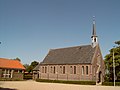 Tinte, kapel foto2 2009-05-21 16.59.JPG 2,272 × 1,704; 1.16 MB
-
 Zij- en voorgevel nr. 100-709 - Tinte - 20486256 - RCE.jpg 1,200 × 900; 191 KB


