Category:Tol 8, Schoonhoven
| Object location | | View all coordinates using: OpenStreetMap |
|---|
 | |||||
| Upload media | |||||
| Instance of |
| ||||
|---|---|---|---|---|---|
| Location | Schoonhoven, Krimpenerwaard, South Holland, Netherlands | ||||
| Street address |
| ||||
| Located on street | |||||
| Heritage designation |
| ||||
 | |||||
|
This is a category about rijksmonument number 33526
|
| Address |
|
Media in category "Tol 8, Schoonhoven"
The following 21 files are in this category, out of 21 total.
-
 Achtergevels - Schoonhoven - 20198736 - RCE.jpg 1,200 × 807; 205 KB
-
 Exterieur OVERZICHT VOORGEVELS - Schoonhoven - 20301807 - RCE.jpg 950 × 1,200; 285 KB
-
 Hoger, overzicht onevenzijde - Schoonhoven - 20198729 - RCE.jpg 1,200 × 813; 227 KB
-

-

-
 Interieur begane grond, sleutelstuk - Schoonhoven - 20382398 - RCE.jpg 1,200 × 1,200; 256 KB
-
 Interieur, detail van raamkozijn in de achtergevel - Schoonhoven - 20382405 - RCE.jpg 1,200 × 1,200; 248 KB
-
 Interieur, kap tijdens restauratie - Schoonhoven - 20382395 - RCE.jpg 1,200 × 1,200; 228 KB
-
 Interieur, keldergewelf tijdens restauratie - Schoonhoven - 20382396 - RCE.jpg 1,200 × 1,200; 329 KB
-

-
 Interieur, raamkozijn in achtergevel - Schoonhoven - 20382401 - RCE.jpg 1,200 × 1,200; 234 KB
-
 Interieur, stucwerk op binnenmuur - Schoonhoven - 20382404 - RCE.jpg 1,200 × 1,200; 296 KB
-

-
 Kelderingang voor de voorgevel - Schoonhoven - 20382403 - RCE.jpg 1,200 × 1,200; 304 KB
-
 Kelderingang voor de voorzijde - Schoonhoven - 20382402 - RCE.jpg 1,200 × 1,200; 358 KB
-
 Overzicht - Schoonhoven - 20198728 - RCE.jpg 1,200 × 805; 229 KB
-
 Overzicht van de voorgevels - Schoonhoven - 20384700 - RCE.jpg 1,191 × 1,200; 248 KB
-
 RM33525 Schoonhoven - Tol 6.jpg 2,592 × 1,944; 1.21 MB
-
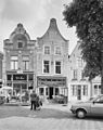
 RM33526 Schoonhoven - Tol 8.jpg 1,944 × 2,592; 1.26 MB
-
 Voorgevels - Schoonhoven - 20198735 - RCE.jpg 1,200 × 1,195; 283 KB
-
 Voorgevels - Schoonhoven - 20198737 - RCE.jpg 816 × 1,200; 226 KB


