Category:Toller Porcorum
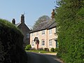
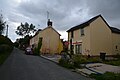
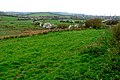
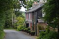
English: Toller Porcorum is a village and civil parish in West Dorset, England, situated in the Toller valley ten miles north west of Dorchester. The village has a population of 292 .
village in United Kingdom  | |||||
| Upload media | |||||
| Instance of | |||||
|---|---|---|---|---|---|
| Location | Dorset, South West England, England | ||||
| Population |
| ||||
 | |||||
Subcategories
This category has only the following subcategory.
T
Media in category "Toller Porcorum"
The following 200 files are in this category, out of 255 total.
(previous page) (next page)-
 A remarkably large lay-by on A356 - geograph.org.uk - 6596148.jpg 1,600 × 1,596; 868 KB
-
 A356 junction for Lancombe Farm - geograph.org.uk - 6596145.jpg 1,600 × 1,198; 715 KB
-
 A356 southeast bound - geograph.org.uk - 3283718.jpg 640 × 480; 61 KB
-
 Access road to Woolcombe Farm - geograph.org.uk - 6637513.jpg 1,600 × 1,066; 730 KB
-
 Barrowland Farm - geograph.org.uk - 1259734.jpg 640 × 428; 57 KB
-
 Barrowland Farm - geograph.org.uk - 5928111.jpg 640 × 427; 50 KB
-
 Barrowland Lane - geograph.org.uk - 5928115.jpg 640 × 427; 70 KB
-
 Barrowland Lane - geograph.org.uk - 5966666.jpg 1,024 × 684; 236 KB
-
 Barrowland Lane - geograph.org.uk - 5966676.jpg 1,024 × 684; 313 KB
-

-

-
 Beside Kingcombe Coppice - geograph.org.uk - 5273180.jpg 5,184 × 3,456; 7.18 MB
-
 Birds'-nest-Orchid (17928756019).jpg 3,000 × 4,000; 5.61 MB
-
 Blue Bells, Stones Common - geograph.org.uk - 3515608.jpg 4,608 × 3,456; 5.85 MB
-
 Bluebells - Shatcombe Lane - geograph.org.uk - 4508489.jpg 1,024 × 768; 260 KB
-
 Bogbean, Powerstock Common - geograph.org.uk - 3510309.jpg 4,608 × 3,456; 5.77 MB
-
 Brambles, Powerstock Common - geograph.org.uk - 3621369.jpg 4,608 × 3,456; 1.26 MB
-
 Bridleway through Barrowland Park - geograph.org.uk - 5928118.jpg 640 × 427; 80 KB
-
 Butts Lane - geograph.org.uk - 2860684.jpg 477 × 640; 200 KB
-
 Byway between School Lane and Kingcombe Road - geograph.org.uk - 2860714.jpg 2,592 × 1,936; 3.04 MB
-
 Common Lane - geograph.org.uk - 2783096.jpg 640 × 480; 72 KB
-
 Cornfield - geograph.org.uk - 2363498.jpg 640 × 480; 81 KB
-
 Cottage at Lower Kingcombe - geograph.org.uk - 2227878.jpg 640 × 457; 74 KB
-
 Cottage at Lower Kingcombe - geograph.org.uk - 2227882.jpg 640 × 437; 70 KB
-
 Cottages near Toller Porcorum - geograph.org.uk - 1259730.jpg 640 × 428; 73 KB
-
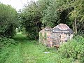 Course of disused railway and building - geograph.org.uk - 126324.jpg 640 × 480; 286 KB
-
 Cuckoo Flower, Kingcome Meadows - geograph.org.uk - 3515605.jpg 4,608 × 3,456; 5.37 MB
-
 Cuckoo Pint, Kingcombe Meadows, DWT - geograph.org.uk - 3515599.jpg 3,456 × 4,608; 2.81 MB
-
 Deer Footprint near Eggardon Hill - geograph.org.uk - 1259769.jpg 640 × 428; 109 KB
-
 Derelict Cottages west of Toller Porcorum - geograph.org.uk - 462530.jpg 640 × 480; 180 KB
-
 Devils Bit Scabious, Kingcombe Meadows - geograph.org.uk - 3635658.jpg 4,536 × 3,318; 2.55 MB
-
 Disused railway bridge and River Hooke - geograph.org.uk - 333818.jpg 640 × 480; 285 KB
-

-
 Dorset Downland - geograph.org.uk - 622536.jpg 640 × 318; 66 KB
-
-
 End of School Lane - geograph.org.uk - 2861057.jpg 478 × 640; 195 KB
-
 Entering Lower Kingcombe - geograph.org.uk - 5273197.jpg 5,184 × 3,456; 6.61 MB
-

-
-
 Fields Near Higher Woolcombe - geograph.org.uk - 4777344.jpg 640 × 428; 64 KB
-

-
 Footbridge west of Toller Porcorum - geograph.org.uk - 5056711.jpg 480 × 640; 137 KB
-
-
 Green Lane - geograph.org.uk - 2896715.jpg 640 × 478; 193 KB
-
 Green Winged Orchid, Powerstock Common - geograph.org.uk - 3510305.jpg 4,608 × 3,456; 5.21 MB
-
 Hedgelaying at Higher Kingcombe - geograph.org.uk - 5292113.jpg 3,776 × 2,520; 4.08 MB
-
 Higher Kingcombe - geograph.org.uk - 2783066.jpg 640 × 414; 55 KB
-
 Higher Kingcombe Coarse Fishing Centre - geograph.org.uk - 415935.jpg 640 × 480; 118 KB
-

-
 Higher Kingcombe, finger-post - geograph.org.uk - 1383400.jpg 480 × 640; 83 KB
-

-
 Honesty - Toller Porcorum - geograph.org.uk - 2362859.jpg 480 × 640; 125 KB
-
 Hooke Valley Lower Kingcombe - geograph.org.uk - 2227870.jpg 640 × 480; 101 KB
-
 House at Higher Kingcombe - geograph.org.uk - 2783106.jpg 640 × 480; 75 KB
-
 In Toller Porcorum - geograph.org.uk - 3632385.jpg 2,560 × 1,920; 2.07 MB
-

-

-

-

-
 Junction of paths on Barrowland Lane - geograph.org.uk - 5928136.jpg 640 × 427; 89 KB
-
 Kingcombe Centre - geograph.org.uk - 4581828.jpg 1,024 × 768; 200 KB
-
 Kingcombe Meadows, Dorset Wildlife Trust - geograph.org.uk - 3507826.jpg 3,072 × 2,304; 1.01 MB
-
 Kingcombe Road - geograph.org.uk - 5657156.jpg 1,024 × 683; 411 KB
-
 Kingcome Meadows, Dorset Wildlife Trust - geograph.org.uk - 3507861.jpg 4,608 × 3,456; 5.84 MB
-
 Knapweed, Kingcome Meadows - geograph.org.uk - 3507851.jpg 3,072 × 2,304; 1.15 MB
-
 Looking north-east from Prestwood - geograph.org.uk - 4848303.jpg 640 × 427; 64 KB
-
 Lower Kingcombe - The Kingcombe Centre - geograph.org.uk - 69088.jpg 512 × 384; 74 KB
-
 Lower Kingcombe Farmhouse - geograph.org.uk - 4581862.jpg 1,024 × 768; 220 KB
-
 Lower Kingcombe, footpath - geograph.org.uk - 4581830.jpg 1,024 × 768; 222 KB
-
 Lower Kingcombe, footpath - geograph.org.uk - 4581871.jpg 1,024 × 768; 241 KB
-
 Lower Kingcombe, lane - geograph.org.uk - 4581851.jpg 1,024 × 768; 222 KB
-
 Lower Kingcombe, Mary's Well Lane - geograph.org.uk - 4581859.jpg 1,024 × 768; 305 KB
-
 Lower Kingcombe, River Hooke - geograph.org.uk - 4581843.jpg 1,024 × 768; 337 KB
-
 Lower Kingcombe, Sunnyside Farmhouse - geograph.org.uk - 4581864.jpg 1,024 × 768; 196 KB
-
 Lower Kingcombe, view - geograph.org.uk - 4581855.jpg 1,024 × 768; 213 KB
-
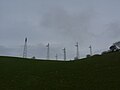
 Masts on Rampisham Down - geograph.org.uk - 5273039.jpg 5,184 × 3,456; 7.15 MB
-
 Mating Clouded Yellows - geograph.org.uk - 3621364.jpg 4,608 × 3,456; 5.14 MB
-
 Memorial pillar to Richard Jennings - geograph.org.uk - 2887585.jpg 478 × 640; 192 KB
-

-
 Minor Road at Stone's Common - geograph.org.uk - 4986784.jpg 1,600 × 1,116; 600 KB
-
 Mount Pleasant - geograph.org.uk - 2783050.jpg 640 × 480; 64 KB
-
 Mount Pleasant Lane - geograph.org.uk - 2889404.jpg 478 × 640; 192 KB
-
 Muck Pile - geograph.org.uk - 1259770.jpg 640 × 428; 93 KB
-
 New Tractor and Trailer - geograph.org.uk - 1259732.jpg 640 × 479; 117 KB
-
 Oak tree near Colesmoor Farm - geograph.org.uk - 5200451.jpg 640 × 427; 69 KB
-
 Old brick kiln, Powerstock Common - geograph.org.uk - 94291.jpg 640 × 480; 274 KB
-
 Old Railway Bridge - geograph.org.uk - 2782367.jpg 640 × 480; 126 KB
-
 Old Track Bed Wytherston Wood - geograph.org.uk - 5643586.jpg 640 × 480; 182 KB
-

-
 Paddocks near Toller Porcorum - geograph.org.uk - 1259731.jpg 640 × 479; 71 KB
-
 Pasture fields at Higher Kingcombe - geograph.org.uk - 2783087.jpg 640 × 480; 70 KB
-

-
 Ploughed Field near Eggardon Hill - geograph.org.uk - 1259768.jpg 640 × 480; 119 KB
-
 Pope's Hill - geograph.org.uk - 2889405.jpg 640 × 478; 182 KB
-
 Pope's Hill approaching the A356 - geograph.org.uk - 5273246.jpg 5,184 × 3,456; 5.62 MB
-
 Pub for sale - Toller Porcorum - geograph.org.uk - 2362875.jpg 640 × 480; 91 KB
-
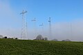
 Pylons, Rampisham Down - geograph.org.uk - 5657175.jpg 427 × 640; 65 KB
-
 Railway bridge at Toller Porcorum - geograph.org.uk - 5058343.jpg 640 × 480; 86 KB
-
 Rampisham Radio Masts - geograph.org.uk - 2783644.jpg 640 × 486; 71 KB
-
 River Hooke at Toller Porcorum - geograph.org.uk - 5058375.jpg 480 × 640; 130 KB
-

-
 Road to Clift - geograph.org.uk - 2782994.jpg 640 × 480; 127 KB
-
 Road to Higher Chilfrome - geograph.org.uk - 5674450.jpg 640 × 480; 58 KB
-
 Road towards Hooke - geograph.org.uk - 5966765.jpg 1,024 × 684; 354 KB
-
 School Lane - Toller Porcorum - geograph.org.uk - 2362843.jpg 640 × 480; 80 KB
-
 Sign for Woolcombe Farm - geograph.org.uk - 4848281.jpg 640 × 427; 87 KB
-
 Site of Toller station, 2013 - geograph.org.uk - 5645880.jpg 2,356 × 1,460; 2.81 MB
-
 Stables near Toller Porcorum - geograph.org.uk - 1259733.jpg 640 × 428; 72 KB
-
 Sun Fly basking on a leaf - geograph.org.uk - 3621346.jpg 4,608 × 3,456; 5.02 MB
-
 The corner of Kingcombe Lane - geograph.org.uk - 5292091.jpg 3,776 × 2,520; 4.1 MB
-

-

-
 The Old Swan - geograph.org.uk - 1211483.jpg 640 × 428; 64 KB
-
 The track from Wytherston Wood - geograph.org.uk - 5058669.jpg 3,264 × 2,448; 1.8 MB
-
 The Wessex Ridgeway path climbing up to Rampisham Down - geograph.org.uk - 5292084.jpg 3,776 × 2,520; 4.09 MB
-
-
 The Wessex Ridgeway path leaving the Hooke valley - geograph.org.uk - 5292118.jpg 3,776 × 2,520; 4.26 MB
-
 Toller Lane - geograph.org.uk - 5674447.jpg 480 × 640; 68 KB
-
 Farmland and church, Toller Porcorum - geograph.org.uk - 126332.jpg 640 × 480; 154 KB
-
 Toller Porcorum , Footpath - geograph.org.uk - 5507925.jpg 6,000 × 4,000; 6.74 MB
-
 Toller Porcorum , Footpath - geograph.org.uk - 5507947.jpg 6,000 × 4,000; 6.76 MB
-
 Toller Porcorum , High Street - geograph.org.uk - 5507948.jpg 6,000 × 4,000; 7.11 MB
-
 Toller Porcorum , High Street - geograph.org.uk - 5507949.jpg 6,000 × 4,000; 5.77 MB
-
 Toller Porcorum , High Street - geograph.org.uk - 5507952.jpg 6,000 × 4,000; 7.6 MB
-
 Toller Porcorum , Kingcombe Road - geograph.org.uk - 5507963.jpg 6,000 × 4,000; 6.66 MB
-
 Toller Porcorum , Kingcombe Road - geograph.org.uk - 5507965.jpg 6,000 × 4,000; 7.31 MB
-
 Toller Porcorum , Lower Road - geograph.org.uk - 5507955.jpg 6,000 × 4,000; 6.93 MB
-
 Toller Porcorum , Lower Road - geograph.org.uk - 5507956.jpg 6,000 × 4,000; 6.79 MB
-
 Toller Porcorum , Northover Farmhouse - geograph.org.uk - 5507964.jpg 6,000 × 4,000; 7.14 MB
-
 Toller Porcorum , Old Mills - geograph.org.uk - 5507944.jpg 6,000 × 4,000; 5.6 MB
-
 Toller Porcorum , Playground - geograph.org.uk - 5505632.jpg 6,000 × 4,000; 7.02 MB
-
 Toller Porcorum , Popes Cottage - geograph.org.uk - 5507962.jpg 6,000 × 4,000; 7.84 MB
-
 Toller Porcorum , School Lane - geograph.org.uk - 5507960.jpg 6,000 × 4,000; 5.65 MB
-
 Toller Porcorum , Stream - geograph.org.uk - 5507927.jpg 6,000 × 4,000; 6.73 MB
-
 Toller Porcorum , Toller House - geograph.org.uk - 5507957.jpg 6,000 × 4,000; 5.66 MB
-
 Toller Porcorum , Track - geograph.org.uk - 5507961.jpg 6,000 × 4,000; 7.27 MB
-
 Toller Porcorum - High Street (geograph 5507954).jpg 6,000 × 4,000; 6.13 MB
-
 Toller Porcorum Old Railway Station - geograph.org.uk - 1466055.jpg 640 × 480; 120 KB
-
 Toller Porcorum, 15 High Street - geograph.org.uk - 1383414.jpg 640 × 480; 80 KB
-
 Toller Porcorum, Barrowland Lane - geograph.org.uk - 550574.jpg 640 × 480; 74 KB
-

-
 Toller Porcorum, Fine house in School Lane - geograph.org.uk - 5349002.jpg 3,678 × 2,455; 4.58 MB
-
 Toller Porcorum, finger-post - geograph.org.uk - 1383424.jpg 640 × 480; 129 KB
-
 Toller Porcorum, finger-post detail - geograph.org.uk - 3361474.jpg 640 × 480; 97 KB
-
 Toller Porcorum, Manor Farm - geograph.org.uk - 5348949.jpg 4,504 × 2,752; 7.45 MB
-

-
 Toller Porcorum, the post office - geograph.org.uk - 1383419.jpg 480 × 640; 58 KB
-
 Track to Hooke - geograph.org.uk - 2783073.jpg 640 × 480; 109 KB
-
 Track to Woolcombe farm - geograph.org.uk - 1259771.jpg 640 × 428; 70 KB
-
 Valley of the River Hooke - geograph.org.uk - 1259728.jpg 640 × 428; 86 KB
-
 Venery Lodge - Clift - geograph.org.uk - 462535.jpg 640 × 480; 167 KB
-
 View from Barrowland Lane - geograph.org.uk - 3537212.jpg 4,608 × 3,456; 5.89 MB
-
 View north-west from Shatcombe Lane - geograph.org.uk - 6263859.jpg 1,024 × 768; 240 KB
-
 View towards the Masts on Rampisham Down - geograph.org.uk - 5273025.jpg 5,184 × 3,456; 6.52 MB
-
 View with Rodmore Coppice in the Distance - geograph.org.uk - 5058664.jpg 3,264 × 2,448; 3.22 MB
-
 Water Spring at Lower Kingcombe - geograph.org.uk - 2227887.jpg 640 × 480; 123 KB
-
 Wessex Ridgeway approaching Kingcombe Coppice - geograph.org.uk - 5273178.jpg 5,184 × 3,456; 5.43 MB
-
 Wessex Ridgeway at Kingcombe (1) - geograph.org.uk - 5273186.jpg 5,184 × 3,456; 4.21 MB
-
 Wessex Ridgeway at Kingcombe (2) - geograph.org.uk - 5273193.jpg 5,184 × 3,456; 7.63 MB
-
 Wessex Ridgeway outside Higher Kingcombe Barn - geograph.org.uk - 5273033.jpg 5,184 × 3,456; 5.98 MB
-
 West Dorset , Beech Cottage - geograph.org.uk - 5508992.jpg 6,000 × 4,000; 7.51 MB
-
 West Dorset , Clift Lane - geograph.org.uk - 5505616.jpg 6,000 × 4,000; 6.21 MB
-
 West Dorset , Clift Lane - geograph.org.uk - 5505617.jpg 6,000 × 4,000; 7.06 MB
-
 West Dorset , Clift Lane - geograph.org.uk - 5505619.jpg 6,000 × 4,000; 6.85 MB
-
 West Dorset , Clift Lane - geograph.org.uk - 5505620.jpg 6,000 × 4,000; 5.62 MB
-
 West Dorset , Clift Lane - geograph.org.uk - 5505623.jpg 6,000 × 4,000; 7.33 MB
-
 West Dorset , Common Lane - geograph.org.uk - 5517346.jpg 6,000 × 4,000; 7.8 MB
-
 West Dorset , Common Lane - geograph.org.uk - 5517348.jpg 6,000 × 4,000; 6.84 MB
-
 West Dorset , Country Lane - geograph.org.uk - 5505605.jpg 6,000 × 4,000; 7.88 MB
-
 West Dorset , Country Lane - geograph.org.uk - 5505610.jpg 6,000 × 4,000; 6.6 MB
-
 West Dorset , Country Lane - geograph.org.uk - 5505611.jpg 6,000 × 4,000; 6.1 MB
-
 West Dorset , Country Lane - geograph.org.uk - 5505612.jpg 6,000 × 4,000; 5.71 MB
-
 West Dorset , Country Lane - geograph.org.uk - 5505614.jpg 6,000 × 4,000; 6.34 MB
-
 West Dorset , Country Lane - geograph.org.uk - 5508993.jpg 6,000 × 4,000; 6.59 MB
-
 West Dorset , Countryside Scenery - geograph.org.uk - 5505626.jpg 6,000 × 4,000; 5.3 MB
-
 West Dorset , Countryside Scenery - geograph.org.uk - 5505629.jpg 6,000 × 4,000; 5 MB
-
 West Dorset , Countryside Scenery - geograph.org.uk - 5509000.jpg 6,000 × 4,000; 6.46 MB
-
 West Dorset , Countryside Scenery - geograph.org.uk - 5509010.jpg 6,000 × 4,000; 5.73 MB
-
 West Dorset , Countryside Scenery - geograph.org.uk - 5509031.jpg 6,000 × 4,000; 5.09 MB
-
 West Dorset , Countryside Scenery - geograph.org.uk - 5509043.jpg 6,000 × 4,000; 7.12 MB
-
 West Dorset , Countryside Scenery - geograph.org.uk - 5517339.jpg 6,000 × 4,000; 5.61 MB
-
 West Dorset , Deer - geograph.org.uk - 5509006.jpg 6,000 × 4,000; 6.56 MB
-
 West Dorset , Farm Barn - geograph.org.uk - 5505608.jpg 6,000 × 4,000; 6.38 MB
-
 West Dorset , Farm Buildings - geograph.org.uk - 5509024.jpg 6,000 × 4,000; 6.53 MB
-
 West Dorset , Footpath - geograph.org.uk - 5507971.jpg 6,000 × 4,000; 7.69 MB
-
 West Dorset , Grassy Field - geograph.org.uk - 5505606.jpg 6,000 × 4,000; 5.89 MB
-
 West Dorset , Grassy Field - geograph.org.uk - 5505622.jpg 6,000 × 4,000; 6.84 MB
-
 West Dorset , Grassy Field - geograph.org.uk - 5505624.jpg 6,000 × 4,000; 7.13 MB
-
 West Dorset , Grassy Field - geograph.org.uk - 5505625.jpg 6,000 × 4,000; 7.33 MB
-
 West Dorset , Grassy Field - geograph.org.uk - 5505627.jpg 6,000 × 4,000; 6.2 MB
-
 West Dorset , Grassy Field - geograph.org.uk - 5505628.jpg 6,000 × 4,000; 6.96 MB
-
 West Dorset , Grassy Field - geograph.org.uk - 5505630.jpg 6,000 × 4,000; 7.19 MB
-
 West Dorset , Grassy Field - geograph.org.uk - 5509013.jpg 6,000 × 4,000; 6.5 MB
-
 West Dorset , Grassy Field - geograph.org.uk - 5517350.jpg 6,000 × 4,000; 6.99 MB
-
 West Dorset , Grassy Field ^ Cattle - geograph.org.uk - 5509003.jpg 5,111 × 3,408; 6.35 MB
-
 West Dorset , Grassy Field ^ Cattle - geograph.org.uk - 5509004.jpg 6,000 × 4,000; 7.91 MB
-
 West Dorset , Grassy Field ^ Cattle - geograph.org.uk - 5509011.jpg 6,000 × 4,000; 5.62 MB
-
 West Dorset , Grassy Field ^ Cattle - geograph.org.uk - 5509014.jpg 6,000 × 4,000; 5.7 MB
-
 West Dorset , Grassy Field ^ Cattle - geograph.org.uk - 5509015.jpg 5,754 × 3,836; 5.96 MB
-
 West Dorset , Grassy Field ^ Cattle - geograph.org.uk - 5509016.jpg 6,000 × 4,000; 5.89 MB


.jpg)


.jpg)


_-_geograph.org.uk_-_5273186.jpg)
_-_geograph.org.uk_-_5273193.jpg)


