Category:Tollymore Forest Park
park in the United Kingdom .JPG) | |||||
| Upload media | |||||
| Instance of | |||||
|---|---|---|---|---|---|
| Location | Bryansford, Newry, Mourne and Down, Northern Ireland | ||||
| Inception |
| ||||
| Area |
| ||||
 | |||||
Subcategories
This category has the following 4 subcategories, out of 4 total.
Media in category "Tollymore Forest Park"
The following 200 files are in this category, out of 287 total.
(previous page) (next page)-

-

-
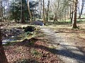
 A car on the main drive at Tollymore - geograph.org.uk - 6343710.jpg 2,669 × 1,998; 4.46 MB
-
 A depleted Shimna at Foley's Bridge - geograph.org.uk - 6452055.jpg 3,000 × 4,000; 3.29 MB
-
 A left hand tributary of the Shimna - geograph.org.uk - 5716393.jpg 3,000 × 4,000; 2.6 MB
-
 A section of the Shimna River gorge above Foley's Bridge - geograph.org.uk - 5816857.jpg 4,000 × 3,000; 2.88 MB
-

-
 A strand of deciduous trees in Tollymore Park - geograph.org.uk - 6343607.jpg 1,990 × 2,660; 5.27 MB
-

-
 Abandoned forestry quarry on Curraghard - geograph.org.uk - 6424199.jpg 4,000 × 3,000; 5.7 MB
-
 Access arch to and from the Clanbrassil Barn - geograph.org.uk - 5715903.jpg 3,000 × 4,000; 2.56 MB
-
 Altavaddy Bridge over the Spinkwee River - geograph.org.uk - 5598668.jpg 3,456 × 2,639; 6.41 MB
-
 Approach path to the Shimna just below Foley's Bridge - geograph.org.uk - 6343215.jpg 2,691 × 3,250; 7.23 MB
-
 Approaching Foley's Bridge from the east - geograph.org.uk - 5599322.jpg 4,000 × 3,000; 2.87 MB
-
 Approaching Foley's Bridge from the West - geograph.org.uk - 6398202.jpg 4,000 × 3,000; 2.84 MB
-
 Approaching Ivy Bridge from the W-NW - geograph.org.uk - 6216330.jpg 4,000 × 3,000; 2.87 MB
-
 Approaching Ivy Bridge in Tollymore Forest Park - geograph.org.uk - 5599317.jpg 4,000 × 3,000; 2.8 MB
-
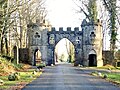
 Approaching the Barbican Gate at Tollymore Forest Park - geograph.org.uk - 5716141.jpg 3,355 × 2,634; 7.04 MB
-
 Approaching the Barbican Gate from the South - geograph.org.uk - 6398408.jpg 2,669 × 1,998; 4.72 MB
-

-
 Autumn colours in the gardens at Tollymore Forest Park - geograph.org.uk - 5975629.jpg 3,447 × 2,208; 6.08 MB
-
 Autumn colours in Tollymore Forest Park - geograph.org.uk - 5599644.jpg 4,000 × 3,000; 2.49 MB
-
 Autumn tree3.jpg 500 × 443; 146 KB
-
 Autumn tree4.jpg 670 × 563; 194 KB
-
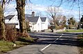 Barbican Farmhouse viewed across Bryansford Road - geograph.org.uk - 5715430.jpg 3,535 × 2,285; 7.14 MB
-
 Barbican Gate - A Close Look - geograph.org.uk - 5716191.jpg 2,504 × 3,676; 5.9 MB
-
 Bedding planes in Curraghard Quarry - geograph.org.uk - 6389178.jpg 4,000 × 3,000; 2.86 MB
-
 Bend in a forestry road on the north side of the Shimna - geograph.org.uk - 6343612.jpg 4,000 × 3,000; 2.87 MB
-

-
 Bluebells at Tollymore Forest Park - geograph.org.uk - 5763027.jpg 4,000 × 3,000; 2.85 MB
-

-

-
 Bryansford House, Newcastle, Co. Down (35172460455).jpg 2,000 × 1,300; 1.41 MB
-
 Clanbrassil Barn at Tollymore viewed across the car park - geograph.org.uk - 5715757.jpg 4,000 × 3,000; 2.81 MB
-

-
 Cloud over Tollymore forest - geograph.org.uk - 1141170.jpg 640 × 378; 47 KB
-
 Coach, Tollymore Forest Park - geograph.org.uk - 805479.jpg 640 × 412; 84 KB
-
 Colourful foliage below Tollymore's Horn Bridge - geograph.org.uk - 5975785.jpg 2,260 × 1,983; 3.57 MB
-
 Cottage, Tollymore, September 2010.JPG 4,272 × 2,848; 7.73 MB
-
 Curraghard Quarry 18 months after the wild fire - geograph.org.uk - 6338187.jpg 3,994 × 2,992; 6.28 MB
-
 Date stone on the Ivy Bridge over the Shimna - geograph.org.uk - 6343072.jpg 4,000 × 3,000; 2.96 MB
-
 Deserted main car park at Tollymore Forest Park - geograph.org.uk - 6464632.jpg 3,904 × 1,902; 2.06 MB
-
 Disused quarry on Curraghard - geograph.org.uk - 6404136.jpg 4,000 × 3,000; 2.84 MB
-
 Disused stone quarry on Curraghard - geograph.org.uk - 5531893.jpg 4,000 × 3,000; 4 MB
-

-
 Early stages of plant re-colonization at Curraghard Quarry - geograph.org.uk - 6338383.jpg 3,976 × 2,968; 6.08 MB
-
 Entrance to the Tollymore Hermitage - geograph.org.uk - 6360727.jpg 3,000 × 4,000; 6.25 MB
-
 Exposed block field on the burnt slopes of Curraghard - geograph.org.uk - 6338392.jpg 4,000 × 3,000; 6.51 MB
-
 Fallen tree on the north facing side of Curraghard - geograph.org.uk - 6424712.jpg 3,384 × 1,685; 1.87 MB
-
 Fallen trees on Curraghard - geograph.org.uk - 6389266.jpg 4,000 × 3,000; 2.88 MB
-
 Fallen trees on the summit of Curraghard - geograph.org.uk - 6424253.jpg 3,721 × 2,709; 4.04 MB
-

-
 Flowering trees in the Arbouretum at Tollymore Forest Park - geograph.org.uk - 6464651.jpg 3,880 × 2,376; 2.56 MB
-
 Foam pollution in the Shimna River at Tollymore - geograph.org.uk - 6216386.jpg 4,000 × 3,000; 2.85 MB
-
 Foley's Alpine Bridge at Tollymore Forest Park - geograph.org.uk - 6216373.jpg 3,729 × 2,896; 7.51 MB
-
 Foley's Alpine-style footbridge at Tollymore Park - geograph.org.uk - 6464574.jpg 4,000 × 3,000; 2.55 MB
-
 Foley's Bridge from the North - geograph.org.uk - 5599329.jpg 2,668 × 2,836; 7.3 MB
-
 Foley's Bridge from the River Drive - geograph.org.uk - 6343221.jpg 2,748 × 3,824; 7.79 MB
-
 Foley's Bridge from the south bank of the Shimna - geograph.org.uk - 6343251.jpg 3,622 × 2,450; 6.18 MB
-
 Foley's Bridge from the south side of the river - geograph.org.uk - 5599659.jpg 4,000 × 3,000; 2.83 MB
-
 Foley's Bridge in Tollymore Forest Park - geograph.org.uk - 6454055.jpg 3,000 × 4,000; 2.89 MB
-
 Foley's Bridge of 1787 - geograph.org.uk - 6216381.jpg 4,000 × 3,000; 2.82 MB
-
 Foley's Bridge spanning the Shimna River at Tollymore Park - geograph.org.uk - 6216380.jpg 4,000 × 3,000; 2.82 MB
-
 Foley's Bridge, Tollymore forest (1) - geograph.org.uk - 644080.jpg 640 × 429; 134 KB
-
 Foley's Bridge, Tollymore Forest Park - geograph.org.uk - 5598498.jpg 4,000 × 3,000; 2.83 MB
-
 Foley's Bridge, Tollymore Forest Park - geograph.org.uk - 5816871.jpg 4,000 × 3,000; 2.88 MB
-
 Foley's Bridge, Tollymore Park - geograph.org.uk - 6343226.jpg 3,589 × 2,409; 6.98 MB
-
 Foley's Footbridge at Tollymore Forest Park - geograph.org.uk - 5816875.jpg 4,000 × 3,000; 2.88 MB
-
 Footbridge over the Shimna at Tollymore Forest Park - geograph.org.uk - 5763079.jpg 4,000 × 3,000; 2.89 MB
-
 Forest drive east of Ivy Bridge, Tollymore Forest Park - geograph.org.uk - 5599319.jpg 3,000 × 4,000; 2.6 MB
-
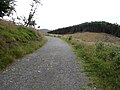
 Forest path along unnamed stream north of the Main Drive - geograph.org.uk - 5716417.jpg 4,000 × 3,000; 2.86 MB
-
 Forest road running west parallel with the Shimna - geograph.org.uk - 5599356.jpg 4,000 × 3,000; 2.88 MB
-
 Forest sunset (2456595398).jpg 2,592 × 3,872; 6.46 MB
-
 Forestry road at the Drinns Col in Tollymore Forest Park - geograph.org.uk - 5532407.jpg 4,000 × 3,000; 3.65 MB
-
 Forestry Road on the southern edge of Curraghard - geograph.org.uk - 6404149.jpg 1,917 × 1,917; 1.89 MB
-
 Forestry Road on the southern edge of Curraghard - geograph.org.uk - 6404214.jpg 4,000 × 3,000; 2.9 MB
-
 Fountain near the Horn Bridge Arch - geograph.org.uk - 5763059.jpg 3,000 × 4,000; 2.61 MB
-
 Gorge immediately west of Old Bridge, Tollymore Park - geograph.org.uk - 5816835.jpg 4,000 × 2,292; 6.06 MB
-

-
 Grazing land on the edge of Tollymore Park - geograph.org.uk - 5716900.jpg 4,000 × 3,000; 2.85 MB
-
 Grazing sheep on parkland at Tollymore Forest Park - geograph.org.uk - 5763097.jpg 2,246 × 1,136; 1.08 MB
-

-
 Harvested timber at Tollymore Forest Park - geograph.org.uk - 5763006.jpg 4,000 × 3,000; 2.86 MB
-

-
 Heron fishing in Tollymore Lake - geograph.org.uk - 5816828.jpg 2,500 × 2,111; 4.21 MB
-

-
 Himalayan Cedars lining the Main Drive at Tollymore - geograph.org.uk - 5715919.jpg 4,000 × 2,473; 7.72 MB
-
 Hore's Bridge on the lower Spinkwee - geograph.org.uk - 5599631.jpg 2,668 × 2,000; 4.42 MB
-
 IAC's AW-139 water bombing on the edge of Tollymore Park - geograph.org.uk - 5855786.jpg 1,779 × 1,334; 930 KB
-
 In Tollymore Forest Park. - geograph.org.uk - 71306.jpg 429 × 640; 146 KB
-
 Inside the Barbican Gate - geograph.org.uk - 5716189.jpg 3,000 × 4,000; 2.58 MB
-
 Ivy Bridge at Tollymore Park - geograph.org.uk - 6216329.jpg 3,918 × 2,376; 7.41 MB
-
 Ivy bridge over the Shimna River - geograph.org.uk - 5599316.jpg 3,662 × 2,593; 7.48 MB
-
 Leaves and trees, Tollymore forest park - geograph.org.uk - 1540007.jpg 625 × 389; 121 KB
-
 Locked vehicle gate at Tollymore's Barbican Gate - geograph.org.uk - 6449479.jpg 4,000 × 3,000; 2.87 MB
-
 Main car park at Tollymore Forest Park - geograph.org.uk - 6216353.jpg 3,407 × 2,182; 3.93 MB
-
 Man-made lake at Tollymore Forest Park - geograph.org.uk - 6451912.jpg 4,000 × 3,000; 3.66 MB
-
 Millpond, Tollymore forest - geograph.org.uk - 644132.jpg 640 × 390; 86 KB
-
 Millrace, Tollymore forest - geograph.org.uk - 644168.jpg 640 × 429; 113 KB
-
 Moss covered rocks in the Shimna Gorge - geograph.org.uk - 6465222.jpg 4,000 × 3,000; 3 MB
-
 Mounds of stones along side the Tollymore demesne wall path - geograph.org.uk - 6419184.jpg 3,000 × 4,000; 3.93 MB
-

-
 Newcastle Way Footpath on Curraghard - geograph.org.uk - 6389158.jpg 4,000 × 3,000; 2.9 MB
-
 Newly clothed trees on the bank of the Shimna - geograph.org.uk - 6464578.jpg 3,000 × 4,000; 2.91 MB
-

-
 NI Forest Service shed in Tollymore Park - geograph.org.uk - 5599305.jpg 4,000 × 3,000; 2.84 MB
-
 NI Forestry Service shed in Tollymore Forest - geograph.org.uk - 6451925.jpg 3,834 × 1,603; 2.69 MB
-
 Nursery plantation on the partially deforested Drinns - geograph.org.uk - 6404103.jpg 4,000 × 3,000; 2.89 MB
-
 On Curraghard Mountain - geograph.org.uk - 6424255.jpg 4,000 × 3,000; 2.86 MB
-
 Parkland above the Shimna at Tollymore Forest Park - geograph.org.uk - 6216358.jpg 2,668 × 2,077; 3.94 MB
-
 Parkland at Tollymore Forest Park - geograph.org.uk - 6464912.jpg 3,560 × 1,713; 1.64 MB
-
 Parkland at Tollymore Park - geograph.org.uk - 5716476.jpg 2,882 × 3,914; 7.73 MB
-
 Parkland trees at Tollymore - geograph.org.uk - 6464916.jpg 4,000 × 3,000; 2.85 MB
-
 Path alongside the Tollymore Demesne Wall - geograph.org.uk - 6418714.jpg 4,000 × 3,000; 4 MB
-
 Path crossroads between Horn Bridge and the Shimna River - geograph.org.uk - 6360704.jpg 3,181 × 2,074; 4.83 MB
-
 Path heading South towards the Horn Bridge - geograph.org.uk - 5763052.jpg 4,000 × 3,000; 2.88 MB
-

-
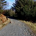
 Path through the forest on the southern slopes of Curraghard - geograph.org.uk - 6423854.jpg 3,000 × 4,000; 4.52 MB
-
 Path, Tollymore forest park (1) - geograph.org.uk - 1539979.jpg 602 × 383; 113 KB
-
 Path, Tollymore forest park (2) - geograph.org.uk - 1540053.jpg 532 × 397; 105 KB
-
 Path, Tollymore forest park (3) - geograph.org.uk - 1540094.jpg 609 × 389; 119 KB
-
 Path, Tollymore forest park (4) - geograph.org.uk - 1540233.jpg 617 × 404; 105 KB
-
 Pony trekking in Tollymore Park - geograph.org.uk - 6398386.jpg 2,670 × 1,999; 4.6 MB
-
 Pools and Riffles in the Shimna River below Foley's Bridge - geograph.org.uk - 5599340.jpg 3,110 × 2,730; 7.54 MB
-
 Pot holes in the bed of the Shimna above Old Bridge - geograph.org.uk - 5816840.jpg 2,668 × 2,531; 4.95 MB
-
 Rangers Office, Tollymore, September 2010.JPG 4,272 × 2,848; 5.94 MB
-
 Riffles below Foley's Bridge - geograph.org.uk - 5599668.jpg 3,000 × 4,000; 2.53 MB
-
 Riverside walk below the Meeting of the Waters - geograph.org.uk - 6343290.jpg 4,000 × 3,000; 2.9 MB
-
 Rushing water (906985277).jpg 1,200 × 803; 518 KB
-
 Shelter overlooking the lower section of the Spinkwee River - geograph.org.uk - 5598674.jpg 2,668 × 2,000; 3.99 MB
-
 Shelter, Tollymore forest park - geograph.org.uk - 1540178.jpg 636 × 380; 108 KB
-
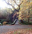
 Shimna Gorge above the Hermitage - geograph.org.uk - 5598563.jpg 2,668 × 2,000; 4.97 MB
-
 Sign of the Times at Tollymore's Barbican Gate - geograph.org.uk - 6449723.jpg 4,000 × 3,000; 2.21 MB
-
 Signature stone on Foley's Bridge, Tollymore Park - geograph.org.uk - 6343234.jpg 3,000 × 3,390; 6.76 MB
-
 Silo and sheds at the Barbican Farm - geograph.org.uk - 6448540.jpg 4,000 × 3,000; 3.4 MB
-

-
-
 Steeple and entrance arch at Clanbrassil Barn, Tollymore - geograph.org.uk - 5715909.jpg 3,000 × 4,000; 2.7 MB
-
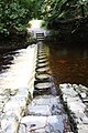
 Stepping stones (906985343).jpg 803 × 1,200; 423 KB
-
 Stepping stones just below the Meeting of the Waters - geograph.org.uk - 6343273.jpg 3,105 × 1,998; 5.87 MB
-
 Stepping stones, Tollymore, September 2010 (01).JPG 2,848 × 4,272; 4.97 MB
-
 Stepping stones, Tollymore, September 2010 (02).JPG 2,848 × 4,272; 5.22 MB
-
 Stepping stones, Tollymore, September 2010 (03).JPG 2,848 × 4,272; 5.9 MB
-
 Stone footbridge, Tollymore forest - geograph.org.uk - 643890.jpg 616 × 420; 103 KB
-

-
 Stream bridge on the grand drive of Tollymore Park - geograph.org.uk - 5763129.jpg 3,480 × 2,457; 6.44 MB
-
 Sunshine river (2450925591).jpg 2,592 × 3,872; 6.65 MB
-

-
 The "Poor Old Jim" Obelisk at Tollymore - geograph.org.uk - 6464906.jpg 4,000 × 3,000; 2.85 MB
-

-
 The Barbican Gate at Tollymore - geograph.org.uk - 5715477.jpg 4,000 × 3,000; 2.85 MB
-
 The Barbican Gate at Tollymore Forest Park - geograph.org.uk - 5975832.jpg 2,593 × 1,894; 3.57 MB
-
 The Barbican Gate at Tollymore Forest Park - geograph.org.uk - 6359191.jpg 2,666 × 1,996; 3.87 MB
-
 The Barbican Gate barred to motor vehicles - geograph.org.uk - 6450359.jpg 4,000 × 3,000; 3.82 MB
-
 The Barbican Gate of Tollymore Forest Park - geograph.org.uk - 5763122.jpg 4,000 × 3,000; 2.9 MB
-
 The Barbican Gate, Tollymore forest - geograph.org.uk - 805119.jpg 640 × 419; 114 KB
-

-
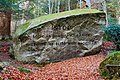 The Big Stone, Tollymore forest - geograph.org.uk - 644197.jpg 581 × 389; 101 KB
-
 The bridge (1613365625).jpg 1,024 × 685; 437 KB
-
 The car park at Tollymore Forest Park - geograph.org.uk - 5612778.jpg 3,084 × 2,456; 3.79 MB
-
 The Clanbrassil Barn at Tollymore - geograph.org.uk - 6464893.jpg 3,000 × 2,707; 2.41 MB
-
 The Drive, Tollymore forest (1) - geograph.org.uk - 805177.jpg 640 × 395; 103 KB
-
 The Drive, Tollymore forest (2) - geograph.org.uk - 805227.jpg 640 × 397; 102 KB
-
 The estate village of Bryansford from the Tollymore Demesne - geograph.org.uk - 5716364.jpg 2,668 × 2,000; 4.67 MB
-
 The fire blackened rocks of Curraghard Stone Quarry - geograph.org.uk - 6338201.jpg 3,928 × 2,902; 7.05 MB
-

-
 The Footstick Bridge, Tollymore forest - geograph.org.uk - 644219.jpg 640 × 429; 118 KB
-

-
 The Hermitage at Tollymore - geograph.org.uk - 5599581.jpg 2,872 × 2,801; 7.28 MB
-
 The Hermitage, Tollymore Forest Park - geograph.org.uk - 5598557.jpg 4,000 × 3,000; 2.89 MB
-
 The High Mournes from The Drinns - geograph.org.uk - 6424319.jpg 3,075 × 1,861; 1.53 MB
-
 The Himalayan Cedar lined main drive of Tollymore Park - geograph.org.uk - 5715500.jpg 3,000 × 4,000; 2.58 MB
-
 The Horn Bridge at Tollymore Forest Park - geograph.org.uk - 5763036.jpg 4,000 × 3,000; 2.82 MB
-
 The Horn Bridge at Tollymore Park - geograph.org.uk - 6464667.jpg 4,000 × 3,000; 2.99 MB
-
 The interior of the Tollymore Hermitage - geograph.org.uk - 6360672.jpg 3,000 × 4,000; 2.5 MB
-
 The Ivy Bridge end of the River Drive at Tollymore Park - geograph.org.uk - 6343075.jpg 2,873 × 3,432; 6.82 MB
-
 The James Bligh Jocelyn obelisk at Tollymore Park - geograph.org.uk - 6343699.jpg 2,670 × 1,998; 3.98 MB
-
 The James Bligh Jocelyn obelisk in Tollymore Park - geograph.org.uk - 5763154.jpg 3,112 × 1,998; 3.43 MB
-
 The James Bligh RN obelisk at Tollymore - geograph.org.uk - 6464920.jpg 3,742 × 2,367; 2.06 MB
-
 The mossy parapets of Foley's Bridge, Tollymore Park - geograph.org.uk - 6343253.jpg 3,479 × 2,480; 6.43 MB
-
 The NI Forest Service Toll Booth at Tollymore Park - geograph.org.uk - 5716453.jpg 1,780 × 1,334; 2.24 MB
-
 The Old Bridge, Tollymore forest - geograph.org.uk - 644051.jpg 640 × 441; 139 KB
-
 The River Shimna above Foley's Bridge - geograph.org.uk - 5599335.jpg 3,113 × 2,186; 6.07 MB
-
 The Riverside Path above Foley's Bridge - geograph.org.uk - 6216360.jpg 3,156 × 2,312; 7.16 MB
-
 The Shimna above Foley's Bridge - geograph.org.uk - 6343237.jpg 2,747 × 3,145; 6.11 MB
-
 The Shimna above Foley's Bridge. - geograph.org.uk - 6360709.jpg 2,115 × 3,386; 6.52 MB
-
 The Shimna below Foley's Bridge - geograph.org.uk - 5599342.jpg 4,000 × 3,000; 2.87 MB
-
 The Shimna downstream of the wooden footbridge - geograph.org.uk - 5763084.jpg 4,000 × 3,000; 2.88 MB
-
 The Shimna Gorge - geograph.org.uk - 6343257.jpg 3,076 × 2,100; 5.53 MB
-
 The Shimna Gorge above Foley's Bridge - geograph.org.uk - 6399308.jpg 2,670 × 1,999; 5.17 MB
-
 The Shimna Gorge West of Foley's Bridge - geograph.org.uk - 6399313.jpg 4,000 × 3,000; 2.87 MB
-
 The Shimna immediately downstream of Foley's Bridge - geograph.org.uk - 6343248.jpg 3,998 × 2,998; 7.93 MB
-
 The Shimna River above Foley's Bridge - geograph.org.uk - 5816854.jpg 3,179 × 2,427; 7.02 MB
-
 The Shimna River above Ivy Bridge - geograph.org.uk - 5598475.jpg 4,000 × 3,000; 2.88 MB
-
 The Shimna River below Ivy Bridge at Tollymore Park - geograph.org.uk - 6216327.jpg 2,669 × 1,998; 4.1 MB
-
 The Shimna River below the Ivy Bridge - geograph.org.uk - 6398414.jpg 3,000 × 4,000; 2.59 MB
-

-
 The Shimna River downstream of Foley's Bridge - geograph.org.uk - 6343212.jpg 3,000 × 4,000; 7.54 MB
-
 The Shimna River downstream of Foley's Bridge - geograph.org.uk - 6343245.jpg 3,000 × 3,663; 7.89 MB
-
 The Shimna River east of Foley's Bridge - geograph.org.uk - 5599324.jpg 4,000 × 3,000; 2.87 MB
.jpg)


.jpg)


_-_geograph.org.uk_-_644080.jpg)


.jpg)


_-_geograph.org.uk_-_1539979.jpg)
_-_geograph.org.uk_-_1540053.jpg)
_-_geograph.org.uk_-_1540094.jpg)
_-_geograph.org.uk_-_1540233.jpg)


.jpg)


.jpg)

.JPG)
.JPG)
.JPG)


.jpg)


.jpg)


_-_geograph.org.uk_-_805177.jpg)
_-_geograph.org.uk_-_805227.jpg)


