Category:Tomich
English: Tomich is a Victorian model conservation village situated in the Scottish Highlands at the western end of Strathglass, approximately 30 miles from Inverness.
human settlement in Highland, Scotland, UK  | |||||
| Upload media | |||||
| Instance of | |||||
|---|---|---|---|---|---|
| Location |
| ||||
 | |||||
Subcategories
This category has the following 2 subcategories, out of 2 total.
G
- Guisachan House (11 F)
T
- Tweedmouth Memorial Fountain (13 F)
Media in category "Tomich"
The following 46 files are in this category, out of 46 total.
-
 A cottage in Tomich - geograph.org.uk - 1536502.jpg 640 × 480; 87 KB
-
 A parting of the ways in Tomich - geograph.org.uk - 1536526.jpg 640 × 480; 92 KB
-
 A residence in Tomich - geograph.org.uk - 1536496.jpg 640 × 480; 85 KB
-
 An old oxbow near Tomich - geograph.org.uk - 1536126.jpg 640 × 480; 65 KB
-
 Approach to Tomich Hotel - geograph.org.uk - 1536457.jpg 640 × 443; 79 KB
-
 Bridge over the Allt Currachan, Tomich - geograph.org.uk - 1035318.jpg 640 × 430; 108 KB
-
 Cattle grid on Tomich road - geograph.org.uk - 1536258.jpg 640 × 510; 116 KB
-
 Cottage at Tomich - geograph.org.uk - 1035340.jpg 640 × 415; 100 KB
-
 Cottage garden in Tomich - geograph.org.uk - 2990949.jpg 640 × 480; 118 KB
-
 Derelict building near Tomich - geograph.org.uk - 169269.jpg 640 × 479; 107 KB
-
 Dried up oxbow near Tomich - geograph.org.uk - 1035312.jpg 640 × 425; 104 KB
-
 Forestry cottages at Tomich - geograph.org.uk - 2274717.jpg 1,024 × 729; 174 KB
-
 Gateway to Guisachan Farm - geograph.org.uk - 1536509.jpg 640 × 480; 122 KB
-
 Gateway to Guisachan Home farm - geograph.org.uk - 1033881.jpg 640 × 425; 135 KB
-
 Guisachan Lodge, by Tomich - geograph.org.uk - 43352.jpg 640 × 480; 87 KB
-
 Hilton Lodge - geograph.org.uk - 169302.jpg 640 × 475; 58 KB
-
 Hump-back bridge, Tomich - geograph.org.uk - 1536429.jpg 640 × 469; 106 KB
-
 Lamp-posts in Tomich - geograph.org.uk - 1536446.jpg 640 × 480; 104 KB
-
 Looking north east through Tomich - geograph.org.uk - 4637063.jpg 1,800 × 1,012; 1.7 MB
-
 Minor road to Tomich - geograph.org.uk - 659591.jpg 640 × 425; 73 KB
-
 Ornamented lamp-post in Tomich - geograph.org.uk - 1536519.jpg 640 × 480; 72 KB
-
 Sign at entrance to Tomich - geograph.org.uk - 1035316.jpg 640 × 425; 111 KB
-
 The Tomich Hotel - geograph.org.uk - 1033892.jpg 640 × 425; 84 KB
-
 The Tomich Hotel - geograph.org.uk - 1536482.jpg 640 × 480; 79 KB
-
 Tomich Hotel - geograph.org.uk - 2990871.jpg 640 × 480; 87 KB
-
 Tomich Hotel - geograph.org.uk - 4133652.jpg 1,024 × 681; 174 KB
-
 Tomich Hotel annexe^ - geograph.org.uk - 1536465.jpg 640 × 480; 69 KB
-
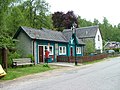
 Tomich Post Office - geograph.org.uk - 1033885.jpg 640 × 428; 113 KB
-
 Tomich Post Office - geograph.org.uk - 1536489.jpg 640 × 480; 103 KB
-
 Tomich Post Office - geograph.org.uk - 1966605.jpg 640 × 395; 85 KB
-
 Tomich Post Office - geograph.org.uk - 2990944.jpg 640 × 480; 106 KB
-
 Tomich post office.JPG 3,100 × 2,077; 3.04 MB
-
 Track to Loch a'Ghreidlein - geograph.org.uk - 1033908.jpg 425 × 640; 100 KB
-

-
 Unclassified road near Tomich - geograph.org.uk - 659590.jpg 640 × 425; 68 KB
-
 Welcome to Tomich - geograph.org.uk - 1536244.jpg 640 × 480; 74 KB
-
 Entrance to the village of Tomich - geograph.org.uk - 169283.jpg 640 × 487; 82 KB
-
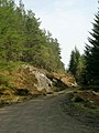
 Forest track - geograph.org.uk - 252737.jpg 640 × 480; 145 KB
-
 Forestry track above Tomich - geograph.org.uk - 168783.jpg 480 × 640; 83 KB
-
 Frozen beach, Loch ma Stac - geograph.org.uk - 16933.jpg 640 × 416; 74 KB
-
 Guisachan Farm - geograph.org.uk - 250881.jpg 640 × 480; 179 KB
-
 Loch "Gretel" Ghreidlein - geograph.org.uk - 250837.jpg 640 × 480; 179 KB
-
 Loch na Beinne Bige - geograph.org.uk - 252734.jpg 640 × 480; 164 KB
-
 Loch na Beinne Moire - geograph.org.uk - 250838.jpg 640 × 480; 133 KB
-
 The Tomich Hotel - geograph.org.uk - 169277.jpg 640 × 476; 73 KB
-
 Track near Plodda falls - geograph.org.uk - 572148.jpg 640 × 427; 131 KB


