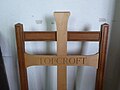
Category:Topcroft
English: Topcroft is a village and a civil parish in the English county of Norfolk. The village is south of the of B1527 road. The nearest railway station is at Norwich for the Great Eastern Main Line which runs between Norwich and Liverpool Street station, London. The nearest airport is Norwich International Airport. The parish in the 2001 census, has a population of 268. For the purposes of local government, the parish falls within the district of South Norfolk. Two notable residents of Topcroft are the artist Hannah Gifford (creator of "Red Fox") and the poet Sophie Tataryn.
village in the United Kingdom  | |||||
| Upload media | |||||
| Instance of | |||||
|---|---|---|---|---|---|
| Location | South Norfolk, Norfolk, East of England, England | ||||
| Area |
| ||||
 | |||||
Subcategories
This category has the following 4 subcategories, out of 4 total.
Media in category "Topcroft"
The following 200 files are in this category, out of 374 total.
(previous page) (next page)-

-

-

-

-

-

-
 A Harvard (T-6) aircraft - geograph.org.uk - 4080222.jpg 640 × 450; 148 KB
-
 A Harvard (T-6) aircraft - geograph.org.uk - 4080226.jpg 640 × 506; 207 KB
-
 A Harvard (T-6) aircraft - nose art - geograph.org.uk - 4080239.jpg 640 × 627; 156 KB
-
 A Mustang P-51D fighter aircraft - geograph.org.uk - 4080209.jpg 640 × 482; 133 KB
-
 A Mustang P-51D fighter aircraft - geograph.org.uk - 4080210.jpg 640 × 513; 193 KB
-
 A Mustang P-51D fighter aircraft - geograph.org.uk - 4080215.jpg 640 × 516; 164 KB
-
 A Mustang P-51D fighter aircraft - geograph.org.uk - 4080217.jpg 640 × 480; 162 KB
-
 A wide hedge - geograph.org.uk - 5197988.jpg 640 × 360; 413 KB
-
 Access road to Airfield Farm - geograph.org.uk - 4722771.jpg 640 × 360; 338 KB
-

-
 Approaching Airfield Farm - geograph.org.uk - 4722831.jpg 640 × 532; 404 KB
-
 Autumn leaves on concrete track - geograph.org.uk - 5198031.jpg 640 × 360; 374 KB
-
 Autumnal crop fields - geograph.org.uk - 4722955.jpg 640 × 360; 211 KB
-

-
 Autumnal hedge near Topcroft Street - geograph.org.uk - 5197966.jpg 640 × 360; 376 KB
-
 Autumnal trees beside footpath - geograph.org.uk - 4722914.jpg 640 × 499; 417 KB
-
 Barford Farm sign - geograph.org.uk - 3761442.jpg 3,072 × 2,304; 1.92 MB
-
 Barford Road past Longwood House - geograph.org.uk - 5197951.jpg 640 × 480; 379 KB
-
 Barford Road sign - geograph.org.uk - 3628816.jpg 2,872 × 2,158; 2.29 MB
-
 Barford Road sign - geograph.org.uk - 3760558.jpg 3,072 × 2,304; 1.87 MB
-
-
 Barford Road, Topcroft Street - geograph.org.uk - 3628856.jpg 3,072 × 2,304; 1.27 MB
-
 Barford Road, Topcroft Street - geograph.org.uk - 3760561.jpg 3,072 × 2,304; 1.71 MB
-
 Barford Road, Topcroft Street - geograph.org.uk - 3760570.jpg 3,072 × 2,304; 1.91 MB
-
 Barford Road, Topcroft Street - geograph.org.uk - 3761455.jpg 3,072 × 2,304; 1.8 MB
-
 Barford Road, Topcroft Street - geograph.org.uk - 3761465.jpg 3,072 × 2,304; 2.02 MB
-
 Barford Road, Topcroft Street - geograph.org.uk - 3761505.jpg 3,072 × 2,304; 1.83 MB
-
 Barrack hut on Communal site A - geograph.org.uk - 4053494.jpg 640 × 480; 190 KB
-
 Bee hives beside the footpath - geograph.org.uk - 4053682.jpg 640 × 480; 278 KB
-
 Beech trees beside the footpath - geograph.org.uk - 4722977.jpg 640 × 505; 556 KB
-

-
 Brass memorial plaque to the 93rd Bomb Group at Topcroft - geograph.org.uk - 4541923.jpg 2,592 × 1,764; 829 KB
-
 Broken Footpath Sign - geograph.org.uk - 5204952.jpg 767 × 1,024; 194 KB
-
 Buildings on the old Hardwick airfield - geograph.org.uk - 2153745.jpg 640 × 480; 136 KB
-
 Bus Shelter Road ^ Name sign ^ Village Notice Board - geograph.org.uk - 3759612.jpg 3,072 × 2,304; 1.96 MB
-
 Cattle shed at Longwood House - geograph.org.uk - 5197947.jpg 640 × 480; 354 KB
-
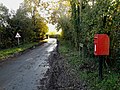
 Church Road Postbox - geograph.org.uk - 3759130.jpg 2,304 × 3,072; 1.87 MB
-
 Church Road Postbox - geograph.org.uk - 3759142.jpg 2,304 × 3,072; 2.11 MB
-
 Church Road Postbox ^ Telephone Box - geograph.org.uk - 3760158.jpg 2,279 × 3,042; 1.95 MB
-
 Church Road sign - geograph.org.uk - 3759148.jpg 3,072 × 2,304; 2.08 MB
-
 Church Road sign - geograph.org.uk - 3760169.jpg 3,072 × 2,304; 1.93 MB
-
 Church Road ^ Church Road Postbox - geograph.org.uk - 3760153.jpg 3,072 × 2,304; 1.88 MB
-
 Church Road ^ Church Road Postbox - geograph.org.uk - 3760155.jpg 3,072 × 2,304; 1.7 MB
-
 Church Road, Topcroft - geograph.org.uk - 3760165.jpg 3,072 × 2,304; 1.8 MB
-
 Church Road, Topcroft - geograph.org.uk - 3760166.jpg 3,072 × 2,304; 1.27 MB
-
 Collapsed straw bale stack - geograph.org.uk - 4722908.jpg 640 × 360; 300 KB
-
 Communications mast on Airfield Farm - geograph.org.uk - 4722833.jpg 432 × 640; 256 KB
-
 Concrete rubble in the hedge - geograph.org.uk - 5197982.jpg 640 × 360; 397 KB
-

-

-

-
 Concreted track - geograph.org.uk - 4722877.jpg 640 × 360; 349 KB
-
 Cottage in Topcroft Street - geograph.org.uk - 3476933.jpg 480 × 640; 220 KB
-
 Country Road - geograph.org.uk - 1899578.jpg 640 × 480; 68 KB
-
 Cracked concrete - geograph.org.uk - 5198037.jpg 640 × 360; 347 KB
-
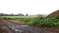
 Crop field by Airfield Farm - geograph.org.uk - 5198000.jpg 640 × 360; 211 KB
-
 Crop field by Airfield Farm - geograph.org.uk - 5198045.jpg 640 × 480; 322 KB
-
 Crop fields beside the footpath - geograph.org.uk - 4722961.jpg 640 × 360; 260 KB
-
 Crop fields by Airfield Farm - geograph.org.uk - 4722773.jpg 640 × 360; 303 KB
-
 Crop fields by Topcroft Street - geograph.org.uk - 5197974.jpg 640 × 360; 360 KB
-
 Cultivated fields by Airfield Farm - geograph.org.uk - 4722809.jpg 640 × 360; 294 KB
-
 Denton Road sign - geograph.org.uk - 3761479.jpg 2,983 × 2,241; 1.52 MB
-
 Denton road sign - geograph.org.uk - 3761493.jpg 3,029 × 2,276; 2.94 MB
-
 Denton Road, Topcroft - geograph.org.uk - 3761485.jpg 3,072 × 2,304; 1.96 MB
-
 Ditch beside lane south of Bedingham - geograph.org.uk - 3846655.jpg 640 × 430; 142 KB
-
 Ditch beside lane to Bedingham - geograph.org.uk - 3846659.jpg 640 × 480; 205 KB
-
 Door in hedge, Topcroft Street - geograph.org.uk - 3475293.jpg 640 × 456; 175 KB
-
 Driveway to Longwood House - geograph.org.uk - 5197945.jpg 640 × 480; 440 KB
-
 Driveway to the Old Rectory - geograph.org.uk - 4347737.jpg 640 × 480; 263 KB
-
 Driveway to Topcroft Hall - geograph.org.uk - 3476895.jpg 640 × 433; 160 KB
-
 Entering Topcroft on Topcroft Street - geograph.org.uk - 3760225.jpg 2,965 × 2,227; 1.02 MB
-
 Entrance to Barford Farm - geograph.org.uk - 3761439.jpg 2,304 × 3,072; 1.85 MB
-
 Entrance to Barford Farm ^ Post Office Stores Postbox - geograph.org.uk - 3761428.jpg 3,072 × 2,304; 2.08 MB
-
 Entrance to Barford Farm ^ Post Office Stores Postbox - geograph.org.uk - 3761458.jpg 3,072 × 2,304; 1.82 MB
-
 Entrance to Topcroft Lakes - geograph.org.uk - 3584686.jpg 3,072 × 2,304; 1.4 MB
-
 Entrance to Topcroft Lodge - geograph.org.uk - 2153780.jpg 640 × 480; 249 KB
-
 Ex-RAF building in Barford Road - geograph.org.uk - 4043867.jpg 640 × 480; 247 KB
-
 Ex-RAF building on Barford Farm - geograph.org.uk - 4043887.jpg 640 × 480; 150 KB
-
 Ex-RAF building on Communal site A - geograph.org.uk - 4053565.jpg 640 × 637; 302 KB
-
 Ex-RAF buildings on Communal site A - geograph.org.uk - 4053502.jpg 640 × 480; 158 KB
-
 Ex-RAF buildings on Communal site A - geograph.org.uk - 4053561.jpg 640 × 480; 218 KB
-
 Ex-RAF buildings on Site 2 - geograph.org.uk - 4053530.jpg 640 × 480; 201 KB
-

-
 Farm buildings at Hill Farm - geograph.org.uk - 4347734.jpg 640 × 480; 124 KB
-
 Farm buildings at Hill Farm - geograph.org.uk - 4347751.jpg 640 × 480; 191 KB
-
 Farm road to Barondale Lane - geograph.org.uk - 4722822.jpg 640 × 360; 314 KB
-
 Farm track to Barford Road - geograph.org.uk - 5197959.jpg 640 × 480; 409 KB
-
 Farm track to Barford Road - geograph.org.uk - 5197964.jpg 640 × 480; 460 KB
-
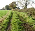
 Farmtrack and footpath - geograph.org.uk - 5197965.jpg 640 × 480; 476 KB
-
 Farmtrack and footpath to Barford Road - geograph.org.uk - 5197967.jpg 640 × 360; 354 KB
-
 Farmtrack and footpath to Barford Road - geograph.org.uk - 5197971.jpg 640 × 360; 321 KB
-
 Farmtrack and footpath to Barondole Road - geograph.org.uk - 5197968.jpg 640 × 360; 343 KB
-
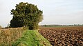
 Field boundary hedge - geograph.org.uk - 3846662.jpg 615 × 640; 241 KB
-
 Field boundary hedge - geograph.org.uk - 4722775.jpg 640 × 360; 366 KB
-
 Field boundary hedge by Low Farm - geograph.org.uk - 3846660.jpg 640 × 480; 223 KB
-
 Field by Airfield Farm - geograph.org.uk - 4722823.jpg 640 × 360; 255 KB
-
 Field entrance off Low Road - geograph.org.uk - 3689461.jpg 3,072 × 2,304; 1.59 MB
-
 Fields beside the path - geograph.org.uk - 4722969.jpg 640 × 360; 262 KB
-
 Fields by Airfield Farm - geograph.org.uk - 4722803.jpg 640 × 360; 214 KB
-
 Fields by Chapel Farm - geograph.org.uk - 4722941.jpg 640 × 360; 313 KB
-
 Fields by Valley Farm - geograph.org.uk - 3846648.jpg 588 × 640; 234 KB
-
 Fields in October - geograph.org.uk - 4722816.jpg 640 × 360; 331 KB
-
 Fields north of Darrow Green Road - geograph.org.uk - 4722915.jpg 640 × 360; 321 KB
-
 Footpath following concrete WW2 road - geograph.org.uk - 4722863.jpg 640 × 556; 463 KB
-
 Footpath junction by Chapel Farm (site) - geograph.org.uk - 4722989.jpg 640 × 360; 421 KB
-
 Footpath near Airfield Farm - geograph.org.uk - 4722862.jpg 640 × 360; 320 KB
-
 Footpath near Longwood Farm - geograph.org.uk - 1899519.jpg 640 × 480; 50 KB
-
 Footpath next to Longwood House - geograph.org.uk - 1899546.jpg 640 × 480; 108 KB
-
 Footpath north of Darrow Green Road - geograph.org.uk - 4722943.jpg 640 × 554; 445 KB
-
 Footpath passing through a tree tunnel - geograph.org.uk - 4722964.jpg 640 × 541; 514 KB
-
 Footpath past fields - geograph.org.uk - 4722947.jpg 640 × 360; 271 KB
-
 Footpath Sign And Path - geograph.org.uk - 5204774.jpg 1,024 × 768; 348 KB
-
 Footpath to Airfield Farm - geograph.org.uk - 4722918.jpg 640 × 449; 459 KB
-
 Footpath to Barondale Lane - geograph.org.uk - 4053673.jpg 640 × 480; 210 KB
-
 Footpath to Barondale Lane - geograph.org.uk - 4722870.jpg 640 × 565; 535 KB
-
 Footpath to Chapel Farm - geograph.org.uk - 4722866.jpg 640 × 360; 337 KB
-
 Footpath to Chapel Farm - geograph.org.uk - 4722917.jpg 640 × 360; 300 KB
-
 Footpath to Longwood House, Topcroft - geograph.org.uk - 3475287.jpg 480 × 640; 290 KB
-
 Former stables at Topcroft Hall - geograph.org.uk - 3476926.jpg 640 × 480; 246 KB
-
 Gate to pheasant rearing pens - geograph.org.uk - 5197953.jpg 640 × 480; 520 KB
-
 Hardstanding near Airfield Farm - geograph.org.uk - 4722799.jpg 640 × 360; 263 KB
-
 Hempnall Road, B1527 - geograph.org.uk - 2231633.jpg 640 × 480; 87 KB
-
 Holland County Fire Brigade - geograph.org.uk - 4080205.jpg 633 × 640; 273 KB
-
 Huts on the former WAAF campsite - geograph.org.uk - 4043875.jpg 640 × 480; 226 KB
-
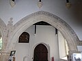
 Inside St. Margaret, Topcroft (i) - geograph.org.uk - 5068882.jpg 640 × 480; 57 KB
-
 Inside St. Margaret, Topcroft (ii) - geograph.org.uk - 5068887.jpg 640 × 480; 43 KB
-
 Inside St. Margaret, Topcroft (iii) - geograph.org.uk - 5068888.jpg 640 × 480; 49 KB
-
 Inside St. Margaret, Topcroft (iv) - geograph.org.uk - 5068891.jpg 640 × 480; 86 KB
-
 Inside St. Margaret, Topcroft (ix) - geograph.org.uk - 5068905.jpg 480 × 640; 41 KB
-
 Inside St. Margaret, Topcroft (v) - geograph.org.uk - 5068893.jpg 480 × 640; 53 KB
-
 Inside St. Margaret, Topcroft (vi) - geograph.org.uk - 5068894.jpg 480 × 640; 51 KB
-
 Inside St. Margaret, Topcroft (vii) - geograph.org.uk - 5068895.jpg 480 × 640; 40 KB
-
 Inside St. Margaret, Topcroft (x) - geograph.org.uk - 5068902.jpg 480 × 640; 74 KB
-
 Inside St. Margaret, Topcroft (xi) - geograph.org.uk - 5068907.jpg 640 × 480; 53 KB
-
 Inside St. Margaret, Topcroft (xii) - geograph.org.uk - 5068908.jpg 480 × 640; 44 KB
-
 Inside St. Margaret, Topcroft (xiii) - geograph.org.uk - 5068910.jpg 480 × 640; 28 KB
-
 Inside St. Margaret, Topcroft (xiv) - geograph.org.uk - 5068909.jpg 480 × 640; 28 KB
-
 Inside St. Margaret, Topcroft (xix) - geograph.org.uk - 5068919.jpg 480 × 640; 54 KB
-
 Inside St. Margaret, Topcroft (xv) - geograph.org.uk - 5068913.jpg 640 × 480; 33 KB
-
 Inside St. Margaret, Topcroft (xvi) - geograph.org.uk - 5068915.jpg 480 × 640; 47 KB
-
 Inside St. Margaret, Topcroft (xvii) - geograph.org.uk - 5068916.jpg 640 × 480; 35 KB
-

-
 Inside St. Margaret, Topcroft (xx) - geograph.org.uk - 5068920.jpg 480 × 640; 55 KB
-
 Inside St. Margaret, Topcroft (xxi) - geograph.org.uk - 5068922.jpg 480 × 640; 52 KB
-
 Inside St. Margaret, Topcroft (xxii) - geograph.org.uk - 5068924.jpg 640 × 480; 58 KB
-

-
 Inside St. Margaret, Topcroft (xxiv) - geograph.org.uk - 5068926.jpg 480 × 640; 66 KB
-
 Inside St. Margaret, Topcroft (xxix) - geograph.org.uk - 5068934.jpg 640 × 480; 43 KB
-
 Inside St. Margaret, Topcroft (xxv) - geograph.org.uk - 5068927.jpg 480 × 640; 46 KB
-
 Inside St. Margaret, Topcroft (xxvi) - geograph.org.uk - 5068931.jpg 640 × 480; 47 KB
-

-

-
 Inside St. Margaret, Topcroft (xxx) - geograph.org.uk - 5068936.jpg 640 × 480; 40 KB
-
 Inside St. Margaret, Topcroft (xxxi) - geograph.org.uk - 5068937.jpg 640 × 480; 41 KB
-

-
 King's Road, Topcroft - geograph.org.uk - 3584539.jpg 3,072 × 2,304; 1.39 MB
-
 King's Road, Topcroft - geograph.org.uk - 3584644.jpg 3,072 × 2,304; 1.29 MB
-
 King's Road, Topcroft - geograph.org.uk - 3584674.jpg 3,072 × 2,304; 1.32 MB
-
 King's Road, Topcroft - geograph.org.uk - 4347749.jpg 640 × 480; 161 KB
-
 Leaves littering farm road - geograph.org.uk - 4722813.jpg 640 × 468; 443 KB
-
 Leaves littering farm track - geograph.org.uk - 4722883.jpg 640 × 455; 365 KB
-
 Leaves littering footpath - geograph.org.uk - 4722966.jpg 640 × 360; 392 KB
-
 Low Road sign - geograph.org.uk - 3585664.jpg 3,072 × 2,304; 1.68 MB
-
 Low Road sign - geograph.org.uk - 3760172.jpg 3,072 × 2,304; 1.78 MB
-
 Low Road, Topcroft - geograph.org.uk - 3585656.jpg 3,072 × 2,304; 1.36 MB
-
 Low Road, Topcroft - geograph.org.uk - 3585662.jpg 3,072 × 2,049; 1.38 MB
-
 Low Road, Topcroft - geograph.org.uk - 3685220.jpg 3,072 × 2,304; 1.45 MB
-
 Low Road, Topcroft - geograph.org.uk - 3689480.jpg 3,072 × 2,304; 1.59 MB
-
 Low Road, Topcroft - geograph.org.uk - 3689483.jpg 3,067 × 2,241; 1.93 MB
-
 Low Road, Topcroft - geograph.org.uk - 3690893.jpg 3,072 × 2,304; 1.51 MB
-
 Low Road, Topcroft - geograph.org.uk - 3760170.jpg 2,983 × 2,079; 1.13 MB
-
 Memorial room and meeting place - geograph.org.uk - 4053556.jpg 640 × 463; 206 KB
-
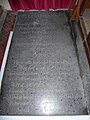
 Memorial to Margery Brewse of Topcroft - geograph.org.uk - 5036578.jpg 3,456 × 2,592; 3.96 MB
-
 Memorial to Margery Brewse, Topcroft - geograph.org.uk - 3475283.jpg 640 × 480; 248 KB
-
 Memorial to the 93rd Bombardment Group - geograph.org.uk - 2153882.jpg 640 × 480; 232 KB
-
 Mess hall on Communal site A - geograph.org.uk - 4053498.jpg 640 × 480; 179 KB
-
 Mill Road sign - geograph.org.uk - 3759611.jpg 3,072 × 2,304; 1.91 MB
-
 Mill Road, Topcroft - geograph.org.uk - 3758928.jpg 3,072 × 2,304; 1.83 MB
-
 Mill Road, Topcroft - geograph.org.uk - 3759101.jpg 3,072 × 2,304; 1.83 MB
-
 Modern pottery shards beside the path - geograph.org.uk - 4053675.jpg 640 × 480; 232 KB
-
 Nettles beside concrete hardstanding - geograph.org.uk - 4722913.jpg 640 × 360; 357 KB
-
 Nissen hut cum museum (489th Bomb Group) - geograph.org.uk - 2153766.jpg 640 × 480; 178 KB
-
 Oilseed rape by Spring Lane Farm - geograph.org.uk - 3475270.jpg 640 × 480; 184 KB
-
 Oilseed rape by Valley Farm - geograph.org.uk - 3846652.jpg 640 × 480; 137 KB
-
 Oilseed rape crop - geograph.org.uk - 4722910.jpg 640 × 360; 270 KB
-
 Oilseed rape crop by Low Farm - geograph.org.uk - 3846656.jpg 640 × 480; 208 KB
-
 Oilseed rape crop by Valley Farm - geograph.org.uk - 3846635.jpg 640 × 480; 159 KB
-
 Oilseed rape crop field - geograph.org.uk - 4722781.jpg 640 × 360; 279 KB
-
 Oilseed rape crop field - geograph.org.uk - 4722907.jpg 640 × 360; 315 KB
-
 Oilseed rape field beside Spring Lane - geograph.org.uk - 3475266.jpg 640 × 532; 308 KB
-
 Oilseed rape field by Valley Farm - geograph.org.uk - 3846647.jpg 640 × 480; 176 KB
-

-
 Old airfield road - geograph.org.uk - 4722794.jpg 640 × 360; 321 KB
-
 Old concreted road - geograph.org.uk - 5197995.jpg 640 × 360; 417 KB


_aircraft_-_geograph.org.uk_-_4080222.jpg)
_aircraft_-_geograph.org.uk_-_4080226.jpg)
_aircraft_-_nose_art_-_geograph.org.uk_-_4080239.jpg)


_-_geograph.org.uk_-_5772505.jpg)


_-_geograph.org.uk_-_4722989.jpg)


_-_geograph.org.uk_-_5068882.jpg)
_-_geograph.org.uk_-_5068887.jpg)
_-_geograph.org.uk_-_5068888.jpg)
_-_geograph.org.uk_-_5068891.jpg)
_-_geograph.org.uk_-_5068905.jpg)
_-_geograph.org.uk_-_5068893.jpg)
_-_geograph.org.uk_-_5068894.jpg)
_-_geograph.org.uk_-_5068895.jpg)
_-_geograph.org.uk_-_5068902.jpg)
_-_geograph.org.uk_-_5068907.jpg)
_-_geograph.org.uk_-_5068908.jpg)
_-_geograph.org.uk_-_5068910.jpg)
_-_geograph.org.uk_-_5068909.jpg)
_-_geograph.org.uk_-_5068919.jpg)
_-_geograph.org.uk_-_5068913.jpg)
_-_geograph.org.uk_-_5068915.jpg)
_-_geograph.org.uk_-_5068916.jpg)
_-_geograph.org.uk_-_5068917.jpg)
_-_geograph.org.uk_-_5068920.jpg)
_-_geograph.org.uk_-_5068922.jpg)
_-_geograph.org.uk_-_5068924.jpg)
_-_geograph.org.uk_-_5068925.jpg)
_-_geograph.org.uk_-_5068926.jpg)
_-_geograph.org.uk_-_5068934.jpg)
_-_geograph.org.uk_-_5068927.jpg)
_-_geograph.org.uk_-_5068931.jpg)
_-_geograph.org.uk_-_5068932.jpg)
_-_geograph.org.uk_-_5068933.jpg)
_-_geograph.org.uk_-_5068936.jpg)
_-_geograph.org.uk_-_5068937.jpg)
_-_geograph.org.uk_-_5068938.jpg)


_-_geograph.org.uk_-_2153766.jpg)


