Category:Topographic maps of Cantabria
Media in category "Topographic maps of Cantabria"
The following 12 files are in this category, out of 12 total.
-
 Cantabria carreteras.png 1,101 × 627; 700 KB
-
 Cantabria ferrocarril.png 1,090 × 627; 691 KB
-
 Cuenca del Deva.png 2,309 × 1,282; 4.61 MB
-
 Cuenca del Miera.png 2,309 × 1,282; 4.55 MB
-
 Cuenca del Nansa.png 2,309 × 1,282; 4.56 MB
-
 Cuenca-Saja-Besaya.png 2,309 × 1,282; 4.61 MB
-
 Cuenca-Saja.png 640 × 428; 319 KB
-
 Mapa topográfico de Cantabria.png 1,518 × 925; 649 KB
-
 Parques Nacionales y Naturales de Cantabria.png 1,518 × 925; 910 KB
-
 Plano Pantano del Ebro 1915.jpg 4,352 × 1,745; 1.47 MB
-
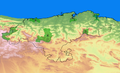
 Relief map of Spain Cantabria.png 2,248 × 1,643; 3.7 MB
-
 Reliefkarte Kantabrien 2022.png 4,583 × 3,326; 10.91 MB


