Category:Topographic maps of Eritrea
Subcategories
This category has only the following subcategory.
S
Media in category "Topographic maps of Eritrea"
The following 8 files are in this category, out of 8 total.
-
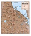 Eritrea and Northern Ethiopia shaded relief map 1999, CIA.jpg 1,070 × 1,268; 322 KB
-
 Dahlak reliefmap.png 3,000 × 3,120; 6.48 MB
-
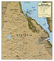 Eritrea Map.jpg 1,046 × 1,190; 184 KB
-
 Eritrea Topography.png 1,148 × 927; 1.41 MB
-
 Hanish.jpg 290 × 296; 22 KB
-
 Mousa Ali Relief Map.png 353 × 250; 66 KB
-
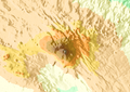
 Nabro map.png 606 × 653; 401 KB
-
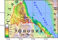 Рельеф Эритреи.png 1,115 × 771; 1.09 MB


