Category:Topographic maps of Finnmark
Media in category "Topographic maps of Finnmark"
The following 10 files are in this category, out of 10 total.
-
 Finnmarkens amt nr 39- Kart over FinmarkensAmt, 1870.jpg 12,094 × 10,207; 20.46 MB
-
 General Kart over den Nordlige Deel af Kongeriget Norge (Noregr) - no-nb krt 00629.jpg 10,848 × 8,795; 23.71 MB
-
 Kart over Finmarkens Amt, 1870 -1.jpg 6,300 × 10,168; 8.13 MB
-
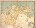
 Kart over Finmarkens Amt, 1870.jpg 6,237 × 10,193; 9.56 MB
-
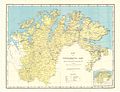
 Kart over Finmarkens Amt, 1906.jpg 10,477 × 8,185; 13.58 MB
-
 Kart over Finmarkens Amt, 1939.jpg 10,807 × 8,798; 12.07 MB
-
 Kart over Finmarkens Amt, 1950.jpg 10,807 × 8,281; 12.22 MB
-
 Kart over Finmarkens Amt, 1954.jpg 10,866 × 8,302; 11.51 MB
-
 Kart over Finmarkens Amt, 1959.jpg 10,783 × 8,078; 11.54 MB
-
 North Norway.png 1,229 × 694; 1.31 MB

_-_no-nb_krt_00629.jpg)


