Category:Topographic maps of Haiti
Subcategories
This category has only the following subcategory.
S
Media in category "Topographic maps of Haiti"
The following 34 files are in this category, out of 34 total.
-
 CIA map Central America & Caribbean.png 1,390 × 1,044; 1.6 MB
-
 Cofresi's Domain 2008 version.jpg 556 × 228; 30 KB
-
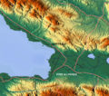
 Deux Mamelles topographic map detail.jpg 1,134 × 804; 984 KB
-
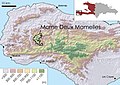
 Deux Mamelles topographic map.jpg 325 × 213; 117 KB
-
 Die ersten europäischen Siedlungen in Amerika.png 1,500 × 677; 1.21 MB
-
 Dm-tm-full-1.jpg 1,134 × 804; 847 KB
-
 Exilien atlasbassinversantdetroisrivieres2015 2~2.jpg 1,232 × 1,272; 316 KB
-
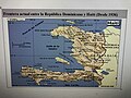 Frontera actual entre la República Dominicana y Haití .jpg 4,032 × 3,024; 8.55 MB
-
 Gb-tm-full-1.jpg 1,134 × 804; 847 KB
-
 GBNP new boundaries detail.jpg 1,134 × 804; 600 KB
-
 Grand Bois topographic map detail.jpg 1,134 × 804; 593 KB
-
 Grand Bois Topographic Map.jpg 1,134 × 804; 845 KB
-
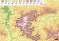
 Grande Colline detail topographic map .jpg 1,134 × 804; 1 MB
-
 Grande Colline National Park topographic map.jpg 1,134 × 804; 867 KB
-
 Haiti blank map with topography.png 1,739 × 1,299; 1.86 MB
-
 Haiti ne18-8 air small.jpg 3,480 × 2,700; 7.65 MB
-
 Haiti relief location map.jpg 1,156 × 900; 314 KB
-
 Haiti topographic map-fr.png 1,739 × 1,299; 2.21 MB
-
 Hispaniola lrg Bg.jpg 3,000 × 1,355; 2.19 MB
-
 Hispaniola lrg.jpg 3,000 × 1,355; 778 KB
-
 Jamaica Passage.png 706 × 345; 320 KB
-
 Karibik 01.png 1,355 × 842; 1.27 MB
-
 Karibik 02.png 1,353 × 840; 961 KB
-
 Karibik 03.png 1,358 × 841; 1.13 MB
-
 Karibik 04.png 1,348 × 838; 963 KB
-
 Karibik 27.png 1,350 × 781; 767 KB
-
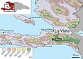
 La Visite topographic map detail.jpg 1,134 × 804; 1.28 MB
-
 La Visite topographic map.jpg 1,134 × 804; 681 KB
-
 Lafiteau.png 798 × 708; 1.02 MB
-
 Montaganes Noires, Haiti map.png 545 × 657; 728 KB
-
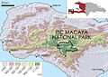
 Pic Macaya National park topographic map detail.jpg 1,134 × 804; 1.24 MB
-
 Pic Macaya national park topographic map.jpg 1,134 × 804; 865 KB
-
 Port-au-Prince-TF.jpg 4,800 × 2,700; 1.75 MB
-
 Tiburon blank map with topography.png 1,497 × 511; 600 KB


