Category:Topographic maps of Hautes-Alpes
Departments of Metropolitan France: Ain [01] · Aisne [02] · Allier [03] · Alpes-de-Haute-Provence [04] · Hautes-Alpes [05] · Alpes-Maritimes [06] · Ardèche [07] · Ardennes [08] · Ariège [09] · Aube [10] · Aude [11] · Aveyron [12] · Bouches-du-Rhône [13] · Calvados [14] · Cantal [15] · Charente [16] · Charente-Maritime [17] · Cher [18] · Corrèze [19] · Corse-du-Sud [2A]† · Haute-Corse [2B]† · Côte-d’Or [21] · Côtes-d'Armor [22] · Creuse [23] · Dordogne [24] · Doubs [25] · Drôme [26] · Eure [27] · Eure-et-Loir [28] · Finistère [29] · Gard [30] · Haute-Garonne [31] · Gers [32] · Gironde [33] · Hérault [34] · Ille-et-Vilaine [35] · Indre [36] · Indre-et-Loire [37] · Isère [38] · Jura [39] · Landes [40] · Loir-et-Cher [41] · Loire [42] · Haute-Loire [43] · Loire-Atlantique [44] · Loiret [45] · Lot [46] · Lot-et-Garonne [47] · Lozère [48] · Maine-et-Loire [49] · Manche [50] · Marne [51] · Haute-Marne [52] · Mayenne [53] · Meurthe-et-Moselle [54] · Meuse [55] · Morbihan [56] · Moselle [57] · Nièvre [58] · Nord [59] · Oise [60] · Orne [61] · Pas-de-Calais [62] · Puy-de-Dôme [63] · Pyrénées-Atlantiques [64] · Hautes-Pyrénées [65] · Pyrénées-Orientales [66] · Bas-Rhin [67] · Haut-Rhin [68] · departmental district of the Rhône [69] · Haute-Saône [70] · Saône-et-Loire [71] · Sarthe [72] · Savoie [73] · Haute-Savoie [74] · Paris [75] · Seine-Maritime [76] · Seine-et-Marne [77] · Yvelines [78] · Deux-Sèvres [79] · Somme [80] · Tarn [81] · Tarn-et-Garonne [82] · Var [83] · Vaucluse [84] · Vendée [85] · Vienne [86] · Haute-Vienne [87] · Vosges [88] · Yonne [89] · Territoire de Belfort [90] · Essonne [91] · Hauts-de-Seine [92] · Seine-Saint-Denis [93] · Val-de-Marne [94] · Val-d'Oise [95]
Overseas departments and regions: Guadeloupe [971] · Martinique [972] · French Guiana [973] · Réunion [974] · Mayotte [976]
Overseas collectivities: Saint Pierre and Miquelon [975] · Saint Barthélemy [977] · Saint-Martin [978] · Wallis and Futuna [986] · French Polynesia [987]
Sui generis territories: New Caledonia [988]
Subcategories
This category has the following 2 subcategories, out of 2 total.
Media in category "Topographic maps of Hautes-Alpes"
The following 19 files are in this category, out of 19 total.
-
 Hautes-Alpes department relief location map.jpg 1,103 × 949; 629 KB
-
 555x503-Carte-05-Hautes-Alpes-R1.jpg 555 × 503; 97 KB
-
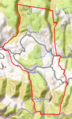
 Carte Massif Devoluy.svg 1,025 × 1,176; 2.8 MB
-
 Champoléon OSM 02.png 529 × 506; 719 KB
-
 Chorges OSM 02.png 382 × 536; 282 KB
-
 Châteauneuf-d'Oze OSM 02.png 698 × 419; 382 KB
-
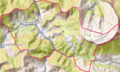
 Col du Galibier OSM.png 746 × 619; 885 KB
-
 Devoluy carte topographique.jpeg 1,653 × 1,889; 1.34 MB
-
 Gap OSM 02.png 404 × 598; 679 KB
-
 Guillestre OSM 02.png 778 × 572; 724 KB
-
 La Motte-en-Champsaur OSM 02.png 438 × 296; 343 KB
-
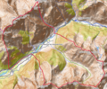
 Lac de Serre-Ponçon.png 738 × 530; 527 KB
-
 Lazer (Hautes-Alpes) OSM 02.png 424 × 501; 225 KB
-
 Le Sauze-du-Lac OSM 02.png 324 × 391; 120 KB
-
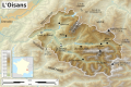 Oisans topographic map-fr.svg 1,953 × 1,302; 2.34 MB
-
 Saint-Clément-sur-Durance OSM 02.png 605 × 806; 664 KB
-
 Saint-Maurice-en-Valgodemard OSM 02.png 742 × 610; 1.07 MB
-
 Sorbiers (Hautes-Alpes) OSM 02.png 312 × 517; 300 KB
-
 Valserres OSM 02.png 327 × 434; 280 KB


_OSM_02.png)


_OSM_02.png)
