Category:Topographic maps of La Guajira Department
Media in category "Topographic maps of La Guajira Department"
The following 17 files are in this category, out of 17 total.
-
 BahiaCocinetas.png 723 × 651; 22 KB
-
 BahiaHonda.PNG 723 × 651; 25 KB
-
 BahiaHondita.PNG 723 × 651; 22 KB
-
 BahiaPortete.PNG 723 × 651; 22 KB
-
 BahiaTukakas.PNG 723 × 651; 22 KB
-
 Bajiplaniciaguajira.JPG 378 × 339; 14 KB
-
 Bajiplanicie.JPG 301 × 282; 12 KB
-
 Colombia-deps-laguajira.svg 1,420 × 1,896; 875 KB
-
 EnsenadaElCalabozo.JPG 378 × 339; 15 KB
-
 Geography Map of La Guajira 2.png 3,087 × 2,174; 1.63 MB
-
 Geography map of Uribia, La Guajira.png 2,331 × 1,641; 2.3 MB
-
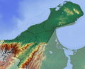 La Guajira Topographic 2.png 1,925 × 1,575; 3.35 MB
-
 La Guajira Topographic.png 308 × 256; 97 KB
-
 Map of Sierra Nevada de Santa Marta.png 1,456 × 1,376; 3.77 MB
-
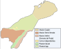 Orografia guajira.svg 907 × 731; 26 KB
-
 RioRancheria.JPG 301 × 282; 10 KB
-
 Topographic Map of the Cesar-Ranchería Basin - Colombia.jpg 1,429 × 788; 821 KB


