Category:Topographic maps of Nord-Pas-de-Calais
Administrative regions and territorial collectivity of Metropolitan France (‡ since start of 2016):
Auvergne-Rhône-Alpes‡ · Bourgogne-Franche-Comté‡ · Brittany · Centre-Val de Loire · Corsica · Grand Est‡ · Hauts-de-France‡ · Île-de-France · Normandy‡ · New Aquitaine‡ · Occitania‡ · Pays de la Loire · Provence-Alpes-Côte d'Azur
Former administrative regions of Metropolitan France (until end of 2015):
Alsace · Aquitaine · Auvergne · Burgundy · Champagne-Ardenne · Franche-Comté · Languedoc-Roussillon · Limousin · Lorraine · Midi-Pyrénées · Nord-Pas-de-Calais · Lower Normandy · Upper Normandy · Picardy · Rhône-Alpes
Overseas departments and regions: Guadeloupe · Martinique · French Guiana · Réunion · Mayotte
Overseas collectivities: Saint Barthélemy · Saint-Martin · Saint Pierre and Miquelon · French Polynesia · Wallis and Futuna
Sui generis territories: New Caledonia
Media in category "Topographic maps of Nord-Pas-de-Calais"
The following 10 files are in this category, out of 10 total.
-
 990x608-Carte-Région-Nord-Pas-de-Calais-R.jpg 990 × 608; 152 KB
-
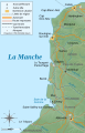
 Calaisis 1360 map-fr.svg 1,424 × 892; 773 KB
-
 Calaisis 1360 map-ru.svg 1,424 × 892; 773 KB
-
 Carte topo Nord - Aa et Yser.png 646 × 427; 353 KB
-
 Côte d'Opale topographic map-fr.svg 771 × 1,195; 2.03 MB
-
 Nord pas de calais topographic blank map.jpg 441 × 324; 61 KB
-
 Nord, Pas-de-Calais & Somme relief location map.png 1,576 × 1,069; 2 MB
-
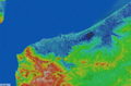
 Nord-Pas-de-Calais region relief location map.jpg 1,576 × 1,069; 339 KB
-
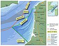 ProjetPérimètre PNM7EstuairesVarianteEnquête2011.jpg 1,557 × 1,203; 417 KB
-
 Relief Nord-Pas de Calais.png 600 × 386; 29 KB


