Category:Topographic maps of Oita prefecture
English: Category for the topographic maps of Oita Prefecture, Japan
日本語: 日本・大分県に関する地形図のカテゴリ
| Prefectures of Japan 地形図 (Topographic map) | |||
|---|---|---|---|
|

| ||
Media in category "Topographic maps of Oita prefecture"
The following 10 files are in this category, out of 10 total.
-
 Hita Basin Relief Map, SRTM-1.jpg 1,000 × 750; 651 KB
-
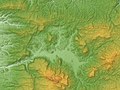
 Kuju Volcano Relief Map, SRTM-1.jpg 1,200 × 900; 648 KB
-
 Kunisaki Peninsula 3D 2012.jpg 1,200 × 1,200; 932 KB
-
 Kusu Basin Relief Map, SRTM-1.jpg 1,200 × 900; 742 KB
-
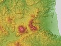
 Mount Haneyama Relief Map, SRTM-1.jpg 1,200 × 900; 665 KB
-
 Mount Hiko Relief Map, SRTM-1.jpg 800 × 600; 416 KB
-
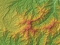 Mount Sobo Relief Map, SRTM-1.jpg 800 × 600; 431 KB
-
 Topographic Map of Beppu-Oita, Japan.jpg 1,357 × 1,030; 1.29 MB
-
 Yufu Volcano & Tsurumi Volcano Relief Map, SRTM-1.jpg 1,200 × 900; 637 KB
-
 Yufuin Basin Relief Map, SRTM-1.jpg 1,000 × 750; 432 KB


