Category:Topographic maps of Papua New Guinea
Subcategories
This category has only the following subcategory.
Media in category "Topographic maps of Papua New Guinea"
The following 26 files are in this category, out of 26 total.
-
 00-363 Goodenough Island.png 810 × 825; 344 KB
-

-
 Admiralty Islands Topography with labels.png 2,554 × 1,328; 564 KB
-
 AmbitleTopography.png 1,052 × 796; 65 KB
-
 Asendi kaart Paapua Uus-Guinea.png 528 × 361; 74 KB
-
 DEntrecasteauxIslandsTopography.png 1,924 × 1,721; 1.19 MB
-
 Feni Islands-txu-oclc-6552576-sb56-3.jpg 966 × 613; 476 KB
-
 FergussonIslandTopography.png 1,859 × 1,415; 586 KB
-
 Location map East New Britain Province.png 717 × 753; 687 KB
-
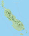
 Location map New Ireland.png 1,637 × 935; 921 KB
-
 Location map West New Britain Province.png 1,080 × 701; 815 KB
-
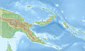
 Map of Papua New Guinea Demis.png 1,189 × 841; 296 KB
-
 New Guinea Topography.png 3,272 × 1,659; 1.68 MB
-
 NewBritain2022OSM.png 7,395 × 3,500; 16.12 MB
-
 NewBritainTopography.png 2,208 × 1,506; 1.31 MB
-
 Normanby Island (Papua New Guinea) Topography.png 2,031 × 1,520; 390 KB
-
 OSM 2023 PNGuinea Bougainville.png 2,552 × 3,176; 3.48 MB
-
 Pacific Ocean laea Oceanian countries map.jpg 1,165 × 1,070; 542 KB
-
 Papua New Guinea - DPLA - 9d797892a5ed5dc2eb827bdb0fc8d274.jpg 2,552 × 3,272; 5.16 MB
-
 Papua New Guinea colour relief map.png 1,002 × 712; 489 KB
-
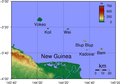
 Papua New Guinea earthquake January 22 2009.gif 411 × 385; 84 KB
-
 Papua New Guinea location map Topographic.png 3,531 × 2,123; 6.27 MB
-
 Papua new guinea Rabaul.jpg 845 × 406; 187 KB
-
 Papua New Guinea relief location map.jpg 2,406 × 1,446; 1.02 MB
-
 Schouten Islands (Papua New Guinea) Topography.png 1,859 × 1,295; 474 KB
-
 Siassi Islands Relief.jpg 450 × 477; 26 KB


_Topography.png)


_Topography.png)
