Category:Topographic maps of the Dominican Republic
Media in category "Topographic maps of the Dominican Republic"
The following 18 files are in this category, out of 18 total.
-
 A geological reconnaissance of the Dominican republic (1921) (14576934860).jpg 3,076 × 2,068; 513 KB
-
 CIA map Central America & Caribbean.png 1,390 × 1,044; 1.6 MB
-
 Cofresi's Domain 2008 version.jpg 556 × 228; 30 KB
-
 Die ersten europäischen Siedlungen in Amerika.png 1,500 × 677; 1.21 MB
-
 Dominican Republic Physiography.jpg 2,881 × 2,067; 1.59 MB
-
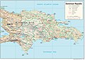
 Dominican Republic relief location map.jpg 1,338 × 1,088; 403 KB
-
 Dominican-republic.jpg 1,302 × 908; 244 KB
-
 Dominicanrepublic-physical-map hu.svg 1,411 × 1,147; 622 KB
-
 DR-bergen.jpg 1,338 × 1,088; 515 KB
-
 DR-lengte-breedte.jpg 250 × 200; 56 KB
-
 Hispaniola lrg Bg.jpg 3,000 × 1,355; 2.19 MB
-
 Hispaniola lrg.jpg 3,000 × 1,355; 778 KB
-
 Jamaica Passage.png 706 × 345; 320 KB
-
 Karibik 01.png 1,355 × 842; 1.27 MB
-
 Karibik 03.png 1,358 × 841; 1.13 MB
-
 Karibik 04.png 1,348 × 838; 963 KB
-
 Karibik 27.png 1,350 × 781; 767 KB
-
 Ubicacion Sierra Bahoruco.jpg 960 × 552; 145 KB
_(14576934860).jpg)


