Category:Tornado track maps
Subcategories
This category has only the following subcategory.
Media in category "Tornado track maps"
The following 146 files are in this category, out of 146 total.
-
 1950–1999 Connecticut tornado tracks.png 567 × 416; 18 KB
-
 1952 Tornadoes.png 1,130 × 700; 257 KB
-
 1953 Tornadoes.png 1,130 × 700; 279 KB
-
 1954 Tornadoes.png 1,130 × 700; 283 KB
-
 1955 F5 Blackwell and Udall tornado tracks.gif 700 × 700; 15 KB
-
 1955 Tornadoes.png 1,130 × 700; 283 KB
-
 1956 Tornadoes.png 1,130 × 700; 282 KB
-
 1957 Tornadoes.png 1,130 × 700; 305 KB
-
 1958 Tornadoes.png 1,130 × 700; 280 KB
-
 1959 Tornadoes.png 1,130 × 700; 281 KB
-
 1960 Tornadoes.png 1,130 × 700; 280 KB
-
 1961 Tornadoes.png 1,130 × 700; 292 KB
-
 1962 Tornadoes.png 1,130 × 700; 284 KB
-
 1963 Tornadoes.png 1,130 × 700; 273 KB
-
 1964 Tornadoes.png 1,130 × 700; 291 KB
-
 1965 Tornadoes.png 1,130 × 700; 305 KB
-
 1966 Candlestick tornado map.JPG 1,518 × 1,163; 358 KB
-
 1966 Candlestick tornado revised map.jpg 1,518 × 1,163; 368 KB
-
 1966 Tornadoes.png 1,130 × 700; 278 KB
-
 1967 Tornadoes.png 1,130 × 700; 299 KB
-
 1968 Tornadoes.png 1,130 × 700; 286 KB
-
 1969 Tornadoes.png 1,130 × 700; 285 KB
-
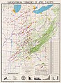
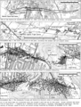
 1974 Super Outbreak Fujita color map Monticello crop.jpg 1,251 × 886; 336 KB
-
 1974 Super Outbreak Fujita color map.jpg 3,315 × 4,500; 6.16 MB
-
 1983 US tors.png 1,130 × 700; 187 KB
-
 1985-05-31 tornado outbreak map.PNG 705 × 520; 141 KB
-
 1987 Edmonton Tornado path.png 678 × 625; 176 KB
-
 1994 Palm Sunday tornado outbreak tracks.jpg 621 × 400; 106 KB
-
 19981004map.png 778 × 661; 181 KB
-
 1999 Salt Lake City Tornado path.jpg 702 × 492; 280 KB
-
 1999-05-03 bigoutbreak.png 1,067 × 768; 53 KB
-
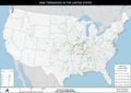
 2000 tornado paths in the United States.png 5,940 × 4,200; 4.67 MB
-
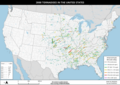
 2001 tornado paths in the United States.png 5,940 × 4,200; 4.73 MB
-
 2002 La Plata Tornado Track.png 1,211 × 778; 1.45 MB
-
 2002 tornado paths in the United States.png 5,940 × 4,200; 4.65 MB
-
 2003 tornado paths in the United States.png 5,940 × 4,200; 4.79 MB
-
 2004 tornado paths in the United States.png 5,940 × 4,200; 4.85 MB
-
 2005 tornado paths in the United States.png 5,940 × 4,200; 4.76 MB
-
 2006 tornado paths in the United States.png 4,700 × 3,323; 3.83 MB
-
 2007 tornado paths in the United States.png 4,700 × 3,323; 3.73 MB
-
 2008 tornado paths in the United States.png 4,700 × 3,323; 4.16 MB
-
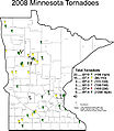 2008mntor.jpg 600 × 689; 94 KB
-
 2009 tornado paths in the United States.png 4,700 × 3,323; 3.95 MB
-
 2009mntor.jpg 598 × 691; 98 KB
-
 2010 tornado paths in the United States.png 4,700 × 3,323; 4.02 MB
-
 2011 El Reno–Piedmont tornado NWS map.jpg 800 × 659; 557 KB
-
 2011 tornado paths in the United States.png 4,700 × 3,323; 4.18 MB
-
 2011 United States tornado map.png 1,130 × 700; 226 KB
-
 2012 tornado paths in the United States.png 4,700 × 3,323; 3.91 MB
-
 2013 El Reno Tornado Timeline.jpg 1,915 × 939; 1.17 MB
-
 2013 tornado paths in the United States.png 4,700 × 3,323; 3.9 MB
-
 2014 tornado paths in the United States.png 4,700 × 3,323; 3.9 MB
-
 2015 tornado paths in the United States.png 4,700 × 3,323; 4 MB
-
 2016 tornado paths in the United States.png 4,700 × 3,323; 3.92 MB
-
 2017 tornado paths in the United States.png 4,700 × 3,323; 4.08 MB
-
 2018 tornado track map summary.png 15,226 × 9,239; 15.89 MB
-
 2022 tornado track map summary.png 15,200 × 9,239; 16.17 MB
-
 2023 Canada tornado track map summary.png 7,000 × 3,609; 1.65 MB
-
 2023 tornado track map summary.png 15,200 × 9,239; 16.38 MB
-
 2024 Lakeview Tornado Track and Intensity Map.jpg 1,211 × 1,193; 585 KB
-
 2024 tornado track map summary.png 15,200 × 9,239; 16.55 MB
-
 2024 Tornado Track Through Lakeview, Ohio.jpg 1,207 × 1,099; 567 KB
-
 2024 Valley View, Texas Tornado Track and Intensity Map.jpg 867 × 702; 191 KB
-

-
 A track map of the July 23, 2023 long-tracked EF0 tornado in Kentucky.jpg 2,262 × 1,394; 2.44 MB
-
 April 16, 2011 North Carolina Tornado Outbreak.gif 671 × 320; 11 KB
-
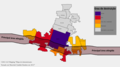
 April 2022 tornado confirmations and warnings.png 3,507 × 2,480; 2.12 MB
-
 August 2022 tornado confirmations and warnings.png 3,507 × 2,480; 1.92 MB
-
 BingerTornado1981.JPG 512 × 411; 29 KB
-
 Blackwelldamage.gif 700 × 700; 21 KB
-
 Břeclav a Hodonín 2021-06-24 Mapy cz.png 1,146 × 859; 998 KB
-
 Canton IL Tornado 1975.jpg 1,200 × 474; 79 KB
-
 Charleston-Mattoon Tornado Outbreak map.PNG 892 × 925; 63 KB
-
 Csptracks.png 1,245 × 767; 479 KB
-
 Intensidad Tornado.PNG 396 × 390; 35 KB
-
 Demonstração - Tornado em Marechal Cândido Rondon 2015.png 1,920 × 1,080; 214 KB
-
 Ef5 NWAL large.png 1,111 × 789; 1.48 MB
-
 Evansville Tornado of 2005 Track Map.gif 500 × 295; 78 KB
-
 February 2022 tornado confirmations and warnings.png 3,507 × 2,480; 1.88 MB
-
 Finley Map Of The Enigma Outbreak, Feb 19 1884 (7994743682).jpg 1,528 × 1,116; 339 KB
-
 Flint Tornado 1953.jpg 600 × 700; 44 KB
-
 Four-State Tornado Swarm.PNG 414 × 348; 9 KB
-
 Fujita Map Of The Carolinas Outbreak, March 28 1984 (7995064756).jpg 2,176 × 928; 277 KB
-
 Greenfield, IA EF4 Tornado Satellite Image.jpg 754 × 581; 561 KB
-
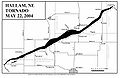 Hallam-NE-tornado-map.jpg 1,700 × 1,100; 205 KB
-
 Huntsville1989track.png 634 × 833; 406 KB
-
 Jackson, MS WFO Hurricane Rita tornado outbreak track map.png 650 × 615; 379 KB
-
 Jan1950-2006 tornadoes.PNG 809 × 649; 30 KB
-
 January 2017 Georgia tornado outbreak.png 1,097 × 842; 266 KB
-
 January 2022 tornado confirmations and warnings.png 3,507 × 2,480; 1.91 MB
-
 January 22, 2017, Albany, Georgia, tornado damage swath.png 1,238 × 773; 2.05 MB
-
 July 2022 tornado confirmations and warnings.png 3,507 × 2,480; 1.97 MB
-
 June17 2010 tornadoes.jpg 416 × 476; 53 KB
-
 Kalamazoo-tornado-path.jpg 1,008 × 725; 588 KB
-
 Map of the February 12, 1945 Montgomery, Alabama tornado.jpg 1,702 × 1,487; 220 KB
-
 Map of the March 22, 2023 EF1 Tornado in the Los Angeles Metro.jpg 1,535 × 811; 470 KB
-
 March 2022 tornado confirmations and warnings.png 3,507 × 2,480; 2.15 MB
-
 May 2022 tornado confirmations and warnings.png 3,507 × 2,480; 2.19 MB
-
 May 24 2011 El Reno tornado track satellite image.png 918 × 919; 1.83 MB
-
 May 6 Tornado Path.jpg 660 × 510; 60 KB
-
 May31CLEtracks.gif 780 × 730; 68 KB
-
 New England tornado paths.png 564 × 668; 37 KB
-
 Nov10map2.JPG 398 × 453; 24 KB
-
 November 2022 tornado confirmations and warnings.png 3,507 × 2,480; 1.98 MB
-
 November.outbreak.1992.png 517 × 351; 25 KB
-

-
 October 12, 2023 Palm Coast, Florida EF2 Tornado Track Map.jpg 1,892 × 1,102; 1.25 MB
-
 October24 2001 tornadoes.gif 510 × 575; 31 KB
-
 Palmsundayalltornadoes.jpg 1,024 × 768; 181 KB
-
 Riegelwood North Carolina tornado track Nov 16 2006.png 600 × 625; 178 KB
-
 Satellite imagery of the scar left behind the Bassfield, MS EF4 tornado.png 883 × 706; 1.45 MB
-
 September 2022 tornado confirmations and warnings.png 3,507 × 2,480; 1.91 MB
-
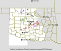
 South Dakota Tornadoes.PNG 915 × 636; 21 KB
-
 Super Outbreak Map.jpg 1,345 × 1,631; 2.46 MB
-
 The March 24, 2023 EF4 tornado’s path and intensity through the city of Rolling Fork.jpg 1,420 × 1,286; 962 KB
-
 The March 24, 2023 EF4 tornado’s path and intensity through the town of Silver City.jpg 1,403 × 1,106; 592 KB
-
 Tornado 2021-06-24.png 1,062 × 819; 543 KB
-
 Tornado outbreak of April 27–28, 2002.png 3,507 × 2,480; 2.48 MB
-
 Tornado outbreak of April 4–7, 2022.png 3,507 × 2,480; 2.49 MB
-
 Tornado outbreak of December 12–15, 2022.png 3,507 × 2,480; 2.62 MB
-
 Tornado outbreak of January 12, 2023.png 3,507 × 2,480; 2.27 MB
-
 Tornado outbreak of March 21–23, 2022.png 3,507 × 2,480; 2.8 MB
-
 Tornado outbreak of March 29–31, 2022.png 3,507 × 2,480; 2.81 MB
-
 Tornado outbreak of March 5–7, 2022.png 3,507 × 2,480; 2.31 MB
-
 Tornado outbreak of May 12, 2022.png 3,507 × 2,480; 1.44 MB
-
 Tornado outbreak of May 6–9, 2024.png 3,507 × 2,480; 3.2 MB
-
 Tornado outbreak of November 4–5, 2022.png 3,507 × 2,480; 2.22 MB
-
 Tornado outbreak sequence of April 25–28, 2024.png 3,507 × 2,480; 2.59 MB
-
 Tornado outbreak sequence of June 14–19, 2023.png 3,507 × 2,480; 2.42 MB
-
 Tornado outbreak sequence of May 19–27, 2024.png 3,507 × 2,480; 3.29 MB
-
 Tornado track map 1999 Oklahoma tornado outbreak.gif 1,599 × 1,297; 113 KB
-
 Tornado Track near Sturbridge, Massachusetts (cropped).jpg 372 × 299; 167 KB
-
 Tornado Track near Sturbridge, Massachusetts.jpg 2,000 × 775; 1.65 MB
-

-
 Tornado's During April 16 2011 Tornado Outbreak in NC.gif 671 × 342; 12 KB
-
 Tornadoes near Vaughnsville.jpg 740 × 348; 84 KB
-
 Tornados en Occitània - Periòde 1999-2018.png 1,835 × 1,062; 417 KB
-
 Tri-State Tornado cyclone track map key.jpg 1,808 × 1,168; 293 KB
-
 Tri-State Tornado cyclone track map.jpg 1,812 × 1,168; 1.44 MB
-
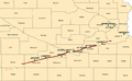
 Tri-State Tornado map.PNG 852 × 695; 61 KB
-
 Tri-State Tornado trackmap (PAH).jpg 555 × 542; 80 KB
-
 Tri-State Tornado trackmap cropped.png 366 × 320; 33 KB
-
 Veterans Day Tornado Outbreak.JPG 722 × 690; 172 KB
-
 Wallingford tornado track.PNG 967 × 540; 95 KB
-
 Wetterereignisse am 1. Juli 1891.jpg 1,214 × 707; 363 KB
-
 Wisconsin Tornado Paths.PNG 555 × 467; 16 KB


.jpg)


.jpg)


.jpg)


.jpg)


