Category:Torrance, East Dunbartonshire
village in East Dunbartonshire, Scotland, UK  | |||||
| Upload media | |||||
| Instance of | |||||
|---|---|---|---|---|---|
| Location |
| ||||
| Population |
| ||||
 | |||||
English: Torrance is a village in East Dunbartonshire, Scotland, located 15 minutes from Glasgow city centre and is home to 2,500 persons. Torrance used to mainly consist of farmland, but now is a growing town. The town was once famous as a resting place for workers on their way to the Campsie Fells north.
Gàidhlig: 'S e baile ann an Dùn Bhreatainn an Ear a tha anns Na Torranan (Beurla: Torrance). 'S e seo na co-chomharran aige: 55° 56′ 26″ Tuath agus 4° 12′ 39″ Iar.
Nederlands: Torrance ( Schots-Gaelisch: An Toran) is een dorp in de Schotse council East Dunbartonshire in het historisch graafschap Dunbartonshire en had in 2001 een populatie van ongeveer 2 500.
Media in category "Torrance, East Dunbartonshire"
The following 31 files are in this category, out of 31 total.
-
 Across the valley of the River Kelvin - geograph.org.uk - 1627145.jpg 640 × 480; 162 KB
-
 Approaching Torrance on the A807 - geograph.org.uk - 1404450.jpg 640 × 480; 131 KB
-
 Approaching Torrance Roundabout - geograph.org.uk - 1410447.jpg 640 × 480; 121 KB
-
 Carlston Farm near Torrance - geograph.org.uk - 131360.jpg 640 × 480; 130 KB
-

-
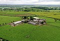
 Farming in Torrance, East Dunbartonshire (51324368580).jpg 5,000 × 3,369; 14.07 MB
-
 Feeding time - geograph.org.uk - 1410438.jpg 640 × 480; 132 KB
-
 Field near Torrance Roundabout - geograph.org.uk - 1410463.jpg 640 × 480; 116 KB
-
 Fields by Bogton Farm - geograph.org.uk - 1410456.jpg 640 × 480; 109 KB
-

-

-
 Harvesting hay at Bogton Farm - geograph.org.uk - 1404459.jpg 640 × 480; 123 KB
-
 Kelvin valley railway 3.jpg 3,933 × 2,622; 827 KB
-
 Kelvinside Garage - geograph.org.uk - 1410449.jpg 640 × 480; 118 KB
-
 Leitchbank House - geograph.org.uk - 116533.jpg 640 × 480; 100 KB
-

-

-
 Meadow Flowers in Acre Valley - geograph.org.uk - 229972.jpg 640 × 480; 180 KB
-
 Pylons west of Torrance - geograph.org.uk - 1410435.jpg 640 × 480; 140 KB
-
 Small loch near Barraston Farm - geograph.org.uk - 116530.jpg 640 × 480; 101 KB
-
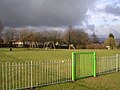 Swing Park, Torrance - geograph.org.uk - 127394.jpg 640 × 480; 134 KB
-
 Torrance (51268997352).jpg 5,000 × 3,333; 11.61 MB
-
 Torrance (51269921593).jpg 5,000 × 3,333; 12.04 MB
-
 Torrance (51270767285).jpg 5,000 × 3,404; 12.1 MB
-
 Torrance Community Centre - geograph.org.uk - 116535.jpg 640 × 480; 109 KB
-
 Torrance from the air (geograph 2965680).jpg 615 × 414; 136 KB
-
 Torrance housing - geograph.org.uk - 1410446.jpg 640 × 480; 116 KB
-
 Torrance Parish Church - geograph.org.uk - 2168518.jpg 640 × 480; 63 KB
-
 Torrance Roundabout - geograph.org.uk - 1404466.jpg 640 × 480; 113 KB
-
 Torrance, East Dunbartonshire (51323376426).jpg 5,000 × 3,520; 11.52 MB
-
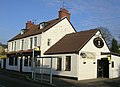 Wheatsheaf Inn, Torrance - geograph.org.uk - 116524.jpg 640 × 465; 77 KB


.jpg)


.jpg)
.jpg)
.jpg)
.jpg)


.jpg)
