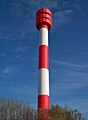
Category:Tossens range rear
| Object location | | View all coordinates using: OpenStreetMap |
|---|
lighthouse in Lower Saxony, Germany  | |||||
| Upload media | |||||
| Instance of | |||||
|---|---|---|---|---|---|
| Part of | |||||
| Made from material | |||||
| Location | Wesermarsch, Lower Saxony, Germany | ||||
| Located in or next to body of water | |||||
| Inception |
| ||||
| Height |
| ||||
 | |||||
Media in category "Tossens range rear"
The following 3 files are in this category, out of 3 total.
-
 Tossens range rear 7694.JPG 2,592 × 1,944; 796 KB
-
 Tossens range rear 7696.JPG 2,592 × 1,944; 700 KB
-
 Tossens range rear 7697.JPG 1,742 × 2,380; 688 KB

