Category:Tour de France maps of the 1950s
Media in category "Tour de France maps of the 1950s"
The following 20 files are in this category, out of 20 total.
-
 Tour de France 1950.png 600 × 600; 272 KB
-
 Tour de France 1951.png 600 × 600; 279 KB
-
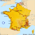
 Tour de France 1952.png 600 × 600; 283 KB
-
 Tour de France 1953.png 600 × 600; 274 KB
-
 Tour de France 1954 map.svg 600 × 650; 373 KB
-
 Tour de France 1955 map.svg 600 × 600; 368 KB
-
 Tour de France 1956 map.svg 600 × 600; 368 KB
-
 Tour de France 1957 map.svg 600 × 600; 369 KB
-
 Tour de France 1958 map.svg 600 × 600; 375 KB
-
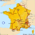
 Route of the 1959 Tour de France.png 3,198 × 3,204; 2.67 MB
-
 Tour de France 1959 map.svg 600 × 600; 373 KB
-
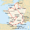
 Route of the 1950 Tour de France.png 2,998 × 3,004; 3.9 MB
-
 Route of the 1951 Tour de France.png 2,998 × 3,004; 3.87 MB
-
 Route of the 1952 Tour de France.png 3,198 × 3,204; 2.69 MB
-
 Route of the 1953 Tour de France.png 3,198 × 3,204; 2.67 MB
-
 Route of the 1954 Tour de France.png 3,198 × 3,462; 2.7 MB
-
 Route of the 1955 Tour de France.png 3,193 × 3,195; 2.66 MB
-
 Route of the 1956 Tour de France.png 3,193 × 3,195; 2.57 MB
-
 Route of the 1957 Tour de France.png 3,198 × 3,204; 2.63 MB
-
 Route of the 1958 Tour de France.png 3,198 × 3,204; 2.67 MB


