Category:Town Hall, Oroszlány
| Object location | | View all coordinates using: OpenStreetMap |
|---|
Media in category "Town Hall, Oroszlány"
The following 11 files are in this category, out of 11 total.
-
 Az Oroszlános díszkút és a Polgármesteri Hivatal, 2018 Oroszlány.jpg 2,272 × 1,704; 1,018 KB
-
 Lion fountain, CoA, 2018 Oroszlány.jpg 2,272 × 1,704; 1.01 MB
-
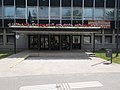
 Mayor's office, 2018 Oroszlány.jpg 2,272 × 1,704; 1.01 MB
-
 Polgármesteri Hivatal, 2008 Oroszlány029.jpg 2,816 × 2,112; 964 KB
-
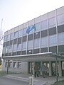
 Polgármesteri Hivatal, 2018 Oroszlány.jpg 2,272 × 1,704; 1 MB
-
 Rákóczi Ferenc út 78, zászlók, 2018 Oroszlány.jpg 1,704 × 1,622; 707 KB
-
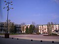
 Town hall from Szent Borbála square, 2018 Oroszlány.jpg 2,272 × 1,704; 940 KB
-
 Virágos ládák a tetőn a Polgármesteri Hivatalnál, 2018 Oroszlány.jpg 1,704 × 2,272; 986 KB
-
 Városháza és Bányászemlékmű, 2008 Oroszlány023.jpg 2,816 × 2,112; 1.21 MB
-
 Városháza, 2008 Oroszlány030.jpg 2,112 × 2,816; 858 KB
-
 Városháza, 2008 Oroszlány031.jpg 2,816 × 2,112; 997 KB


