Category:Town hall in Mysłowice
| Object location | | View all coordinates using: OpenStreetMap |
|---|
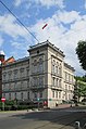
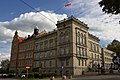
Polski: Urząd Miasta - Mysłowice, ul. Powstańców 1
 | |||||
| Upload media | |||||
| Instance of | |||||
|---|---|---|---|---|---|
| Location | Mysłowice, Silesian Voivodeship, Poland | ||||
| Heritage designation |
| ||||
 | |||||
Media in category "Town hall in Mysłowice"
The following 15 files are in this category, out of 15 total.
-
 MYSŁOWICE, AB. 011.JPG 1,067 × 800; 300 KB
-
 MYSŁOWICE, AB. 012.JPG 1,067 × 800; 242 KB
-
 MYSŁOWICE, AB. 013.JPG 1,280 × 796; 300 KB
-
 Plac Wolności 03.JPG 465 × 480; 54 KB
-
 Ratusz w Mysłowicach 01.JPG 3,456 × 4,608; 3.67 MB
-
 Ratusz w Mysłowicach 02.JPG 2,964 × 4,482; 7.44 MB
-
 Ratusz w Mysłowicach 03.JPG 3,456 × 4,608; 3.83 MB
-
 Ratusz w Mysłowicach 04.JPG 4,608 × 3,456; 3.97 MB
-
 Ratusz w Mysłowicach 05.JPG 4,608 × 3,456; 3.67 MB
-
 Ratusz w Mysłowicach 06.JPG 4,608 × 3,456; 4.39 MB
-
 Ratusz w Mysłowicach 2.jpg 5,202 × 3,465; 11.46 MB
-
 UM Mysłowice (cropped).jpg 1,734 × 1,155; 367 KB
-
 UM Mysłowice.jpg 2,216 × 1,662; 643 KB
-
 Urząd Miasta Mysłowice.jpg 900 × 675; 171 KB
-
 Urząd Miejski w Mysłowicach.jpg 3,450 × 3,172; 5.34 MB


.jpg)

