Category:Town hall of Cáceres
| Object location | | View all coordinates using: OpenStreetMap |
|---|
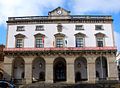
municipal building in Cáceres, Spain  .jpg) | |||||
| Upload media | |||||
| Instance of | |||||
|---|---|---|---|---|---|
| Location | Cáceres, Cáceres Province, Extremadura, Spain | ||||
| Located on street | |||||
| Owned by | |||||
| Occupant | |||||
| Inception |
| ||||
 | |||||
Media in category "Town hall of Cáceres"
The following 8 files are in this category, out of 8 total.
-
 1867 Primera piedra del Ayuntamiento de Cáceres por Ludwik Tarszeński.jpg 1,024 × 715; 335 KB
-
 Caceres - Ayuntamiento.JPG 1,544 × 1,134; 188 KB
-
 Caceres 2 1 (6623675573).jpg 3,710 × 2,782; 6.02 MB
-
 Centro histórico de Cáceres (9840620564).jpg 2,560 × 1,920; 2.12 MB
-
 Cáceres (12040992256).jpg 3,888 × 2,592; 3.14 MB
-
 Cáceres - Plaza Mayor 1.jpg 1,600 × 1,200; 180 KB
-
 Cáceres. Town Hall. Extremadura. Spain (4462699499).jpg 6,144 × 4,096; 12.9 MB
-
 J29 207 Plaza Mayor, ayuntamiento.jpg 5,215 × 3,498; 3.97 MB

.jpg)
.jpg)

.jpg)
