Category:Tram maps of New Hampshire
Media in category "Tram maps of New Hampshire"
The following 22 files are in this category, out of 22 total.
-
 1905 bird's eye view streetcar map of southern New England.jpg 4,000 × 2,723; 3.08 MB
-
 1907 bird's eye view of trolley routes in New England.jpg 6,672 × 9,580; 17.18 MB
-
 1907 map of Atlantic Shore Line Railway and connecting lines.jpg 1,040 × 2,444; 321 KB
-
 1908 bird's eye view of trolley routes in New England.jpg 4,439 × 6,366; 10.27 MB
-
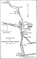 1908 map of Manchester Street Railway suburban lines.jpg 1,078 × 1,701; 299 KB
-
 1908 map of streetcar lines between Boston and the Merrimack Valley.jpg 721 × 871; 134 KB
-
 1908 map of the Atlantic Shore Line Railway.jpg 1,069 × 1,602; 319 KB
-
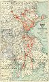
 1908 map of the New Hampshire Electric Railways.jpg 1,578 × 1,711; 722 KB
-
 1909 streetcar map of New England.jpg 2,653 × 4,000; 1.66 MB
-
 1910 Tri-state Trolley Map.jpg 2,864 × 4,740; 3.4 MB
-
 1910s Bay State Street Railway map.png 3,500 × 6,149; 41.66 MB
-
 1911 aerial map of Boston and Northern Street Railway and Old Colony Street Railway.png 3,500 × 6,193; 43.94 MB
-
 1911 Tri-state Trolley Map.png 2,583 × 3,500; 17.01 MB
-
 1912 aerial map of the Bay State Street Railway.png 3,500 × 6,285; 50.46 MB
-
 1912 map of the Exeter, Hampton and Amesbury Street Railway.jpg 603 × 662; 122 KB
-
 1916 aerial map of the Bay State Street Railway.png 3,500 × 6,279; 39.4 MB
-
 1917 Massachusetts Northeastern Street Railway timetable cover and map.jpg 1,112 × 1,201; 1.12 MB
-
 Birds Eye View of Street Railway Routes in New England, 1904.png 2,392 × 3,500; 20.63 MB
-
 Birds Eye View of Street Railway Routes in New England, 1905.png 3,500 × 5,018; 53.03 MB
-
 By trolley through eastern New England (1904) (14796493203).jpg 1,636 × 1,816; 395 KB
-
 Concord and Manchester Electric Branch 1904 map.jpg 998 × 2,922; 105 KB
-
 Electric railway review (1906) (14758369712).jpg 1,052 × 1,742; 253 KB


_(14796493203).jpg)
_(14758369712).jpg)