Category:Transport in Stevenage
Subcategories
This category has the following 5 subcategories, out of 5 total.
B
- Bikeways in Stevenage (7 F)
S
- Stevenage Bus Station (27 F)
- Stevenage railway station (47 F)
Media in category "Transport in Stevenage"
The following 35 files are in this category, out of 35 total.
-
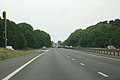
 A1 (M) skirting Stevenage - geograph.org.uk - 2322794.jpg 639 × 440; 51 KB
-
-
 A1(M) - west of Stevenage - geograph.org.uk - 2322824.jpg 640 × 412; 47 KB
-
 A1(M) crosses Bessemer Drive - geograph.org.uk - 2513687.jpg 640 × 480; 31 KB
-
 A1(M) northbound at junction 7 - geograph.org.uk - 2513683.jpg 640 × 481; 41 KB
-
 A1(M) northbound at junction 8 - geograph.org.uk - 2513708.jpg 640 × 480; 39 KB
-
 A1(M) northbound near Fishers Green - geograph.org.uk - 2513701.jpg 640 × 480; 42 KB
-

-
 A1(M) passing west of Stevenage - geograph.org.uk - 2322809.jpg 639 × 460; 52 KB
-
 A1(M) south of junction 7 - geograph.org.uk - 2458352.jpg 640 × 425; 37 KB
-
 A1(M) southbound - junction 7 - geograph.org.uk - 2444110.jpg 640 × 419; 41 KB
-
 A1(M), J7 - geograph.org.uk - 4283868.jpg 3,264 × 2,448; 4.08 MB
-
 A1(M), London - 32 miles - geograph.org.uk - 2444076.jpg 640 × 421; 43 KB
-
 Bike lane along Hitchin Road - geograph.org.uk - 2535714.jpg 1,594 × 1,143; 489 KB
-
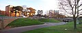
 Blackberry Mead, Stevenage - geograph.org.uk - 2226981.jpg 640 × 480; 87 KB
-
 Botany Bay Lane, Great Ashby, Stevenage - geograph.org.uk - 3142522.jpg 2,048 × 1,536; 1.14 MB
-
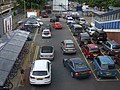 Busy concourse, Stevenage Station - geograph.org.uk - 3102272.jpg 640 × 480; 93 KB
-
 Colestrete - geograph.org.uk - 3860075.jpg 640 × 480; 80 KB
-
 Cycle path beside Gunnels Wood Road - geograph.org.uk - 3102236.jpg 640 × 480; 69 KB
-
 Cycle path beside Martins Way - geograph.org.uk - 3102234.jpg 640 × 480; 75 KB
-
 Cycle path beside railway, Stevenage - geograph.org.uk - 3102260.jpg 640 × 480; 57 KB
-
 Cycle path beside Six Hills Way - geograph.org.uk - 3860080.jpg 640 × 480; 62 KB
-
 Footpath crossroads. - geograph.org.uk - 118551.jpg 640 × 482; 164 KB
-
 Junction 8 - A1(M) - geograph.org.uk - 3261017.jpg 640 × 452; 40 KB
-
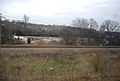 Langley Junction, Stevenage - geograph.org.uk - 2378356.jpg 640 × 430; 59 KB
-
 Looking north along the High Street, Stevenage Old Town - geograph.org.uk - 3983186.jpg 4,320 × 3,240; 4.98 MB
-
 Old Milestone - geograph.org.uk - 3507248.jpg 1,024 × 768; 294 KB
-
 Path by the Knebworth Park access road - geograph.org.uk - 3109853.jpg 1,600 × 1,067; 506 KB
-
 St George's Way multi-storey car park, Stevenage (14854873311).jpg 4,288 × 3,216; 3.45 MB
-
 Stevenage1.jpg 1,556 × 616; 250 KB
-
 The end of the green strip, Great Ashby, Stevenage - geograph.org.uk - 3142517.jpg 2,048 × 1,536; 776 KB
-
 The green, Great Ashby, Stevenage - geograph.org.uk - 3142370.jpg 2,000 × 1,412; 737 KB
-
 The junction of Botany Bay Lane and Back Lane - geograph.org.uk - 3142508.jpg 2,048 × 1,536; 945 KB
-
-

_skirting_Stevenage_-_geograph.org.uk_-_2322794.jpg)
_-_Knebworth_House_turning_(Jnct-7)_-_geograph.org.uk_-_2458347.jpg)
_-_west_of_Stevenage_-_geograph.org.uk_-_2322824.jpg)
_crosses_Bessemer_Drive_-_geograph.org.uk_-_2513687.jpg)
_northbound_at_junction_7_-_geograph.org.uk_-_2513683.jpg)
_northbound_at_junction_8_-_geograph.org.uk_-_2513708.jpg)
_northbound_near_Fishers_Green_-_geograph.org.uk_-_2513701.jpg)
_northbound,_north_west_of_Stevenage_-_geograph.org.uk_-_2513694.jpg)
_passing_west_of_Stevenage_-_geograph.org.uk_-_2322809.jpg)
_south_of_junction_7_-_geograph.org.uk_-_2458352.jpg)
_southbound_-_junction_7_-_geograph.org.uk_-_2444110.jpg)
,_J7_-_geograph.org.uk_-_4283868.jpg)
,_London_-_32_miles_-_geograph.org.uk_-_2444076.jpg)


_-_geograph.org.uk_-_3261017.jpg)


.jpg)


