Category:Transport maps of India
Countries of Asia: Afghanistan · Armenia‡ · Azerbaijan‡ · Bangladesh · Bhutan · People's Republic of China · Cyprus‡ · East Timor · Egypt‡ · Georgia‡ · India · Indonesia‡ · Iran · Iraq · Israel · Japan · Jordan · Kazakhstan‡ · Kuwait · Kyrgyzstan · Laos · Lebanon · Malaysia · Myanmar · North Korea · Pakistan · Russia‡ · Saudi Arabia · Singapore · South Korea · Sri Lanka · Syria · Tajikistan · Thailand · Turkey‡ · Turkmenistan · Vietnam · Yemen
Limited recognition: Taiwan
‡: partly located in Asia
Limited recognition: Taiwan
‡: partly located in Asia
States of India: Andhra Pradesh · Assam · Gujarat · Himachal Pradesh · Karnataka · Kerala · Maharashtra · Tamil Nadu · West Bengal
Union territories: Delhi · Puducherry
Former states of India:
Former union territories:
Union territories: Delhi · Puducherry
Former states of India:
Former union territories:

Subcategories
This category has the following 8 subcategories, out of 8 total.
Media in category "Transport maps of India"
The following 10 files are in this category, out of 10 total.
-
 CIA map of transportation in India.jpg 2,018 × 2,412; 1.61 MB
-
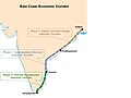 East Coast Economic Corridor Map.jpg 819 × 615; 56 KB
-
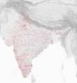 Geovisualization of places and river systems in India.png 2,000 × 2,172; 4.05 MB
-
 Hyderabad Boundaries and Railways - DPLA - cbaf432f34eac65162f01cf00600819d.jpg 4,672 × 3,377; 1.83 MB
-
 India Transportation and Political Divisions - DPLA - d87ac45c1eb7048e5a58c5ac83d6c202.jpg 5,072 × 4,994; 2.19 MB
-
 India Transportation.jpg 2,018 × 2,412; 1.61 MB
-
 Map of dedicated freight corridors of India.jpg 6,859 × 8,733; 4.03 MB
-
 Potential Diamond Quadrilateral HSR route map.JPG 6,859 × 8,240; 3.82 MB
-
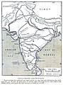 Rivers and railways.jpg 553 × 744; 476 KB
-
 இந்திய வரைபடம்.png 5,500 × 6,194; 8.4 MB


