Category:Transport maps of London
Most populous urban areas of the world: Algiers [DZ] · Bangkok [TH] · Barcelona [ES] · Bogotá [CO] · Delhi [IN] · Dhaka [BD] · London [GB] · New York City [US] · Paris [FR] · Saint Petersburg [RU] · Singapore [SG] · Taipei [TW] · Tehran [IR] · Tokyo [JP] · Washington, D.C. [US]
Subcategories
This category has the following 3 subcategories, out of 3 total.
P
R
Media in category "Transport maps of London"
The following 12 files are in this category, out of 12 total.
-
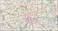
 Greater London transportations map.svg 1,006 × 709; 5.62 MB
-
 London Bus & Night Bus Map.jpg 1,120 × 795; 309 KB
-
 London Commuter Belt map no TTW.svg 1,000 × 739; 2.94 MB
-
 London Commuter Belt map.svg 1,000 × 739; 3.01 MB
-
 Map of the Great Victorian Way.jpg 957 × 600; 121 KB
-
 MapLondonAirports.png 506 × 384; 62 KB
-
 Regent's Canal map.jpg 1,453 × 789; 1.52 MB
-
 ReveleyThamesscheme1796.JPG 700 × 397; 59 KB
-
 Road name suffixes in London.jpg 1,425 × 1,101; 447 KB
-
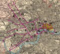
 Royal Commission on London Traffic - Road Impovements.png 1,994 × 1,362; 6.86 MB
-
 Royal Commission on London Traffic - Tramway Improvements.png 1,450 × 1,323; 4.95 MB
-
 Urban Transport and Morphology - London.png 4,558 × 4,204; 1.01 MB


