Category:Transport maps of Saxony
Federal states of Germany:
Subcategories
This category has the following 6 subcategories, out of 6 total.
C
D
L
Media in category "Transport maps of Saxony"
The following 14 files are in this category, out of 14 total.
-
 A17 BallungsraumDresden.png 236 × 217; 7 KB
-
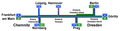 A4 Chemnitz Dresden.png 614 × 158; 15 KB
-
 Frankonia Seilbahn Beierfeld 1924.jpg 459 × 891; 302 KB
-
 Karte MDV 2019.svg 618 × 594; 226 KB
-
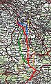 Kulmer Steig.jpg 2,072 × 3,364; 1.21 MB
-
 Mdv-gebiet landkreise.png 726 × 490; 41 KB
-
 Moritzburg.png 885 × 590; 208 KB
-
 S177.jpg 568 × 568; 20 KB
-
 Sachsen Flughäfen und Landeplätze.png 1,500 × 1,070; 327 KB
-
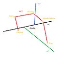
 Schkeuditzer Kreuz der A14 mit der A9.png 1,520 × 1,136; 330 KB
-
 Staatsstraße S51 Verlauf.png 320 × 400; 24 KB
-
 Staatsstraße S57 Verlauf.PNG 320 × 400; 24 KB
-
 Sächsische Radfahrer-Zeitung 1899-11-11, p442.jpg 1,124 × 1,227; 230 KB
-
 Wasserwege zwischen Merseburg und Leipzig.png 2,894 × 684; 342 KB


