Category:Transport maps of Sudan
Countries of Africa: Algeria · Benin · Cape Verde · Democratic Republic of the Congo · Djibouti · Egypt‡ · Eswatini · Ethiopia · Gabon · Ghana · Ivory Coast · Kenya · Liberia · Madagascar · Morocco · Namibia · Niger · Rwanda · Senegal · Sierra Leone · Somalia · South Africa · Sudan · Tanzania · Togo · Tunisia · Uganda · Zambia · Zimbabwe
Limited recognition: Somaliland – Other areas: Réunion
‡: partly located in Africa
Limited recognition: Somaliland – Other areas: Réunion
‡: partly located in Africa
Media in category "Transport maps of Sudan"
The following 7 files are in this category, out of 7 total.
-
 FerrovieSudan.jpg 477 × 599; 32 KB
-
 Sudan - administrative and railroads. LOC 2013590437.jpg 4,771 × 5,834; 2.17 MB
-
 Sudan Administrative Divisions 1989.jpg 996 × 1,246; 520 KB
-
 Sudan Administrative Divisions 1994.jpg 1,019 × 1,245; 540 KB
-
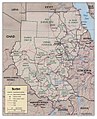
 Sudan Administrative Divisions 2000.jpg 1,016 × 1,244; 561 KB
-
 Sudan Physiography 1994.jpg 1,020 × 1,240; 281 KB
-
 Sudan Physiography 2000.jpg 1,025 × 1,261; 579 KB


