Category:Travel maps of Bavaria
Federal states of Germany:
Media in category "Travel maps of Bavaria"
The following 10 files are in this category, out of 10 total.
-
 BayreuthMap.png 2,997 × 2,395; 1.59 MB
-
 BayreuthMap.svg 1,715 × 1,216; 244 KB
-
 BayreuthPlan.png 784 × 529; 180 KB
-
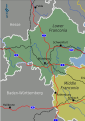
 FranconiaRegionalMap 02.png 2,500 × 2,176; 1.09 MB
-
 FranconiaRegionalMap 02.svg 744 × 1,052; 2.68 MB
-
 FranconiaRegionalMap.png 2,484 × 2,160; 1.03 MB
-
 FranconiaRegionalMap.svg 744 × 1,052; 2.65 MB
-
 FranconiaRegionalMapNoRoutes.png 2,500 × 2,176; 736 KB
-
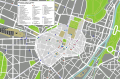
 Munich City Center.png 3,000 × 2,426; 1.9 MB
-
 Munich City Center.svg 1,960 × 1,290; 326 KB


