Category:Travel maps of North America
Subcategories
This category has the following 7 subcategories, out of 7 total.
Media in category "Travel maps of North America"
The following 15 files are in this category, out of 15 total.
-
 Antigua and Barbuda Regions map.png 1,328 × 2,500; 584 KB
-
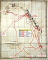 Cote-N-O-Roquefeuil def.jpg 614 × 768; 121 KB
-
 DL Destionation Cuts.png 2,478 × 1,240; 1.13 MB
-
 Map of North America (Arabic).png 1,000 × 651; 154 KB
-
 Map of North America (eo 2).png 1,000 × 651; 129 KB
-
 Map of North America (eo).png 1,000 × 651; 130 KB
-
 Map of North America (fr).png 3,083 × 2,006; 628 KB
-
 Map of North America (he).png 3,083 × 2,006; 584 KB
-
 Map of North America (nl).png 2,466 × 1,605; 469 KB
-
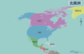 Map of North America (zh-hans)-北美洲地图.png 2,466 × 1,605; 445 KB
-
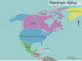 Map of North America ka.svg 2,732 × 2,006; 1.89 MB
-
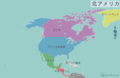 Map of North America(ja).png 2,466 × 1,605; 448 KB
-
 Map of North America(pt).png 2,466 × 1,605; 478 KB
-
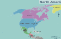
 Map of North America.png 1,000 × 651; 102 KB
-
 Map of North America.svg 3,082 × 2,006; 2.36 MB


.png)
.png)
.png)
.png)
.png)
.png)
-%E5%8C%97%E7%BE%8E%E6%B4%B2%E5%9C%B0%E5%9B%BE.png)

.png)
.png)

