Category:Trees in Lincolnshire

Subcategories
This category has the following 70 subcategories, out of 70 total.
*
- Avenues in Lincolnshire (13 F)
- Orchards in Lincolnshire (2 F)
- Woodland of Lincolnshire (2 F)
A
B
- Trees in Bardney (4 F)
- Trees in Barrow upon Humber (24 F)
- Trees in Barton-upon-Humber (78 F)
- Trees in Blankney (5 F)
- Trees in Bonby (18 F)
- Trees in Bourne (32 F)
- Trees in Branston and Mere (3 F)
- Trees in Brigg (7 F)
- Trees in Brocklesby (6 F)
- Trees in Burton upon Stather (5 F)
C
- Trees in Caistor (4 F)
- Trees in Carlby (1 F)
D
- Trees in Denton, Lincolnshire (13 F)
E
F
G
- Trees in Goxhill, Lincolnshire (36 F)
- Trees in Grimsby (3 F)
H
- Trees in Horkstow (33 F)
K
- Trees in Kirton in Lindsey (9 F)
L
- Trees in Leadenham (8 F)
- Trees in Lincoln, England (17 F)
- Trees in Louth, Lincolnshire (18 F)
N
O
- Trees in Owersby (4 F)
R
- Trees in Rippingale (7 F)
- Trees in Roxby cum Risby (15 F)
S
- Trees in Saxby All Saints (26 F)
- Trees in Scrivelsby (20 F)
- Trees in Scunthorpe (32 F)
- Trees in Searby-cum-Owmby (6 F)
- Trees in Lincolnshire in snow (20 F)
- Trees in South Ferriby (15 F)
- Trees in Spilsby (3 F)
T
- Trees in Thornton Curtis (27 F)
- Trees in Tupholme (2 F)
U
W
- Trees in West Halton (13 F)
- Trees in Woodhall Spa (8 F)
- Trees in Wootton, Lincolnshire (11 F)
- Trees in Worlaby (23 F)
Media in category "Trees in Lincolnshire"
The following 200 files are in this category, out of 768 total.
(previous page) (next page)-

-
 -2021-03-26 Larch trees inside Bourne wood, Lincolnshire.jpg 4,927 × 5,800; 7.8 MB
-
 -2021-03-31 Spring foliage on a Larch tree, Bourne Wood, Lincolnshire (1).jpg 3,024 × 4,032; 4.4 MB
-
 -2021-03-31 Spring foliage on a Larch tree, Bourne Wood, Lincolnshire.jpg 3,024 × 4,032; 3.55 MB
-
 At Old Somerby, Lincolnshire - St Mary Magdalene's Church, - Dec 2005.JPG 2,560 × 1,920; 3.93 MB
-
 Londonthorpe Wood in 2005, near Grantham, Lincolnshire, England 01.jpg 2,560 × 1,920; 3.51 MB
-
 Londonthorpe Wood in 2005, near Grantham, Lincolnshire, England 02.jpg 2,560 × 1,920; 3.49 MB
-
 Londonthorpe Wood in 2005, near Grantham, Lincolnshire, England 03.jpg 2,530 × 1,686; 3.64 MB
-
 Londonthorpe Wood in 2005, near Grantham, Lincolnshire, England 04.jpg 2,560 × 1,707; 4.17 MB
-
 Londonthorpe Wood in 2005, near Grantham, Lincolnshire, England 05.jpg 2,560 × 1,707; 3.98 MB
-
 Londonthorpe Wood in 2005, near Grantham, Lincolnshire, England 06.jpg 2,560 × 1,707; 3.74 MB
-
 Londonthorpe Wood in 2005, near Grantham, Lincolnshire, England 07.jpg 2,560 × 1,920; 4.04 MB
-
 Londonthorpe Wood in 2005, near Grantham, Lincolnshire, England 08.jpg 2,560 × 1,920; 4.21 MB
-
 Londonthorpe Wood in 2005, near Grantham, Lincolnshire, England 09.jpg 2,536 × 1,690; 3.59 MB
-
 Londonthorpe Wood in 2005, near Grantham, Lincolnshire, England 10.jpg 2,560 × 1,706; 4.02 MB
-
 Londonthorpe Wood in 2005, near Grantham, Lincolnshire, England 11.jpg 2,560 × 1,440; 3.61 MB
-
 A weeping ash Stow Green, nr Horbling Lincolnshire, England.JPG 2,560 × 1,920; 4.14 MB
-
 A view south from the A52 east from Grantham, Lincolnshire - Dec 2005 (1).JPG 2,560 × 1,512; 2.78 MB
-
 Corby Glen St John's - from the south-west.jpg 2,500 × 1,875; 3.9 MB
-
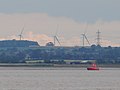 32A Float, Winterton and Wind Farm - geograph.org.uk - 1392909.jpg 640 × 480; 115 KB
-
 A December view of Woodnook Valley, Little Ponton, Lincolnshire, England 01.JPG 2,560 × 1,920; 2.57 MB
-
 A December view of Woodnook Valley, Little Ponton, Lincolnshire, England 02.JPG 1,920 × 2,183; 2.9 MB
-
 A December view of Woodnook Valley, Little Ponton, Lincolnshire, England 03.JPG 2,560 × 1,920; 3.63 MB
-
 A December view of Woodnook Valley, Little Ponton, Lincolnshire, England 04.JPG 2,560 × 1,920; 3.63 MB
-
 A December view of Woodnook Valley, Little Ponton, Lincolnshire, England 05.JPG 2,560 × 1,920; 4.24 MB
-
 A December view of Woodnook Valley, Little Ponton, Lincolnshire, England 06.JPG 1,920 × 2,560; 4.11 MB
-
 A December view of Woodnook Valley, Little Ponton, Lincolnshire, England 07.JPG 2,560 × 1,920; 4.69 MB
-
 A December view of Woodnook Valley, Little Ponton, Lincolnshire, England 08.JPG 2,560 × 1,920; 2.57 MB
-
 A December view of Woodnook Valley, Little Ponton, Lincolnshire, England 09.JPG 1,920 × 2,560; 3.71 MB
-
 A December view of Woodnook Valley, Little Ponton, Lincolnshire, England 10.JPG 1,920 × 2,560; 3.05 MB
-
 A December view of Woodnook Valley, Little Ponton, Lincolnshire, England 11.JPG 2,560 × 1,920; 2.71 MB
-
 A December view of Woodnook Valley, Little Ponton, Lincolnshire, England 12.JPG 2,560 × 1,920; 2.88 MB
-
 A December view of Woodnook Valley, Little Ponton, Lincolnshire, England 13.JPG 1,920 × 2,560; 3.17 MB
-
 A December view of Woodnook Valley, Little Ponton, Lincolnshire, England 14.JPG 2,560 × 1,920; 3.46 MB
-
 A dyke near Wrangle - geograph.org.uk - 589825.jpg 640 × 480; 91 KB
-
 A Footpath From Garthorpe Grange - geograph.org.uk - 251222.jpg 640 × 480; 101 KB
-
 A Humber Tug - geograph.org.uk - 247499.jpg 640 × 480; 104 KB
-
 A stream near Alvingham - geograph.org.uk - 599339.jpg 464 × 640; 106 KB
-
 A sunset at Eastoft, Lincolnshire 01.JPG 2,560 × 1,920; 1.35 MB
-
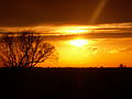 A sunset at Eastoft, Lincolnshire 02.JPG 2,560 × 1,920; 1.57 MB
-
 A sunset at Eastoft, Lincolnshire 03.JPG 2,560 × 1,920; 1.87 MB
-
 A sunset at Eastoft, Lincolnshire 04.JPG 2,560 × 1,920; 1.62 MB
-
 A tree at Aunsby, Lincolnshire, England.JPG 2,290 × 1,465; 2.15 MB
-
 A view east, Woodnook Valley, Little Ponton, Lincolnshire, England 01.jpg 2,448 × 1,660; 2.69 MB
-
 A view south from the A52 east from Grantham, Lincolnshire - Dec 2005 (2).JPG 2,560 × 1,920; 4.28 MB
-
 A view south from the A52 east from Grantham, Lincolnshire - Dec 2005 (3).JPG 2,560 × 1,920; 3.99 MB
-
 A view south from the A52 east from Grantham, Lincolnshire - Dec 2005 (4).JPG 2,560 × 1,920; 3.92 MB
-
 A view south from the A52 east from Grantham, Lincolnshire - Dec 2005 (5).JPG 2,560 × 1,920; 3.82 MB
-
 A view south, Woodnook Valley, Little Ponton, Lincolnshire, England.jpg 2,560 × 1,920; 4.56 MB
-
 A view south-east from north of village, Belton (nr Grantham).jpg 2,560 × 1,920; 2.96 MB
-
 A view towards Grimsthorpe Castle, Lincolnshire, England 02.JPG 2,560 × 1,641; 4.4 MB
-
 A view towards Grimsthorpe Castle, Lincolnshire, England 03.JPG 2,560 × 1,470; 3.23 MB
-
 A view towards Grimsthorpe Castle, Lincolnshire, England 04.JPG 2,560 × 1,245; 2.39 MB
-
 A view towards Grimsthorpe Castle, Linconlshire, England 01.JPG 2,560 × 1,560; 3.54 MB
-
 A view west across meadow from north of village, Belton (nr Grantham).jpg 2,560 × 1,920; 2.87 MB
-
 A view west, Woodnook Valley, Little Ponton, Lincolnshire, England 01.jpg 1,920 × 2,560; 4.55 MB
-
 A view west, Woodnook Valley, Little Ponton, Lincolnshire, England 02.jpg 2,560 × 1,920; 4.65 MB
-
 A1077 Ferriby Road - geograph.org.uk - 56364.jpg 640 × 425; 92 KB
-
 A1077 Junction - geograph.org.uk - 1310921.jpg 640 × 480; 67 KB
-
 A161 road (Kings Causeway), Swinefleet to Eastoft, Lincolnshire, with rainbow.JPG 2,560 × 1,920; 3.95 MB
-
 A161 road (Kings Causeway), Swinefleet to Eastoft, Lincolnshire.JPG 2,560 × 1,920; 4.36 MB
-
 Across meadow to Washdyke Lane, Belton (nr Grantham) - 01.jpg 2,560 × 1,920; 2.99 MB
-
 Across meadow to Washdyke Lane, Belton (nr Grantham) - 02.jpg 2,560 × 1,920; 3.23 MB
-
 Across meadow to Washdyke Lane, Belton (nr Grantham) - 03.jpg 2,560 × 1,920; 2.48 MB
-
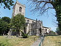
 St.John the Baptist's church - geograph.org.uk - 1019674.jpg 640 × 427; 63 KB
-
 Almost there - geograph.org.uk - 1279695.jpg 640 × 480; 99 KB
-
 Fenland Church - geograph.org.uk - 316541.jpg 640 × 480; 128 KB
-
 St.Andrew's church, Asgarby, Lincs. - geograph.org.uk - 81231.jpg 640 × 427; 66 KB
-
 Ash Tree - geograph.org.uk - 590710.jpg 480 × 640; 109 KB
-
 Church sign - geograph.org.uk - 378588.jpg 640 × 480; 155 KB
-
-
 Aswarby- St Denis (geograph 1849766).jpg 640 × 492; 89 KB
-
 Auster Wood - geograph.org.uk - 1290138.jpg 640 × 427; 94 KB
-
 Autumn at Well - geograph.org.uk - 1016918.jpg 600 × 450; 112 KB
-
 Autumn colour at St. Lambert's Hall - geograph.org.uk - 1024355.jpg 640 × 480; 135 KB
-
 Autumn colours from Easton Lane - geograph.org.uk - 282068.jpg 640 × 480; 103 KB
-
 Autumn Reflections - geograph.org.uk - 625330.jpg 640 × 426; 128 KB
-
 Awaiting Auction - geograph.org.uk - 580878.jpg 640 × 426; 164 KB
-
 Baptist Chapel Lane - geograph.org.uk - 676826.jpg 640 × 513; 116 KB
-
 Bardney Catholic church - geograph.org.uk - 383738.jpg 640 × 427; 55 KB
-
 Barkston St Nicholas Church 02 - From the south-west.jpg 4,608 × 3,456; 5.84 MB
-
 St.Edward's church, Barlings, Lincs. - geograph.org.uk - 93734.jpg 640 × 427; 64 KB
-
 Barlings Abbey - geograph.org.uk - 93738.jpg 640 × 427; 62 KB
-
 Barlings Eau near Reasby Grange - geograph.org.uk - 186960.jpg 640 × 427; 135 KB
-
 Barrowby4.jpg 360 × 480; 42 KB
-
 Saint Bartholomew's Church, Ingoldsby - geograph.org.uk - 87064.jpg 640 × 480; 99 KB
-
 Cross Road - geograph.org.uk - 1229995.jpg 480 × 640; 76 KB
-
 Main Road, Baston - geograph.org.uk - 1230005.jpg 640 × 480; 113 KB
-
 Beacon Hill Farm - geograph.org.uk - 277949.jpg 640 × 480; 107 KB
-
 Beech Tree - geograph.org.uk - 742480.jpg 640 × 427; 84 KB
-
 Almshouses - Belton (nr Grantham), Lincolnshire, England.jpg 2,560 × 1,920; 2.41 MB
-

-
 Belton (Grantham) - The Old School 01.jpg 2,560 × 1,920; 2.61 MB
-
 Belton (Grantham) - The Old School 02.jpg 2,560 × 1,920; 4.61 MB
-
 Belton and Manthorpe, UK - panoramio.jpg 1,600 × 899; 267 KB
-
 Belton Forge - geograph.org.uk - 123004.jpg 600 × 450; 124 KB
-
 Belton House Bellmount Tower.jpg 480 × 640; 133 KB
-
 Belton village estate cottage - geograph.org.uk - 130258.jpg 640 × 427; 91 KB
-
 Bend in A158 outside Barr Farm - geograph.org.uk - 425819.jpg 640 × 480; 107 KB
-
 All Saints' church, Benington - geograph.org.uk - 406000.jpg 640 × 427; 57 KB
-
 St. Swithin, Bicker - geograph.org.uk - 119179.jpg 640 × 427; 71 KB
-
 St.Swithun's church - geograph.org.uk - 733504.jpg 640 × 427; 82 KB
-
 St.Swithun's church - geograph.org.uk - 733511.jpg 640 × 427; 64 KB
-
 St.Swithun's church - geograph.org.uk - 733515.jpg 640 × 427; 74 KB
-
 St.Swithun's churchyard - geograph.org.uk - 733512.jpg 640 × 427; 85 KB
-
 Bicker, Lincolnshire in 2008.jpg 640 × 427; 77 KB
-
 Birch with Fungus - geograph.org.uk - 464428.jpg 640 × 480; 114 KB
-
 Four ash trees near Atterby - geograph.org.uk - 544680.jpg 640 × 480; 83 KB
-
 Black Bank - geograph.org.uk - 458032.jpg 640 × 427; 59 KB
-
 Black Bank Pumping Station - geograph.org.uk - 458027.jpg 640 × 427; 72 KB
-
 Bloxholm Church.jpg 640 × 427; 77 KB
-
 Bluestone Heath Road Junction - geograph.org.uk - 149879.jpg 640 × 426; 91 KB
-
 Bluestone Heath Road, South Ormsby (geograph 3068665).jpg 2,256 × 1,504; 2.59 MB
-
 Bluestone Ridge road near South Ormsby - geograph.org.uk - 482286.jpg 640 × 482; 139 KB
-
 St Andrew's , Boothby Graffoe, Lincolnshire.jpg 800 × 699; 221 KB
-
-
 Borrow-pit, Thurlby Fen Slipe - geograph.org.uk - 587844.jpg 640 × 427; 146 KB
-
 St Nicholas Church, Boston - geograph.org.uk - 737039.jpg 467 × 640; 62 KB
-

-
 Brankwell Crescent, Yaddlethorpe (geograph 2044092).jpg 640 × 480; 251 KB
-
 St.Peter's church, Bottesford - geograph.org.uk - 235539.jpg 640 × 427; 70 KB
-
 Bourne Castle (geograph 3257014).jpg 4,320 × 3,240; 5.91 MB
-
 Saint Margaret's Church, Braceby - geograph.org.uk - 87302.jpg 640 × 480; 151 KB
-
 Brandon Chapel (geograph 4425171).jpg 1,024 × 683; 289 KB
-
 Brandon Chapel - geograph.org.uk - 164582.jpg 640 × 427; 112 KB
-
 Branston Moor - geograph.org.uk - 380495.jpg 640 × 427; 65 KB
-
 Branston Moor Lane - geograph.org.uk - 380454.jpg 640 × 427; 71 KB
-
 Bridge - geograph.org.uk - 10752.jpg 640 × 480; 60 KB
-
 Bridge and ford on B1176 - geograph.org.uk - 114481.jpg 640 × 480; 96 KB
-
 Bridge and stile over the East Glen River - geograph.org.uk - 600139.jpg 640 × 427; 127 KB
-

-
 Bridge over River Slea - geograph.org.uk - 545124.jpg 640 × 427; 116 KB
-
 Bridge over the A180 - geograph.org.uk - 883277.jpg 640 × 480; 73 KB
-
 Bridge over the West Glen River - geograph.org.uk - 1584210.jpg 640 × 480; 142 KB
-
 Bridge over the West Glen River - geograph.org.uk - 629009.jpg 640 × 427; 77 KB
-
 Bridge to the Next Square - geograph.org.uk - 214632.jpg 640 × 480; 94 KB
-
 St Mary's Church, Broughton, Lincolnshire.jpg 640 × 480; 134 KB
-
 Bully Hill Beeches - geograph.org.uk - 680905.jpg 640 × 427; 85 KB
-
 Windmill at Burgh Le Marsh - geograph.org.uk - 216370.jpg 440 × 293; 195 KB
-

-

-
 Church Lane, Burton-le-Coggles - geograph.org.uk - 629677.jpg 640 × 427; 102 KB
-

-
 Burton-by-Lincoln - geograph.org.uk - 1144458.jpg 640 × 426; 101 KB
-
 Burton-le-Coggles - geograph.org.uk - 599752.jpg 640 × 427; 82 KB
-
 BurtonCoggles StThomasOfC ChancelEast.jpg 960 × 768; 380 KB
-
 BurtonCoggles StThomasOfC EastTrees.jpg 1,024 × 683; 401 KB
-
 St Michael, Buslingthorpe - geograph.org.uk - 428644.jpg 640 × 480; 114 KB
-
 St.Michael's church, Buslingthorpe, Lincs. - geograph.org.uk - 73328.jpg 640 × 427; 147 KB
-
 Butterwick Ings - geograph.org.uk - 406065.jpg 640 × 427; 70 KB
-
 By Rainsbutt Road looking north (geograph 6936740).jpg 3,732 × 4,965; 4.98 MB
-

-
 Cambridge Avenue, Lincoln - geograph.org.uk - 600869.jpg 640 × 480; 82 KB
-
 St. Benedicts church, Candlesby (geograph 3610032).jpg 1,600 × 1,064; 390 KB
-
 Arties Mill, Castlethorpe. - geograph.org.uk - 388417.jpg 640 × 427; 121 KB
-
 Castlethorpe, Arties Mill.jpg 640 × 427; 72 KB
-
 Caythorpe parish church, Lincolnshire - panoramio.jpg 2,120 × 2,088; 1.43 MB
-
 Caythorpe St Vincent - Cemetery cross from the north.jpg 2,000 × 3,447; 3.79 MB
-
 Change In The Air^ - geograph.org.uk - 95154.jpg 640 × 480; 210 KB
-
 Chapel in Autumn - geograph.org.uk - 602615.jpg 640 × 481; 123 KB
-
 Chapel Lane, Foston - geograph.org.uk - 301181.jpg 640 × 427; 99 KB
-
 Cherry blossom time - geograph.org.uk - 418088.jpg 640 × 480; 130 KB
-
 Cherry Holt - geograph.org.uk - 1496880.jpg 640 × 572; 84 KB
-
 Cherry tree and St. Martin's - geograph.org.uk - 2922195.jpg 1,024 × 768; 193 KB
-

-
 Chestnut Avenue to Grimsthorpe Castle - geograph.org.uk - 401710.jpg 640 × 480; 122 KB
-
 Church Lane, Castle Bytham - geograph.org.uk - 1614314.jpg 640 × 480; 113 KB
-
 Church of St Firmin, Thurlby - geograph.org.uk - 1577767.jpg 640 × 475; 90 KB
-
 Church Walk - geograph.org.uk - 593970.jpg 427 × 640; 108 KB
-
 Saint Peter's Church, Claypole - geograph.org.uk - 95865.jpg 640 × 480; 88 KB
-
 St.Peter's church - geograph.org.uk - 280894.jpg 640 × 427; 64 KB
-
 Clump of Trees at A16 Near Walmsgate - geograph.org.uk - 657550.jpg 480 × 640; 143 KB
-

-
 St Peter church, Conisholme - geograph.org.uk - 372174.jpg 640 × 638; 583 KB
-
 St.Peter's church, Conisholme - geograph.org.uk - 432136.jpg 640 × 427; 91 KB
-
 Copse over the Field - geograph.org.uk - 662244.jpg 640 × 427; 67 KB
-
 St. John the Evangelist, Corby Glen - geograph.org.uk - 120456.jpg 324 × 486; 42 KB
-
 Country road near Lound - geograph.org.uk - 420129.jpg 640 × 427; 138 KB
-
-
 Fallen airmen - geograph.org.uk - 677727.jpg 640 × 427; 74 KB
-
 Service Graves, St Andrew's churchyard, Cranwell, Lincolnshire.jpg 808 × 608; 522 KB
-
 St.Andrew's churchyard - geograph.org.uk - 677732.jpg 640 × 427; 98 KB
-

-

-
 Cranwell Village Centre.jpg 640 × 480; 127 KB
-
 Church of St Peter, Creeton, Lincolnshire - Dec 2005.JPG 2,560 × 1,920; 4.36 MB
-
 Cross Roads sign - geograph.org.uk - 949853.jpg 640 × 480; 100 KB
-
 Crossing and Box - geograph.org.uk - 258840.jpg 640 × 480; 94 KB
-
 Crossing the A15 - geograph.org.uk - 848959.jpg 640 × 480; 63 KB
-
 Culvert bridge for former railway tracks - geograph.org.uk - 1162194.jpg 640 × 480; 126 KB
-
 Guardian angel - geograph.org.uk - 1161468.jpg 426 × 640; 113 KB
-
 St.Helen's church - geograph.org.uk - 1161467.jpg 640 × 426; 117 KB
-

-
 Former road to Maxey - geograph.org.uk - 864864.jpg 640 × 480; 121 KB
-
 Arable land by Littleworth Drove - geograph.org.uk - 599954.jpg 640 × 480; 129 KB
-
 Denton Reservoir - geograph.org.uk - 1129170.jpg 640 × 423; 102 KB
-
 Doddington parkland - geograph.org.uk - 962110.jpg 640 × 427; 76 KB
-
 Driveway north of Greatford - geograph.org.uk - 487298.jpg 640 × 477; 134 KB
-
 All Saints' Church and churchyard, Dunsby, Lincolnshire.jpg 640 × 427; 103 KB
-
 All Saints' Church, Dunsby, Lincolnshire.jpg 427 × 640; 89 KB


.jpg)


.JPG)


.JPG)
.JPG)
.JPG)
.JPG)

.jpg)


.jpg)


,_Swinefleet_to_Eastoft,_Lincolnshire,_with_rainbow.JPG)
,_Swinefleet_to_Eastoft,_Lincolnshire.JPG)
_-_01.jpg)
_-_02.jpg)
_-_03.jpg)


.jpg)


,_Lincolnshire,_England.jpg)

_-_The_Old_School_01.jpg)
_-_The_Old_School_02.jpg)


.jpg)


.jpg)

.jpg)

.jpg)


.jpg)


.jpg)


