Category:Trekking in Nepal
Subcategories
This category has the following 11 subcategories, out of 11 total.
A
B
C
- Chisapani hiking trail (17 F)
G
M
- Mardi Himal Trek (179 F)
P
- Porter in Nepal (1 F)
R
- Trekking routes in Nepal (3 F)
S
T
- Teahouse in Nepal (2 F)
Pages in category "Trekking in Nepal"
The following 2 pages are in this category, out of 2 total.
Media in category "Trekking in Nepal"
The following 160 files are in this category, out of 160 total.
-
 1981 NEPAL trekking permit, p.2.tif 3,346 × 1,638; 12.1 MB
-
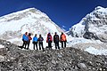
 A group of trekkers on the way to Everest Base Camp.jpg 5,184 × 3,456; 5.26 MB
-
 A trekker enjoying the beauty of Langtang, Nepal.jpg 3,500 × 2,318; 4.88 MB
-
 Ace Vision Nepal,Hike in Nepal.jpg 4,160 × 3,120; 5.49 MB
-
 Ama Dablam - Himalayas - Nepal.jpg 4,000 × 5,000; 8.32 MB
-
 Ama dablam.jpg 4,229 × 3,456; 1.57 MB
-
 Amadhablam.jpg 3,515 × 4,000; 10.71 MB
-
 Amazing Annapurna.jpg 4,032 × 3,024; 2.29 MB
-
 Amphu-lapcha-pass-trek-Mera peak.jpg 1,200 × 325; 435 KB
-
 An approach to the pass Tashi Laptse. - panoramio.jpg 3,243 × 2,162; 1.52 MB
-
 Annapurna Base Camp Trekk (211511187).jpeg 1,371 × 2,048; 631 KB
-
 Annapurna-base-camp-trek.jpg 1,200 × 430; 701 KB
-
 Annapurna-circut-trek-e1701078463794.jpg 1,200 × 390; 189 KB
-
 Backpacking and Trekking Life at Mustang,Nepal.jpg 5,184 × 3,456; 5.75 MB
-
 Bags with Patience.jpg 4,096 × 2,730; 3.19 MB
-
 Beautiful Landscape seen during Badimalike-Triveni Trekking, Bajura.jpg 4,608 × 2,304; 1.94 MB
-
 Beautiful Nepal- A country you must visit once in your life time.jpg 5,184 × 3,456; 7.19 MB
-
 Beginning ascent to the pass. - panoramio.jpg 3,872 × 2,592; 1.77 MB
-
 Best time to trek Everest Base Camp..jpg 1,000 × 800; 79 KB
-
 Bird of Langtang National Park, 16 Jan 2020.jpg 4,608 × 3,456; 3.19 MB
-
 Buddhist monastery prayer wheels.jpg 4,864 × 3,648; 5.47 MB
-
 Camp at 4610m. - panoramio.jpg 1,936 × 1,296; 1.14 MB
-
 Camp at an altitude of 5080 m. Upper DOLPA trekking in August. - panoramio.jpg 1,936 × 1,296; 1.08 MB
-
 Camp under a rock. - panoramio.jpg 1,936 × 1,296; 1.22 MB
-
 Camp under a rock. Morning, the 20th day of Barun trekking. GPS exactly. - panoramio.jpg 1,936 × 1,296; 996 KB
-
 Chhomroung -Morning.jpg 3,840 × 5,760; 4.31 MB
-
 Deep Manandhar Wikipedia Mardi Himal Trek.jpg 2,432 × 3,648; 1.08 MB
-
 Descent to Muktinath (4522749757).jpg 1,067 × 1,600; 433 KB
-
 Dole, Khumbu, Kangtega and Thamserku mountain peaks, Trekking in Nepal.jpg 4,032 × 2,688; 6.63 MB
-
 Dole, Khumbu, Kangtega and Thamserku, Mountains of Nepal.jpg 4,032 × 2,688; 5.61 MB
-
 Everest Base Camp Short Trek 13 days map.webp 1,000 × 1,000; 99 KB
-
 Everest base camp trek (2).jpg 800 × 500; 45 KB
-
 Everest region trek.jpg 1,536 × 2,048; 507 KB
-
 Everest Trek.jpg 4,000 × 3,000; 3.22 MB
-
 Everest-base-camp-trek-itinerary-weather.jpg 750 × 400; 66 KB
-
 Everest-base-camp-trekking-e1700994491309.jpg 1,126 × 455; 176 KB
-
 Female trekkers posing on Upper Mustang.jpg 1,280 × 720; 170 KB
-
 From left Himalayan peaks Cholotse,Tobuche,Kangtega and Thamaserku.JPG 3,648 × 2,736; 4.57 MB
-
 G.K.Majestic Trek P.Ltd..jpg 1,840 × 3,264; 2.37 MB
-
 Going back from Everest Base Camp (15094746501).jpg 2,000 × 1,435; 2.36 MB
-
 Gokyo Valley in the Khumbu Region.jpg 4,000 × 1,800; 4.18 MB
-
 Gokyo-lake,-trekking-lodge,-and-mountains.jpg 2,100 × 1,500; 753 KB
-
 Gosaikunda lake-Langtang National Park.jpg 10,113 × 6,188; 41.91 MB
-
 Gurung Village- Ghandurk.jpg 4,496 × 3,000; 12.13 MB
-
 Halo in the Himalayas.jpg 933 × 1,400; 555 KB
-
 Hero of Mountain.jpg 3,264 × 1,836; 1.93 MB
-
 High Altitude Trekkers.jpg 3,888 × 2,592; 9.46 MB
-
 High Camp of Mardi Himal Trek 02.jpg 6,000 × 4,000; 6.54 MB
-
 Himalayan Adventure Intl Treks .jpg 4,288 × 2,848; 2.11 MB
-
 Icecap1.jpg 3,120 × 4,160; 4.02 MB
-
 Kanchenjunga Trek Nepal.jpg 750 × 400; 54 KB
-
 Kang la pass after.jpg 4,160 × 3,120; 4.74 MB
-
 Kang la pass with my friend.jpg 2,592 × 1,944; 1.65 MB
-
 Khumai trekking.jpg 4,000 × 3,000; 2.68 MB
-
 Landscape at an altitude of 4500m. Weakly visible trail leads to the pass. - panoramio.jpg 1,936 × 1,296; 1.03 MB
-
 Landscape on a mountain ridge at an altitude of 5300 m. - panoramio.jpg 1,936 × 1,296; 1.06 MB
-
 Langtang Khola Rasuwa District.jpg 3,000 × 4,000; 5.23 MB
-
 Langtang Khola Rasuwa Jilla.jpg 3,000 × 4,000; 5.64 MB
-
 Langtang Range.JPG 2,592 × 1,944; 1.74 MB
-
 Last 100 meters to the pass. - panoramio.jpg 1,936 × 1,296; 1.14 MB
-
 Last meters ascent to the pass Tashi Laptse. - panoramio.jpg 3,872 × 2,592; 1.89 MB
-
 Last overnight stay, from this place a half-day on foot to Jomsom. - panoramio.jpg 1,936 × 1,296; 1.12 MB
-
 License file.jpg 1,700 × 2,338; 495 KB
-
 Life in Himalayas.jpg 3,264 × 2,448; 3.16 MB
-
 Looking at ama dablam.jpg 960 × 1,280; 476 KB
-
 Low Camp Mardi.jpg 4,000 × 2,248; 1.99 MB
-
 Lusa. The school playground is the best place to camp. - panoramio.jpg 1,936 × 1,296; 1.16 MB
-
 Macchapuchhare view from Annapurna Base Camp.jpg 4,496 × 3,000; 6.96 MB
-
 Machermo, Hikers, Nepal.jpg 4,032 × 2,688; 7.69 MB
-
 Mahabir pun by prakash neupane.jpeg 3,264 × 2,448; 1.43 MB
-
 Majestic view Annapurna Base Camp.jpg 6,000 × 4,000; 4.95 MB
-
 Manang site (65).JPG 3,872 × 2,592; 4.53 MB
-
 Manang site (85).JPG 2,896 × 1,936; 1.6 MB
-
 Mardi Himal Trek in Nepal Deep Manandhar Travel Enthusiast.jpg 6,000 × 4,000; 3.52 MB
-
 Mardi Himal Trek-unpacking glide (38187215636).jpg 3,648 × 2,736; 2.14 MB
-
 Mardi himal trekking.jpg 1,080 × 1,080; 326 KB
-
 Mountains of Nepal 06.jpg 2,048 × 1,536; 968 KB
-
 Mountains-3423897.jpg 6,000 × 4,000; 6.88 MB
-
 Mt Makalu and other mountains from Everest Himalayas.jpg 2,100 × 1,500; 951 KB
-
 Mt. Annapurna and Mt. Machhapuchhre in the morning glow.jpg 2,048 × 1,367; 2.25 MB
-
 Mt. Fishtail and trekkers.jpg 2,800 × 3,500; 7.48 MB
-
 Mt.cholate-and-trekkers-on-cho-la-pass-trail.jpg 2,100 × 1,500; 1.14 MB
-
 Mt.ghyangchhempo-from-langtang-valley-near-kyanjin-gumba.jpg 2,100 × 1,500; 1.27 MB
-
 Namche.jpg 2,400 × 1,800; 2.99 MB
-
 Near Gokyo lake,Nepal.JPG 3,648 × 2,736; 4.25 MB
-
 Nepal Sanctuary Treks.png 284 × 159; 26 KB
-
 Nepal Trekking.JPG 2,816 × 2,112; 1.77 MB
-
 Nepalma-trekking.jpg 5,184 × 3,456; 7.14 MB
-
 North base camp.jpg 4,075 × 3,456; 2.95 MB
-
 Nuptse,-Everest-and-Lola-mountains-from-Kala-Patthar.jpg 2,100 × 1,500; 837 KB
-
 On the way to Mardi Himal Base Camp.jpg 6,000 × 4,000; 5.1 MB
-
 Path to Mugu and farther to Tibet. - panoramio.jpg 1,936 × 1,296; 1.03 MB
-
 Phortse Tenga, Hikers, Trekkers, Nepal.jpg 4,032 × 2,688; 6.99 MB
-
 Pokhara Valley, Nepal (27637341053).jpg 3,721 × 2,444; 1.49 MB
-
 Prayer and thanks to the gods. Camp. - panoramio.jpg 1,936 × 1,296; 1.14 MB
-
 Responsible Adventures (Raj).jpg 3,264 × 2,448; 905 KB
-
 Rest in the lap of Himalayas.jpg 3,456 × 5,184; 5.95 MB
-
 Rocky pass 5408 meters. Clearly visible the further way to the top. - panoramio.jpg 1,936 × 1,296; 1.04 MB
-
 Rugged route around lake.jpg 3,264 × 2,448; 2.26 MB
-
 Sangmelo3.jpg 5,184 × 3,456; 4.03 MB
-
 Sign marking the beginning of Upper Mustang area.JPG 2,592 × 1,944; 1.01 MB
-
 Snow covered Trails of Badimalika, Bajura.jpg 4,608 × 2,304; 1.75 MB
-
 Snow covered Trails of Badimalika-Triveni Trekking, Bajura.jpg 2,304 × 4,608; 2.21 MB
-
 Sunrise from Mardi Himal.jpg 5,472 × 3,648; 10.74 MB
-
 Suspension Bridge-IMG 1581.jpg 5,184 × 3,456; 14.75 MB
-
 Symbol as a Road sign that travelers need to follow at Badimalika Region.jpg 4,608 × 2,304; 1.17 MB
-
 Tashi Laptse 5755 - panoramio.jpg 3,872 × 2,592; 1.72 MB
-
 Thame on the way to Renjola.jpg 3,024 × 4,032; 5.23 MB
-
 The "workhorse" of the Gokyo Valley trek - panoramio.jpg 3,872 × 2,592; 4.14 MB
-
 The descent from the pass into the valley Lakkyan Khola. - panoramio.jpg 1,936 × 1,296; 955 KB
-
 The descent from the pass Jhyarkoi La. - panoramio.jpg 1,936 × 1,296; 1.01 MB
-
 The Last Climb.jpg 6,000 × 4,000; 7.23 MB
-
 The pass 4766 meters on the way to Shey Gompa. - panoramio.jpg 1,800 × 1,200; 997 KB
-
 The Resting Shoes.jpg 4,096 × 2,730; 3.75 MB
-
 Thoughtful Trek.jpg 4,032 × 3,024; 2.76 MB
-
 Tilicho-way.jpg 3,968 × 2,976; 7.69 MB
-
 Toilet, trekking style - Annapurna Circuit, Nepal - panoramio.jpg 2,500 × 1,653; 1.42 MB
-
 Tourist on the way to Tilicho base camp.jpg 5,472 × 3,648; 15.61 MB
-
 Tourist on the way to Tilicho lake, Nepal.jpg 5,472 × 3,648; 10.87 MB
-
 Tourists trekking in Annapurna region.jpg 863 × 573; 179 KB
-
 Trackers on the way from Cho La Pass (5400m), Nepal (26100534705).jpg 2,000 × 1,335; 2.71 MB
-
 Trails to Tribeni from Badimalika, Bajura.jpg 4,608 × 2,304; 2.08 MB
-
 Transition to the left bank. - panoramio.jpg 1,936 × 1,296; 1.01 MB
-
 Trekker and the snowy way.jpg 3,888 × 2,592; 6.65 MB
-
 Trekker on Kala Patthar.jpg 2,916 × 1,944; 1.49 MB
-
 Trekkers having rest during their Annapurna circuit trek.jpg 1,260 × 945; 196 KB
-
 Trekkers marching towards the base camp , Annapurna Base Camp.jpg 3,120 × 3,900; 7.28 MB
-
 Trekkers near Namche Bazar.jpg 864 × 576; 173 KB
-
 Trekkers On Himalayas!!.jpg 4,000 × 2,667; 5.12 MB
-
 Trekkers on the way towards kalapatthar, mt Pumori standing tall infront.jpg 6,000 × 4,000; 14.95 MB
-
 Trekkers Porters Ghorepaani 1.jpg 3,264 × 4,928; 7.28 MB
-
 Trekkers posing in Everest Base Camp.jpg 5,184 × 3,456; 9.35 MB
-
 Trekkers-resting-on-the-way-to-ebc.jpg 2,100 × 1,500; 1.18 MB
-
 Trekkers.jpg 3,888 × 2,592; 9.82 MB
-
 Trekking 200714 MG 61920101.jpg 5,184 × 3,456; 12.55 MB
-
 Trekking at Mustang, Nepal.jpg 3,264 × 2,448; 4.02 MB
-
 Trekking in Nepal.jpg 6,000 × 4,000; 3.56 MB
-
 Trekking Life at Mustang,Nepal.jpg 5,184 × 3,456; 4.82 MB
-
 Trekking path and beautiful himalayas seen at Mustang,Nepal.jpg 5,184 × 3,456; 6.89 MB
-
 Trekking path and beautiful Himalayas seen at Mustang,Nepal.jpg 5,184 × 3,456; 5.46 MB
-
 Trekking Tashi Laptse 5755, Nepal, April 2012. - panoramio.jpg 3,872 × 2,592; 2.12 MB
-
 Trekking Trail and Beautiful Himalayas seen at Mustang,Nepal.jpg 5,184 × 3,456; 5.98 MB
-
 Trekking trail of Langtang.jpg 2,848 × 4,272; 10 MB
-
 Trekking Trail seen at Mustang, Nepal.jpg 3,264 × 2,448; 3.84 MB
-
 Trekking trail to Thorong Pass.JPG 4,000 × 3,000; 6.33 MB
-
 Trekking Trail to Tribeni from Badimalika covered by Snow.jpg 2,304 × 4,608; 2.78 MB
-
 Trekking Trails to Tribeni from Badimalika, Bajura.jpg 2,304 × 4,608; 3.27 MB
-
 Tribeni Trek.jpg 6,000 × 4,000; 12.6 MB
-
 Upper DOLPA trekking, camp. - panoramio.jpg 1,800 × 1,200; 974 KB
-
 View from Poon Hill .jpg 9,792 × 2,304; 3.08 MB
-
 View of Mount Fishtail from Highcamp of Mardi Himal.jpg 6,000 × 4,000; 11.68 MB
-
 View on Namche.jpg 4,288 × 2,335; 7.77 MB
-
 Walk carefully.JPG 5,184 × 3,456; 11.14 MB
-
 Wanderer Nepal.jpg 3,456 × 5,184; 2.05 MB
-
 Way down along the ridge. - panoramio.jpg 1,936 × 1,296; 1.24 MB
-
 Way to the pass from the valley Swaksa Khola. - panoramio.jpg 1,936 × 1,296; 1.13 MB
-
 Why you love to hike in Mountains.jpg 6,000 × 4,000; 10.69 MB
-
 Yambur La 4822 m between Pho and Bhijer. Upper DOLPA trekking - panoramio.jpg 1,936 × 1,296; 958 KB
-
 कैलाशमानडु, बाजुरा.jpg 4,608 × 2,304; 2.27 MB
-
 घान्द्रुक घोरेपानी पदयात्राको दौरान एक पदयात्री.jpg 6,016 × 4,016; 4.3 MB


.jpeg)


.jpg)


.jpg)


.jpg)


.JPG)
.JPG)

.jpg)


.jpg)

.jpg)


,_Nepal_(26100534705).jpg)