Category:Trimley St Mary
English: Trimley St. Mary is a parish and village between Felixstowe and Ipswich in Suffolk, England. Its eastern border is either the Dock Spur bridge or Spriteshall Lane. History would dictate that Spriteshall lane is the more likely border.
village in Suffolk, England, UK  | |||||
| Upload media | |||||
| Instance of | |||||
|---|---|---|---|---|---|
| Location |
| ||||
 | |||||
Subcategories
This category has the following 8 subcategories, out of 8 total.
B
- Blofield Lane foot crossing (2 F)
E
- Environs of Trimley St Mary (1 F)
M
- St Mary, Trimley St Mary (9 F)
S
T
- Trimley railway station (46 F)
W
- Trimley St Mary Water Tower (8 F)
Media in category "Trimley St Mary"
The following 200 files are in this category, out of 263 total.
(previous page) (next page)-
 A bare field - geograph.org.uk - 3307684.jpg 640 × 430; 46 KB
-
 A barren field - geograph.org.uk - 3307686.jpg 640 × 430; 46 KB
-
 A glimpse of Felixstowe Container Terminal - geograph.org.uk - 1944817.jpg 3,072 × 2,304; 2.43 MB
-
 A14 Roundabout At Trimley - geograph.org.uk - 3161407.jpg 1,024 × 768; 465 KB
-
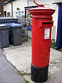
 Almshouses George V Postbox - geograph.org.uk - 4577954.jpg 2,253 × 2,995; 3.57 MB
-
 Almshouses George V Postbox - geograph.org.uk - 4577961.jpg 3,072 × 2,304; 1.88 MB
-
 Almshouses George V Postbox - geograph.org.uk - 4577964.jpg 3,072 × 2,304; 1.87 MB
-
 Almshouses George V Postbox - geograph.org.uk - 4577967.jpg 2,253 × 2,995; 3.09 MB
-
 Approaching Fagbury Cliff - geograph.org.uk - 1944789.jpg 2,304 × 3,072; 2.83 MB
-
 Approaching Searson's Farm - geograph.org.uk - 1943934.jpg 3,072 × 2,304; 3.09 MB
-
 Approaching the footpath level crossing - geograph.org.uk - 1947380.jpg 2,304 × 3,072; 2.41 MB
-
 Approaching the footpath level crossing - geograph.org.uk - 1947406.jpg 3,072 × 2,304; 2.53 MB
-
 Approaching the Port of Felixstowe - geograph.org.uk - 3297608.jpg 640 × 430; 72 KB
-
 Approaching Trimley Level Crossing - geograph.org.uk - 5725138.jpg 1,280 × 851; 423 KB
-
 Bench and Path - geograph.org.uk - 4394600.jpg 1,024 × 768; 314 KB
-
 Blofield Track - geograph.org.uk - 1943859.jpg 3,072 × 2,304; 2.71 MB
-
 Blofield Track - geograph.org.uk - 1948464.jpg 2,304 × 3,072; 2.46 MB
-
 Blofield Track - geograph.org.uk - 1948536.jpg 2,304 × 3,072; 2.66 MB
-
 Blofield Track - geograph.org.uk - 1948561.jpg 2,304 × 3,072; 2.55 MB
-
 Blofield Track - geograph.org.uk - 1948577.jpg 3,072 × 2,304; 2.71 MB
-

-
 Branch line goes over the bridleway - geograph.org.uk - 3312077.jpg 640 × 430; 55 KB
-
 Branch line to Port of Felixstowe - geograph.org.uk - 3307707.jpg 640 × 430; 85 KB
-
 Branch line to Port of Felixstowe - geograph.org.uk - 3307710.jpg 640 × 430; 111 KB
-

-
 Bridleway along Fagbury Cliff - geograph.org.uk - 1945980.jpg 2,304 × 3,072; 2.91 MB
-
 Bridleway along the field edge - geograph.org.uk - 3307682.jpg 640 × 430; 67 KB
-
 Bridleway approaching Clickett Hill - geograph.org.uk - 1947412.jpg 2,304 × 3,072; 2.5 MB
-
-
-

-

-
 Bridleway around the Port of Felixstowe - geograph.org.uk - 3307713.jpg 640 × 430; 109 KB
-
 Bridleway between high hedges - geograph.org.uk - 3307694.jpg 640 × 430; 106 KB
-
 Bridleway between Searson's Farm and Christmasyards Wood - geograph.org.uk - 1944587.jpg 2,304 × 3,072; 2.76 MB
-
 Bridleway by Searson's Farm - geograph.org.uk - 1943957.jpg 3,072 × 2,304; 2.87 MB
-
 Bridleway by Searson's Farm - geograph.org.uk - 1944544.jpg 2,304 × 3,072; 3.01 MB
-
 Bridleway Gate - geograph.org.uk - 1946118.jpg 3,072 × 2,304; 2.77 MB
-
 Bridleway leaving Christmasyards Wood - geograph.org.uk - 1944616.jpg 2,304 × 3,072; 2.94 MB
-
 Bridleway level crossing - geograph.org.uk - 1946136.jpg 3,072 × 2,304; 2.41 MB
-
 Bridleway near Fagbury Cliff Viewpoint - geograph.org.uk - 1945967.jpg 2,304 × 3,072; 3 MB
-
 Bridleway near Searson's Farm - geograph.org.uk - 1944555.jpg 2,304 × 3,072; 2.89 MB
-

-
 Bridleway through Christmasyards Wood - geograph.org.uk - 1944609.jpg 2,304 × 3,072; 2.88 MB
-
 Bridleway to Gulpher Road - geograph.org.uk - 4578191.jpg 3,072 × 2,304; 1.82 MB
-
 Bridleway to Trimley - geograph.org.uk - 3312081.jpg 640 × 430; 88 KB
-
 Bridleway towards Clickett Hill - geograph.org.uk - 1947410.jpg 3,072 × 2,304; 2.66 MB
-
 Bridleway towards Fagbury Cliff - geograph.org.uk - 1944757.jpg 2,304 × 3,072; 2.79 MB
-
 Bridleway towards Trimley Marshes Nature Reserve - geograph.org.uk - 1944736.jpg 2,304 × 3,072; 2.59 MB
-
 Church Lane - geograph.org.uk - 1325932.jpg 640 × 480; 92 KB
-
 Church of St. Martin signs ^ Bus Shelter - geograph.org.uk - 2648114.jpg 3,072 × 2,304; 1.43 MB
-
 Concrete marker block on seawall - geograph.org.uk - 4392870.jpg 1,024 × 768; 363 KB
-

-
-
 Container ship at Fagbury Point - geograph.org.uk - 3224872.jpg 1,024 × 683; 130 KB
-
 Container ships at the port of Felixstowe - geograph.org.uk - 5502813.jpg 1,024 × 768; 161 KB
-
 Container ships at Trinity Terminal, Felixstowe Docks - geograph.org.uk - 4113753.jpg 1,600 × 1,067; 377 KB
-
 Containers in the Container Park - geograph.org.uk - 3305179.jpg 640 × 372; 73 KB
-
 Containers, Port of Felixstowe - geograph.org.uk - 3307675.jpg 640 × 430; 66 KB
-
 Cordy's Lane, Trimley St Mary - geograph.org.uk - 5720396.jpg 1,280 × 851; 508 KB
-

-
 Cranes looming over Trimley Marshes - geograph.org.uk - 3297606.jpg 640 × 430; 56 KB
-
 Cranes on Felixstowe Docks from Shotley - geograph.org.uk - 5318781.jpg 3,436 × 1,303; 1.24 MB
-
 Cranes, Port of Felixstowe - geograph.org.uk - 3297611.jpg 640 × 430; 56 KB
-
 Cranes, Port of Felixstowe, from the south - geograph.org.uk - 5502803.jpg 1,024 × 768; 155 KB
-
 Creek off the Orwell - geograph.org.uk - 3297603.jpg 640 × 430; 56 KB
-
 Danger deep mud - geograph.org.uk - 3297598.jpg 640 × 430; 59 KB
-
 Disused platform at Trimley station - geograph.org.uk - 1949263.jpg 3,072 × 2,304; 2.94 MB
-
 Dock cranes at Felixstowe Docks - geograph.org.uk - 4422750.jpg 1,024 × 768; 308 KB
-
 Drainage channel, Trimley Marshes - geograph.org.uk - 3297602.jpg 640 × 430; 61 KB
-

-
 Eagle House, Trimley St Mary 2.jpg 2,743 × 1,822; 589 KB
-
 East of Trimley Station - geograph.org.uk - 1949261.jpg 3,072 × 2,304; 2.79 MB
-
 Eastbound A14, Trimley St Mary - geograph.org.uk - 3858910.jpg 640 × 480; 262 KB
-
 Eastern end of Trimley Station - geograph.org.uk - 1949260.jpg 2,304 × 3,072; 2.48 MB
-
 Entrance to Trimley Marshes - geograph.org.uk - 282436.jpg 640 × 480; 147 KB
-
 Fagbury Cliff Viewpoint - geograph.org.uk - 1945908.jpg 3,072 × 2,304; 2.78 MB
-
 Fagbury Road, Felixstowe - geograph.org.uk - 4174761.jpg 640 × 480; 106 KB
-
 Fagbury viewpoint - geograph.org.uk - 1205939.jpg 640 × 480; 90 KB
-
 Fagbury Wood - geograph.org.uk - 3305189.jpg 640 × 430; 126 KB
-
 Fallow field - geograph.org.uk - 3307676.jpg 640 × 430; 38 KB
-
 Fallow field - geograph.org.uk - 3307677.jpg 640 × 430; 45 KB
-
 Farmland and Barn - geograph.org.uk - 4394624.jpg 1,023 × 768; 321 KB
-

-
 Farmland and shelterbelt - geograph.org.uk - 4394593.jpg 1,024 × 768; 243 KB
-
 Farmland by Christmasyards Wood - geograph.org.uk - 3299643.jpg 640 × 430; 65 KB
-
 Farmland by the Port of Felixstowe - geograph.org.uk - 3307698.jpg 640 × 430; 47 KB
-
 Farmland near Trimley - geograph.org.uk - 3312088.jpg 640 × 430; 70 KB
-
 Farmland, Trimley Marshes - geograph.org.uk - 3299611.jpg 640 × 409; 37 KB
-
 Farmland, Trimley Marshes - geograph.org.uk - 3299612.jpg 640 × 430; 40 KB
-
 Farmland, Trimley Marshes - geograph.org.uk - 3299622.jpg 640 × 430; 54 KB
-
 Farmland, Trimley Marshes - geograph.org.uk - 3299624.jpg 640 × 430; 54 KB
-
 Farmland, Trimley Marshes - geograph.org.uk - 3299630.jpg 640 × 430; 53 KB
-
 Farmland, Trimley Marshes - geograph.org.uk - 3299634.jpg 640 × 430; 44 KB
-
 Felixstowe Branch Line at Trimley - geograph.org.uk - 3312110.jpg 640 × 430; 43 KB
-
 Felixstowe Container Park - geograph.org.uk - 3305183.jpg 640 × 430; 39 KB
-
 Felixstowe Container Park - geograph.org.uk - 3312072.jpg 640 × 430; 53 KB
-
 Felixstowe Container port - geograph.org.uk - 5370552.jpg 640 × 481; 244 KB
-
 Felixstowe Container port - geograph.org.uk - 5371275.jpg 640 × 480; 241 KB
-
 Felixstowe Container port - geograph.org.uk - 5371276.jpg 640 × 480; 249 KB
-
 Felixstowe Container port - geograph.org.uk - 5371277.jpg 640 × 480; 269 KB
-
 Felixstowe Container port - geograph.org.uk - 5371279.jpg 640 × 480; 245 KB
-
 Felixstowe Container port - geograph.org.uk - 5371288.jpg 640 × 480; 211 KB
-
 Felixstowe Container port - geograph.org.uk - 5371292.jpg 640 × 481; 216 KB
-
 Felixstowe Container port - geograph.org.uk - 5371295.jpg 640 × 480; 203 KB
-
 Felixstowe Container port - geograph.org.uk - 5371297.jpg 640 × 480; 213 KB
-
 Felixstowe Container Terminal - geograph.org.uk - 1946179.jpg 3,072 × 2,304; 2.61 MB
-
 Felixstowe Container Terminal - geograph.org.uk - 1946293.jpg 3,072 × 2,304; 2.4 MB
-
 Felixstowe Cranes - geograph.org.uk - 3301996.jpg 640 × 421; 65 KB
-
 Felixstowe Docks - geograph.org.uk - 2087225.jpg 2,048 × 1,360; 1.74 MB
-
 Felixstowe Port - geograph.org.uk - 5071272.jpg 2,592 × 1,944; 522 KB
-
 Field Drain, Trimley marshes - geograph.org.uk - 4392852.jpg 1,024 × 768; 414 KB
-
 Field near the Container Port - geograph.org.uk - 3305178.jpg 640 × 430; 50 KB
-
 Footpath along the field boundary - geograph.org.uk - 3312065.jpg 640 × 430; 82 KB
-
 Footpath and Bridleway junction - geograph.org.uk - 1946335.jpg 2,304 × 3,072; 2.68 MB
-
 Footpath and Bridleway junction on Blofield Track - geograph.org.uk - 1948509.jpg 3,072 × 2,304; 3.02 MB
-
 Footpath approaching the railway level crossing - geograph.org.uk - 1947400.jpg 2,304 × 3,072; 2.97 MB
-
 Footpath at edge of field - geograph.org.uk - 1946346.jpg 2,304 × 3,072; 2.68 MB
-
 Footpath beside the Felixstowe Docks loop line - geograph.org.uk - 1946318.jpg 3,072 × 2,304; 2.83 MB
-
 Footpath level crossing - geograph.org.uk - 1947387.jpg 3,072 × 2,304; 2.98 MB
-
 Footpath to Fagbury Cliff - geograph.org.uk - 4461265.jpg 1,024 × 768; 356 KB
-
 Footpath to Trimley - geograph.org.uk - 3299639.jpg 640 × 430; 110 KB
-
 Footpath to Trimley - geograph.org.uk - 3312084.jpg 640 × 430; 60 KB
-
 Footpath towards Trimley - geograph.org.uk - 1946226.jpg 2,304 × 3,072; 2.49 MB
-
 Footpath towards Trimley - geograph.org.uk - 1946240.jpg 2,304 × 3,072; 2.55 MB
-
 Footpath towards Trimley - geograph.org.uk - 1946262.jpg 2,304 × 3,072; 2.4 MB
-
 Footpath towards Trimley - geograph.org.uk - 1946279.jpg 3,072 × 2,304; 2.8 MB
-
 Gaymers Lane sign - geograph.org.uk - 2648098.jpg 3,072 × 2,304; 1.51 MB
-
 Gaymers Lane, Trimley St Mary ^ Keeper's Lane Bridleway - geograph.org.uk - 2648095.jpg 3,072 × 2,304; 1.38 MB
-
 Gaymers Lane, Trimley St Mary ^ Keeper's Lane Bridleway - geograph.org.uk - 2648097.jpg 3,072 × 2,304; 1.39 MB
-
 Grassland by the track to Trimley - geograph.org.uk - 3312087.jpg 640 × 430; 43 KB
-
 Gun Lane Restricted Byway - geograph.org.uk - 2648134.jpg 3,072 × 2,304; 1.3 MB
-
 Heavy Anti-Aircraft Emplacement - geograph.org.uk - 4217664.jpg 640 × 480; 142 KB
-
 Heavy Anti-Aircraft Emplacement - geograph.org.uk - 4217667.jpg 640 × 480; 108 KB
-
 Heavy Anti-Aircraft Emplacement - geograph.org.uk - 4217672.jpg 640 × 480; 200 KB
-
 Heavy Anti-Aircraft Emplacement - geograph.org.uk - 4217677.jpg 640 × 480; 170 KB
-
 Heavy Anti-Aircraft Emplacement - geograph.org.uk - 4217683.jpg 640 × 480; 214 KB
-
 Heavy Anti-Aircraft Emplacement - geograph.org.uk - 4217687.jpg 1,600 × 654; 503 KB
-
 Heavy Anti-Aircraft Emplacement - geograph.org.uk - 4217694.jpg 640 × 480; 132 KB
-
 Heavy Anti-Aircraft Emplacement - geograph.org.uk - 4217699.jpg 640 × 480; 202 KB
-
 Heavy Anti-Aircraft Emplacement - geograph.org.uk - 4217703.jpg 480 × 640; 201 KB
-
 Heavy Anti-Aircraft Emplacement - geograph.org.uk - 4217720.jpg 640 × 480; 192 KB
-
 Heavy Anti-Aircraft Emplacement - geograph.org.uk - 4217722.jpg 640 × 480; 104 KB
-
 High hedged bridleway - geograph.org.uk - 3307692.jpg 640 × 430; 109 KB
-
 High Road Bus Shelter - geograph.org.uk - 2648116.jpg 3,072 × 2,304; 1.46 MB
-
 High Road Trimley St.Martin - geograph.org.uk - 2648121.jpg 3,072 × 2,304; 1.27 MB
-
 High Road, Trimley St Martin - geograph.org.uk - 2648122.jpg 3,072 × 2,304; 1.32 MB
-
 High Road, Trimley St Mary - geograph.org.uk - 4577901.jpg 3,072 × 2,304; 1.77 MB
-
 High Road, Trimley St Mary - geograph.org.uk - 4577907.jpg 3,072 × 2,304; 1.68 MB
-
 High Road, Trimley St Mary - geograph.org.uk - 4578783.jpg 3,072 × 2,304; 1.85 MB
-
 High Road, Trimley St Mary - geograph.org.uk - 4578789.jpg 2,888 × 2,170; 1.87 MB
-
 High Road, Trimley St Mary - geograph.org.uk - 5719972.jpg 1,280 × 851; 323 KB
-
 High Road, Trimley St. Mary - geograph.org.uk - 4578003.jpg 3,072 × 2,304; 1.89 MB
-
 Keepers Track - geograph.org.uk - 1943903.jpg 3,072 × 2,304; 2.63 MB
-
 Kingsbury Road, Trimley St. Mary - geograph.org.uk - 4577977.jpg 3,072 × 2,304; 1.83 MB
-

-
 Level Crossing at Trimley Station - geograph.org.uk - 4217713.jpg 640 × 479; 108 KB
-
 Level crossing, Trimley - geograph.org.uk - 3312103.jpg 640 × 430; 44 KB
-
 Level Crossing, Trimley Station - geograph.org.uk - 1931972.jpg 2,304 × 3,072; 2.41 MB
-
 Line to Ipswich - geograph.org.uk - 3312106.jpg 640 × 430; 66 KB
-
 Marker post near Felixstowe Container Terminal - geograph.org.uk - 1946205.jpg 2,304 × 3,072; 2.58 MB
-
 Mudflats and River Orwell near Trimley Marshes - geograph.org.uk - 5549928.jpg 3,648 × 2,255; 2.52 MB
-
 Outflow to the Orwell near Trimley Marshes Nature Reserve - geograph.org.uk - 5549926.jpg 3,648 × 2,255; 2.76 MB
-

-
 Path to Dains Place - geograph.org.uk - 4577993.jpg 2,304 × 3,072; 2.44 MB
-
 Path to Trimley Marshes - geograph.org.uk - 4394607.jpg 1,024 × 768; 299 KB
-
 Port of Felixstowe - geograph.org.uk - 2565271.jpg 2,518 × 1,349; 586 KB
-
 Port of Felixstowe - geograph.org.uk - 3297610.jpg 640 × 365; 57 KB
-
 Port of Felixstowe - geograph.org.uk - 3307672.jpg 640 × 430; 51 KB
-
 Port of Felixstowe - geograph.org.uk - 3307704.jpg 640 × 430; 48 KB
-
 Port of Felixstowe Road - geograph.org.uk - 5725215.jpg 1,280 × 851; 312 KB
-
 Post Office 206-211 High Road Postbox - geograph.org.uk - 2648145.jpg 2,304 × 3,072; 1.41 MB
-
 Post Office 206-211 High Road Postbox - geograph.org.uk - 2648147.jpg 2,304 × 3,072; 1.42 MB
-
 Quayside crane, Trinity Terminal - geograph.org.uk - 1070252.jpg 427 × 640; 59 KB
-
 Quayside cranes at Trinity Terminal - geograph.org.uk - 1070256.jpg 640 × 427; 60 KB
-
 Railhead, Port of Felixstowe - geograph.org.uk - 3307673.jpg 640 × 430; 71 KB
-
 Railway bridge near Clickett Hill - geograph.org.uk - 1947416.jpg 3,072 × 2,304; 2.79 MB
-
 Railway bridge over the A14 - geograph.org.uk - 4175028.jpg 615 × 480; 104 KB
-
 Railway bridge over the A14 - geograph.org.uk - 4175033.jpg 640 × 445; 101 KB
-
 Railway embankment near Clickett Hill - geograph.org.uk - 1947427.jpg 3,072 × 2,304; 2.71 MB
-
 Railway line towards Ipswich - geograph.org.uk - 1948667.jpg 2,304 × 3,072; 2.49 MB
-
 Rough grassland near Searson's Farm - geograph.org.uk - 3312076.jpg 640 × 430; 44 KB
-
 Roundabout at Trimley St. Mary - geograph.org.uk - 4169743.jpg 640 × 480; 108 KB
-
 Searson's Farm - geograph.org.uk - 1944533.jpg 3,072 × 2,304; 2.46 MB
-
 Seven Oaks - geograph.org.uk - 1431982.jpg 640 × 480; 90 KB
-
 Sign for Trimley Marshes - geograph.org.uk - 3299607.jpg 640 × 430; 98 KB
-
 Signpost along the bridleway - geograph.org.uk - 3312063.jpg 640 × 430; 86 KB
-
 Spriteshall Lane - geograph.org.uk - 3161414.jpg 1,024 × 768; 509 KB
-
 Spriteshall Lane ^ Eastland Court sign - geograph.org.uk - 4578777.jpg 3,072 × 2,304; 1.88 MB
-
 Spriteshall Lane, Trimley St Mary - geograph.org.uk - 4578193.jpg 3,072 × 2,304; 1.89 MB
-
 Spriteshall Lane, Trimley St Mary - geograph.org.uk - 4578781.jpg 3,072 × 2,304; 1.72 MB
-
 Station Rd - geograph.org.uk - 3312107.jpg 640 × 430; 50 KB
-
 Steps to the A14 Felixstowe Road - geograph.org.uk - 4578212.jpg 3,072 × 2,304; 1.79 MB
-
 Steps to the A14 Felixstowe Road - geograph.org.uk - 4578793.jpg 2,304 × 3,072; 1.91 MB
-
 Stour and Orwell Walk - geograph.org.uk - 3297604.jpg 640 × 430; 55 KB
-
 Stour and Orwell Walk - geograph.org.uk - 3297615.jpg 640 × 430; 82 KB
-
 Stour and Orwell Walk - geograph.org.uk - 3297622.jpg 640 × 430; 83 KB
-
 Stour and Orwell Walk - geograph.org.uk - 3297624.jpg 640 × 430; 88 KB
-
 Stour and Orwell Walk - geograph.org.uk - 3299610.jpg 640 × 430; 62 KB
-
 Stour and Orwell Walk - geograph.org.uk - 3299614.jpg 640 × 430; 70 KB


