Category:Trout farms in the United Kingdom
Countries of Europe: France‡ · Germany · Italy · Netherlands‡ · Russia‡ · Switzerland · United Kingdom
‡: partly located in Europe
‡: partly located in Europe
Media in category "Trout farms in the United Kingdom"
The following 46 files are in this category, out of 46 total.
-
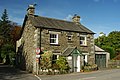 Anvil Cottage, Near Sawrey - geograph.org.uk - 1548514.jpg 640 × 428; 92 KB
-
 Bangour Reservoir - geograph.org.uk - 65443.jpg 640 × 480; 71 KB
-
 Bibury Trout Farm - geograph.org.uk - 1440334.jpg 640 × 427; 97 KB
-
 Bibury trout farm.jpg 2,736 × 3,648; 4.21 MB
-
 Blackwool Trout Farm from South-west - geograph.org.uk - 259911.jpg 640 × 480; 148 KB
-
 Bowden Springs - geograph.org.uk - 179451.jpg 640 × 480; 142 KB
-
 Dining alfresco - trout style - geograph.org.uk - 208439.jpg 640 × 480; 118 KB
-
 Donnington Trout Farm (1) - geograph.org.uk - 1718380.jpg 4,000 × 3,000; 3.12 MB
-
 Footpath past Padworth Mill - geograph.org.uk - 1189234.jpg 426 × 640; 219 KB
-
 Honiton, Tracey Mill Trout Farm - geograph.org.uk - 194569.jpg 640 × 428; 197 KB
-
 Kilnsey Trout Farm - geograph.org.uk - 1180092.jpg 640 × 478; 147 KB
-
 Kilnsey Trout Farm - geograph.org.uk - 643507.jpg 640 × 479; 69 KB
-
 Mallard duck and large Goose - geograph.org.uk - 63921.jpg 471 × 640; 125 KB
-
 Narborough Trout Farm creek - geograph.org.uk - 422068.jpg 420 × 640; 92 KB
-
 Narborough Trout Farm Foresters Lake - geograph.org.uk - 422079.jpg 640 × 512; 99 KB
-

-
 Roadside barn at Dunsop Trout Farm - geograph.org.uk - 1017632.jpg 640 × 480; 140 KB
-
 Roadside building at Dunsop Trout Farm - geograph.org.uk - 1017636.jpg 640 × 480; 148 KB
-
 Rosslynlee Trout Fishery - geograph.org.uk - 1210961.jpg 640 × 480; 64 KB
-
 Sikes Beck - Kilnsey - geograph.org.uk - 1173497.jpg 640 × 480; 130 KB
-
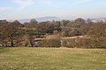
 Southernmost Borrowdale - geograph.org.uk - 872982.jpg 640 × 480; 116 KB
-
 Stepping stones - geograph.org.uk - 66084.jpg 480 × 640; 172 KB
-
 The Lees Trout Farm - geograph.org.uk - 97025.jpg 640 × 426; 82 KB
-
 Tranquil Scene in Bibury - geograph.org.uk - 955690.jpg 640 × 426; 131 KB
-
 Trout Farm - geograph.org.uk - 982602.jpg 640 × 480; 132 KB
-
 Trout Farm and old mill - geograph.org.uk - 1031856.jpg 640 × 480; 76 KB
-
 Trout Farm Bridge - geograph.org.uk - 219562.jpg 640 × 480; 96 KB
-
 Trout Farm by Hebden Beck - geograph.org.uk - 409144.jpg 640 × 480; 134 KB
-
 Trout Farm, Bickton - geograph.org.uk - 61359.jpg 640 × 481; 131 KB
-
 Water treatment - geograph.org.uk - 231374.jpg 640 × 480; 96 KB
-
 Weir at Padworth Mill - geograph.org.uk - 1189273.jpg 640 × 427; 191 KB
-
 Wincle - River Dane - geograph.org.uk - 280555.jpg 640 × 480; 211 KB
-
 Aldermaston trout farm - geograph.org.uk - 1189230.jpg 640 × 427; 187 KB
-
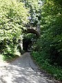
 Belleau Bridge - geograph.org.uk - 394374.jpg 640 × 480; 148 KB
-
 Brockington, fish farm - geograph.org.uk - 1443671.jpg 640 × 480; 76 KB
-
 Dis-used Fish Farm - geograph.org.uk - 544332.jpg 640 × 427; 99 KB
-
 Hatchery Cottage, Mastiles Lane, Kilnsey - geograph.org.uk - 675756.jpg 640 × 480; 103 KB
-
 Llywernog Pond (detail) - geograph.org.uk - 36478.jpg 640 × 480; 141 KB
-
 Llywernog Pond, Bwlch Nant-yr-Arian - geograph.org.uk - 36477.jpg 640 × 480; 127 KB
-
 Narborough Trout Farm footbridge - geograph.org.uk - 422074.jpg 640 × 480; 97 KB
-
 Parkwood Trout Farm - geograph.org.uk - 63848.jpg 640 × 505; 122 KB
-
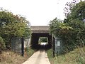
 Railway Bridge over Goddington Lane - geograph.org.uk - 63933.jpg 480 × 640; 173 KB
-
 Ruined barn - geograph.org.uk - 544336.jpg 640 × 427; 85 KB
-
 Salterford Lane - geograph.org.uk - 685529.jpg 640 × 427; 69 KB
-
 Salterford Trout Farm - geograph.org.uk - 685543.jpg 640 × 427; 66 KB
-
 Stream at Raithby - geograph.org.uk - 300936.jpg 525 × 640; 198 KB


_-_geograph.org.uk_-_1718380.jpg)


_-_geograph.org.uk_-_36478.jpg)


