Category:Tsuen Wan Government Primary School
| Object location | | View all coordinates using: OpenStreetMap |
|---|
中文:荃灣官立小學
primary school in Hong Kong .jpg) | |||||
| Upload media | |||||
| Instance of | |||||
|---|---|---|---|---|---|
| Location | Tsuen Wan District, Hong Kong, PRC | ||||
| Street address |
| ||||
| Inception |
| ||||
| official website | |||||
 | |||||
Media in category "Tsuen Wan Government Primary School"
The following 4 files are in this category, out of 4 total.
-
 Belvedere Garden, a private housing estate in Tsuen Wan, Hong Kong.jpg 2,592 × 1,944; 1.29 MB
-
 Tsuen Wan Government Primary School (blue sky).jpg 5,959 × 3,942; 11.91 MB
-
 Tsuen Wan Government Primary School north side.JPG 2,560 × 1,920; 1.02 MB
-
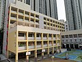
 Tsuen Wan Government primary School.JPG 3,648 × 2,736; 2.03 MB


