Category:Tung Wah Group of Hospitals Sin Chu Wan Primary School
| Object location | | View all coordinates using: OpenStreetMap |
|---|
中文:東華三院冼次雲小學
primary school in Hong Kong  | |||||
| Upload media | |||||
| Instance of | |||||
|---|---|---|---|---|---|
| Location | Sha Tin District, Hong Kong, PRC | ||||
| Street address |
| ||||
| official website | |||||
 | |||||
Media in category "Tung Wah Group of Hospitals Sin Chu Wan Primary School"
The following 18 files are in this category, out of 18 total.
-

-

-

-
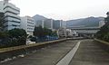
 HK STD 大圍 Tai Wai 美田路 Mei Tin Road MTR Station December 2022 Px3 06.jpg 4,000 × 3,000; 4.79 MB
-
 HK TaiWaiVacuumPumpStation.JPG 1,280 × 960; 301 KB
-
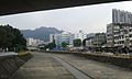
 Shing Mun River Tai Wai.jpg 1,600 × 1,200; 183 KB
-
 Tai Wai Hui aerial view 201802.jpg 1,600 × 1,200; 2.12 MB
-
 Tai Wai Nullah 02.jpg 2,560 × 1,536; 1.32 MB
-
 Tai Wai Nullah 03.jpg 2,560 × 1,536; 1.46 MB
-
 Tai Wai Nullah 04.jpg 2,560 × 1,536; 1.41 MB
-
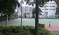 Tai Wai Playground 04.jpg 2,560 × 1,536; 1.69 MB
-
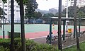
 Tai Wai Playground 05.jpg 2,560 × 1,536; 1.36 MB
-
 Tai Wai Playground 06.jpg 2,560 × 1,536; 1.77 MB
-
 Tai Wai Playground 07.jpg 2,560 × 1,536; 1.46 MB
-
 Tai Wai Playground 09.jpg 2,560 × 1,536; 1.35 MB
-
 Tai Wai Playground 10.jpg 2,560 × 1,536; 1.33 MB
-
 Tai Wai Station Property Site View 201612.jpg 1,600 × 1,200; 1.6 MB
-
 Tai Wai Station Property Site View 201706.jpg 1,600 × 1,200; 1.75 MB


