Category:Tunnel Saint-Léonard
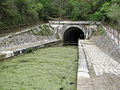
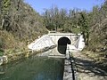
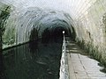
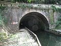
English: Canal from Marans to La Rochelle
· Français : Canal de Marans à La Rochelle en Charente-Maritime (France)
· | Object location | | View all coordinates using: OpenStreetMap |
|---|
canal tunnel in France  | |||||
| Upload media | |||||
| Instance of | |||||
|---|---|---|---|---|---|
| Location | Dompierre-sur-Mer, canton of La Rochelle-8, La Rochelle, Charente-Maritime, New Aquitaine, Metropolitan France, France | ||||
| Owned by |
| ||||
| Carries | |||||
| Date of official opening |
| ||||
| Width |
| ||||
| Length |
| ||||
| Elevation above sea level |
| ||||
 | |||||
Media in category "Tunnel Saint-Léonard"
The following 13 files are in this category, out of 13 total.
-
 Canal Marans LaRochelle 015.JPG 3,072 × 2,304; 1.36 MB
-
 Canal Marans LaRochelle 015b.JPG 2,592 × 1,944; 1.04 MB
-
 Canal Marans LaRochelle 016.JPG 3,072 × 2,304; 1.37 MB
-
 Canal Marans LaRochelle 017.JPG 2,592 × 1,944; 1.05 MB
-
 Canal Marans LaRochelle 017b.JPG 1,944 × 2,592; 1.03 MB
-
 Canal Marans LaRochelle 017h.JPG 2,492 × 1,700; 643 KB
-
 Canal Marans LaRochelle 018.JPG 3,072 × 2,304; 1.36 MB
-
 Canal Marans LaRochelle 018b.JPG 2,592 × 1,944; 1.03 MB
-
 Canal Marans LaRochelle 030.JPG 1,944 × 2,592; 1.05 MB
-
 Canal Marans LaRochelle 031.jpg 2,592 × 1,944; 1.07 MB
-
 RIMG0680.JPG 3,072 × 2,304; 1.37 MB
-
 Tunnel Saint-Léonard 001.JPG 1,944 × 2,592; 1,013 KB
-
 Tunnel Saint-Léonard 002.JPG 1,944 × 2,592; 1.06 MB


