Category:Tunstall, Lancashire
English: Tunstall is a village in north Lancashire, England ( northeast of Lancaster on the A683 road between Lancaster and Kirkby Lonsdale. In the 2001 census the civil parish of Tunstall had a population of 105. (→Tunstall, Lancashire)
Polski: Tunstall – wieś w Anglii, w hrabstwie Lancashire. Leży 81 km na północ od miasta Manchester i 338 km na północny zachód od Londynu. (→Tunstall (Lancashire))
village and civil parish in Lancashire, UK  | |||||
| Upload media | |||||
| Instance of | |||||
|---|---|---|---|---|---|
| Location | Lancaster, Lancashire, North West England, England | ||||
 | |||||
Subcategories
This category has only the following subcategory.
J
Media in category "Tunstall, Lancashire"
The following 121 files are in this category, out of 121 total.
-
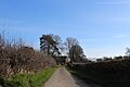
 A hedge-lined Coneygarth Lane at Tunstall - geograph.org.uk - 6307545.jpg 4,000 × 3,000; 3.77 MB
-
 A683 looking north - panoramio.jpg 3,072 × 1,728; 779 KB
-
 A683, Tunstall - geograph.org.uk - 5933983.jpg 640 × 480; 92 KB
-
 A683, Tunstall - geograph.org.uk - 6001150.jpg 800 × 600; 713 KB
-
 Approaching Churchfield House - geograph.org.uk - 5157245.jpg 1,600 × 1,067; 555 KB
-
 Back Lane, Tunstall - geograph.org.uk - 5326930.jpg 5,184 × 3,456; 7.47 MB
-
 Barley field near Tunstall Church - geograph.org.uk - 1993296.jpg 1,280 × 960; 320 KB
-
 Barn and haymaking equipment - geograph.org.uk - 5035679.jpg 2,668 × 1,998; 2.7 MB
-
 Barn conversion, Tunstall - geograph.org.uk - 5926441.jpg 640 × 430; 69 KB
-
 Big Daddy - geograph.org.uk - 5035667.jpg 1,997 × 3,163; 3.99 MB
-
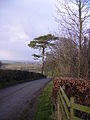
 Blocked lane near Tunstall - geograph.org.uk - 1992898.jpg 640 × 480; 120 KB
-
 Boundary stone, Coneygarth Lane - geograph.org.uk - 2257165.jpg 640 × 480; 165 KB
-
 Bridge over Newton Beck - geograph.org.uk - 3302237.jpg 2,048 × 1,536; 573 KB
-
 Channel of the Lune near Tunstall - geograph.org.uk - 1992889.jpg 640 × 480; 97 KB
-
 Church Lane, Tunstall - geograph.org.uk - 5926444.jpg 640 × 480; 91 KB
-
 Churchfield House near Tunstall - geograph.org.uk - 3773758.jpg 1,024 × 768; 136 KB
-
 Close up, Elizabeth II postbox on the A683, Tunstall - geograph.org.uk - 5933982.jpg 1,621 × 2,976; 989 KB
-

-
 Coneygarth Lane - geograph.org.uk - 2784064.jpg 2,592 × 1,944; 1.57 MB
-
 Coneygarth Lane - geograph.org.uk - 3302244.jpg 2,048 × 1,536; 628 KB
-
 Coneygarth Lane - geograph.org.uk - 5328062.jpg 5,184 × 3,456; 7.52 MB
-
 Coneygarth Lane, Tunstall - geograph.org.uk - 5035643.jpg 1,280 × 960; 1.31 MB
-
 Copse near Tunstall - geograph.org.uk - 1992881.jpg 640 × 480; 72 KB
-
 Copy of The Pieta by Francesco Montemezzano - geograph.org.uk - 5156421.jpg 1,600 × 1,284; 387 KB
-

-

-
 Elizabeth II postbox on the A683, Tunstall - geograph.org.uk - 5933980.jpg 3,648 × 2,736; 2.55 MB
-
 Entrance to a field across the road - geograph.org.uk - 5841738.jpg 1,024 × 768; 335 KB
-
 Farm track and hedgerow - geograph.org.uk - 5926437.jpg 640 × 480; 74 KB
-
 Farmland near Tunstall - geograph.org.uk - 5035657.jpg 1,280 × 960; 730 KB
-
 Farmland near Tunstall - geograph.org.uk - 5035664.jpg 2,668 × 1,997; 2.36 MB
-
 Field beside Coneygarth Lane - geograph.org.uk - 5328328.jpg 5,184 × 3,456; 7.03 MB
-
 Footpath through a wheat field - geograph.org.uk - 4485022.jpg 1,024 × 768; 860 KB
-
 Ford over the Lune near Tunstall - geograph.org.uk - 1992885.jpg 640 × 480; 106 KB
-
 Grazing off Church Lane, Tunstall - geograph.org.uk - 5926443.jpg 640 × 480; 90 KB
-
 Hedgerow near Tunstall - geograph.org.uk - 5035651.jpg 1,280 × 960; 1.01 MB
-
 Hut by the Lune near Newton - geograph.org.uk - 2257174.jpg 640 × 480; 100 KB
-
 Hut on Stilts beside the River Lune - geograph.org.uk - 5328050.jpg 5,184 × 3,456; 5.98 MB
-

-

-

-

-

-

-

-

-

-

-

-
-

-

-
 Livestock feeder in farmland - geograph.org.uk - 5035661.jpg 1,280 × 960; 966 KB
-
 Lunesdale Arms, Tunstall - geograph.org.uk - 2485744.jpg 1,024 × 738; 145 KB
-
 Main Street, Tunstall - geograph.org.uk - 4484995.jpg 1,024 × 767; 725 KB
-
 Main Street, Tunstall - geograph.org.uk - 5926452.jpg 640 × 455; 73 KB
-
 Marmaduke House - panoramio.jpg 3,072 × 1,728; 704 KB
-
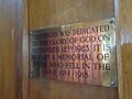
 Memorial plaque, Tunstall Church - geograph.org.uk - 1992965.jpg 480 × 640; 112 KB
-
 Milestone on Main Street, Tunstall - geograph.org.uk - 5926451.jpg 640 × 611; 98 KB
-
 Muddy path through farmland - geograph.org.uk - 5035658.jpg 1,280 × 945; 1.39 MB
-
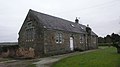
 Old School House, Tunstall.jpg 640 × 480; 131 KB
-
 Old School Tunstall - panoramio.jpg 3,072 × 1,728; 687 KB
-
 On Coneygarth Lane - geograph.org.uk - 5326921.jpg 5,184 × 3,456; 6.08 MB
-
 On the Bridleway between Tunstall Church and Cantsfield - geograph.org.uk - 5157237.jpg 1,600 × 1,067; 376 KB
-
 Ordnance Survey Cut Mark - geograph.org.uk - 4090817.jpg 4,000 × 3,000; 4.51 MB
-
 Ordnance Survey Flush Bracket S0738 - geograph.org.uk - 4090835.jpg 4,000 × 3,000; 4.98 MB
-
 Pasture beside Newton Beck - geograph.org.uk - 5328059.jpg 5,184 × 3,456; 6.35 MB
-

-
 Plaque, Old School House, Tunstall - geograph.org.uk - 1992916.jpg 1,280 × 960; 460 KB
-
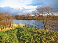
 Pond on the floodplain - geograph.org.uk - 4901249.jpg 640 × 480; 197 KB
-
 River Lune - geograph.org.uk - 295141.jpg 568 × 426; 119 KB
-
 River Lune near Newton - geograph.org.uk - 5328056.jpg 5,184 × 3,456; 4.7 MB
-
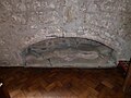
 Roman inscription, Tunstall Church - geograph.org.uk - 1992950.jpg 480 × 640; 152 KB
-
 Sheep Pasture, Tunstall - geograph.org.uk - 5326935.jpg 5,184 × 3,456; 7.66 MB
-
 Sign on the Lunesdale Arms, Tunstall - geograph.org.uk - 5926446.jpg 640 × 379; 49 KB
-
 St John the Baptist, Tunstall, altar - geograph.org.uk - 5517095.jpg 640 × 480; 67 KB
-

-

-

-

-

-

-

-

-

-

-
 St John the Baptist, Tunstall, font - geograph.org.uk - 5510848.jpg 480 × 640; 56 KB
-
 St John the Baptist, Tunstall, porch - geograph.org.uk - 5517004.jpg 480 × 640; 87 KB
-

-

-

-
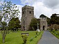
 St. John the Baptist Church, Tunstall (1) - geograph.org.uk - 5156385.jpg 1,600 × 1,067; 531 KB
-
 St. John the Baptist Church, Tunstall (2) - geograph.org.uk - 5156395.jpg 1,600 × 1,067; 403 KB
-
 St. John the Baptist church, Tunstall - geograph.org.uk - 4485015.jpg 1,024 × 768; 999 KB
-
 St. John the Baptist's church at Tunstall - geograph.org.uk - 3773753.jpg 1,024 × 768; 185 KB
-
 St. John the Baptist, Tunstall - geograph.org.uk - 4485000.jpg 1,024 × 767; 839 KB
-

-

-

-
-

-

-

-

-

-
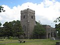 The Church of St John the Baptist at Tunstall - geograph.org.uk - 4046259.jpg 4,000 × 3,000; 2.37 MB
-
 The Lunesdale Arms, Tunstall - geograph.org.uk - 5926445.jpg 640 × 480; 63 KB
-
 Tunstall - geograph.org.uk - 6001145.jpg 800 × 600; 757 KB
-
 Tunstall, The Lunesdale Arms - geograph.org.uk - 6001141.jpg 800 × 600; 669 KB
-
 War Memorial - panoramio (15).jpg 1,728 × 3,072; 687 KB
-
 Wheat field in Tunstall - geograph.org.uk - 4485008.jpg 1,024 × 768; 753 KB
-
 Wheat field near Tunstall Church - geograph.org.uk - 1993285.jpg 1,280 × 960; 557 KB
-
 Barn Near Bull Bank - geograph.org.uk - 127347.jpg 640 × 480; 94 KB
-
 Junction on A683 - geograph.org.uk - 48707.jpg 640 × 480; 128 KB
-
 Junction on A687 - geograph.org.uk - 48704.jpg 640 × 480; 145 KB
-
 Longriggs Barn - geograph.org.uk - 378605.jpg 636 × 477; 109 KB
-
 Muddy track, Tunstall - geograph.org.uk - 612949.jpg 640 × 480; 196 KB
-
 Scots Pine - geograph.org.uk - 127348.jpg 480 × 640; 123 KB
-
 The Lunesdale Arms, Tunstall - geograph.org.uk - 612952.jpg 640 × 480; 172 KB
-
 Tunstall - geograph.org.uk - 48701.jpg 640 × 480; 133 KB
-
 What Roman road^ - geograph.org.uk - 378611.jpg 636 × 477; 93 KB


_-_geograph.org.uk_-_5510850.jpg)
_-_geograph.org.uk_-_5510851.jpg)
_-_geograph.org.uk_-_5510854.jpg)
_-_geograph.org.uk_-_5510855.jpg)
_-_geograph.org.uk_-_5510858.jpg)
_-_geograph.org.uk_-_5517053.jpg)
_-_geograph.org.uk_-_5517059.jpg)
_-_geograph.org.uk_-_5517060.jpg)
_-_geograph.org.uk_-_5517062.jpg)
_-_geograph.org.uk_-_5517063.jpg)
_-_geograph.org.uk_-_5517065.jpg)
_-_geograph.org.uk_-_5517085.jpg)
_-_geograph.org.uk_-_5517087.jpg)
_-_geograph.org.uk_-_5517091.jpg)


_-_geograph.org.uk_-_5502772.jpg)
_-_geograph.org.uk_-_5502773.jpg)
_-_geograph.org.uk_-_5510667.jpg)
_-_geograph.org.uk_-_5510668.jpg)
_-_geograph.org.uk_-_5510846.jpg)
_-_geograph.org.uk_-_5516987.jpg)
_-_geograph.org.uk_-_5516991.jpg)
_-_geograph.org.uk_-_5516995.jpg)
_-_geograph.org.uk_-_5516997.jpg)


_-_geograph.org.uk_-_5510849.jpg)
_-_geograph.org.uk_-_5517047.jpg)
_-_geograph.org.uk_-_5156385.jpg)
_-_geograph.org.uk_-_5156395.jpg)


_-_geograph.org.uk_-_5517067.jpg)
_-_geograph.org.uk_-_5517068.jpg)
_-_geograph.org.uk_-_5517069.jpg)
_-_geograph.org.uk_-_5517071.jpg)
_-_geograph.org.uk_-_5517074.jpg)
_-_geograph.org.uk_-_5517075.jpg)
_-_geograph.org.uk_-_5517081.jpg)
_-_geograph.org.uk_-_5517083.jpg)
_-_geograph.org.uk_-_5517080.jpg)


.jpg)


