Category:Tyler Hill
village in United Kingdom  | |||||
| Upload media | |||||
| Instance of | |||||
|---|---|---|---|---|---|
| Location | Hackington, Canterbury, Kent, South East England, England | ||||
 | |||||
Subcategories
This category has the following 2 subcategories, out of 2 total.
P
- Park Farm Oast, Tyler Hill (4 F)
T
- Tyler Hill Tunnel (5 F)
Media in category "Tyler Hill"
The following 74 files are in this category, out of 74 total.
-
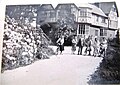 1946-62 Alcroft Grange, Tyler Hill, Canterbury YHA.jpg 3,850 × 2,722; 3.7 MB
-
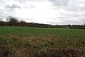
 A large bare field off Hackington Rd - geograph.org.uk - 1208121.jpg 640 × 430; 89 KB
-
 A stand of conifers, Clowes Wood - geograph.org.uk - 1211608.jpg 640 × 430; 99 KB
-
 An arable field near Well Court - geograph.org.uk - 1208862.jpg 640 × 430; 69 KB
-
 Barn, Little Hall Farm - geograph.org.uk - 1142329.jpg 640 × 430; 56 KB
-
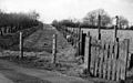
 Bed of Dismantled railway - geograph.org.uk - 1208868.jpg 640 × 430; 145 KB
-
 Blean & Tyler Hill Halt 1832585 b6e9dd33.jpg 640 × 402; 135 KB
-

-
 Bridleway off Hackington Rd - geograph.org.uk - 1144482.jpg 640 × 430; 129 KB
-
 Bridleway to Langton Lodge - geograph.org.uk - 1523083.jpg 427 × 640; 104 KB
-
 Byway to Amery Court - geograph.org.uk - 1520998.jpg 640 × 427; 106 KB
-
 Church, Hackington Rd, Tyler Hill - geograph.org.uk - 1144859.jpg 640 × 430; 75 KB
-
 Clowes Wood off Hackington Rd - geograph.org.uk - 1208095.jpg 640 × 430; 142 KB
-
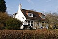 Daweswood Cottage, Tyler Hill - geograph.org.uk - 1144645.jpg 640 × 430; 96 KB
-
 Dismantled Railway - geograph.org.uk - 1208871.jpg 640 × 430; 142 KB
-
 Early growth potatoes, Well Court - geograph.org.uk - 1208863.jpg 640 × 430; 91 KB
-
 Fading rainbow near Tyler Hill - geograph.org.uk - 928363.jpg 430 × 640; 50 KB
-
 Farmhouse, Little Hall Farm - geograph.org.uk - 1142337.jpg 640 × 430; 95 KB
-
 Farmhouse, Well Court - geograph.org.uk - 1208160.jpg 640 × 430; 77 KB
-
 Food troughs, Little Hall Farm - geograph.org.uk - 1142331.jpg 640 × 430; 74 KB
-
 Footpath beside Little Hall Wood - geograph.org.uk - 1523001.jpg 640 × 427; 79 KB
-

-
 Glasshouses, Well Court - geograph.org.uk - 1208859.jpg 640 × 430; 75 KB
-

-
 Ivy House, Tyler Hill - geograph.org.uk - 1144807.jpg 640 × 430; 72 KB
-

-

-

-

-
 Little Hall Woods - geograph.org.uk - 1142348.jpg 640 × 430; 135 KB
-
 Looking NW along the Crab and Winkle Way - geograph.org.uk - 1144927.jpg 640 × 430; 118 KB
-

-
 Looking S along Summer Lane - geograph.org.uk - 747465.jpg 640 × 480; 221 KB
-

-
 Northern end of Summer Lane - geograph.org.uk - 747462.jpg 640 × 480; 211 KB
-
 Park Farm Close off Summer Lane - geograph.org.uk - 747438.jpg 640 × 480; 172 KB
-
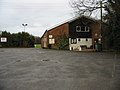
 Playing fields at Tyler Hill - geograph.org.uk - 747461.jpg 640 × 480; 221 KB
-

-

-
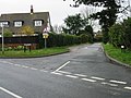
 Roundabout, Giles Rd and Darwin Rd - geograph.org.uk - 1211672.jpg 640 × 430; 93 KB
-
 Sarre Penn emerges from a culvert - geograph.org.uk - 1144908.jpg 640 × 430; 135 KB
-
 Sarre Penn, South of Tyler Hill - geograph.org.uk - 1144893.jpg 640 × 430; 132 KB
-
 Sign posts at the W end of Link Road - geograph.org.uk - 747444.jpg 640 × 480; 265 KB
-

-
 Small paddocks off Tyler Hill Road - geograph.org.uk - 751862.jpg 640 × 480; 246 KB
-
 Small road off Calais Hill - geograph.org.uk - 747449.jpg 640 × 480; 235 KB
-
 Small stream in Brotherhood Wood - geograph.org.uk - 1132190.jpg 430 × 640; 132 KB
-
 St John's Crescent, Tyler Hill - geograph.org.uk - 1144766.jpg 640 × 430; 78 KB
-
-
 Sunnymead, Tyler Hill - geograph.org.uk - 1144755.jpg 640 × 430; 66 KB
-
 Sunnyside, Hackington Rd, Tyler Hill - geograph.org.uk - 1144884.jpg 640 × 430; 67 KB
-

-

-
 The Ivy House pub, Tyler Hill - geograph.org.uk - 747468.jpg 640 × 480; 186 KB
-
 The Lodge, Little Hall Farm - geograph.org.uk - 1142336.jpg 640 × 430; 85 KB
-
 Track to Little Hall Farm - geograph.org.uk - 1142320.jpg 640 × 430; 99 KB
-

-
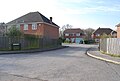
 Tyler Hill community centre - geograph.org.uk - 747456.jpg 640 × 480; 160 KB
-
 Tyler Hill fishery - geograph.org.uk - 1144610.jpg 640 × 430; 88 KB
-
 Tyler Hill Rd, Fleets Lane junction - geograph.org.uk - 1144783.jpg 640 × 430; 69 KB
-
 Tyler Hill Village Sign - geograph.org.uk - 1502249.jpg 480 × 640; 85 KB
-
 Tyler Hill Village Sign - geograph.org.uk - 1760626.jpg 2,304 × 3,072; 1.24 MB
-

-

-
 View along Fleet Lane, Tyler Hill - geograph.org.uk - 751856.jpg 640 × 480; 180 KB
-

-
 View along Tyler Hill Road - geograph.org.uk - 751845.jpg 640 × 480; 213 KB
-

-
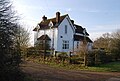
 Weatherboarded cottage, Tyler Hill - geograph.org.uk - 1144823.jpg 640 × 430; 74 KB
-

-
 Community centre, Tyler Hill - geograph.org.uk - 747458.jpg 640 × 480; 169 KB
-

-

-


