Category:U.S. Route 29 in the District of Columbia
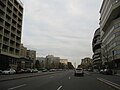
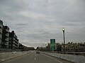
highway in the District of Columbia  US Route 29 eastbound, Washington D.C.   | |||||
| Upload media | |||||
| Instance of | |||||
|---|---|---|---|---|---|
| Part of | |||||
| Location | Washington, D.C., District of Columbia | ||||
| Transport network |
| ||||
| Owned by | |||||
| Maintained by | |||||
| Length |
| ||||
| Partially coincident with | |||||
 | |||||
Subcategories
This category has the following 4 subcategories, out of 4 total.
G
K
W
Media in category "U.S. Route 29 in the District of Columbia"
The following 37 files are in this category, out of 37 total.
-

-

-

-

-

-

-

-
 U.S. Route 29 in the District of Columbia Map.svg 1,028 × 609; 3.65 MB
-
 US 29 DC 1970.svg 600 × 600; 15 KB
-
 US 29 District of Columbia 1926.svg 1,485 × 1,440; 27 KB
-
 US Route 29 - Washington, D.C. - 4128950457.jpg 1,600 × 1,200; 380 KB
-
 US Route 29 - Washington, D.C. - 4128950913.jpg 1,600 × 1,200; 398 KB
-
 US Route 29 - Washington, D.C. - 4128951075.jpg 1,600 × 1,200; 413 KB
-
 US Route 29 - Washington, D.C. - 4128951297.jpg 1,600 × 1,200; 330 KB
-
 US Route 29 - Washington, D.C. - 4128951781.jpg 1,600 × 1,200; 331 KB
-
 US Route 29 - Washington, D.C. - 4128951899.jpg 1,600 × 1,200; 325 KB
-
 US Route 29 - Washington, D.C. - 4128952001.jpg 1,600 × 1,200; 327 KB
-
 US Route 29 - Washington, D.C. - 4128952309.jpg 1,600 × 1,200; 352 KB
-
 US Route 29 - Washington, D.C. - 4128952435.jpg 1,600 × 1,200; 333 KB
-
 US Route 29 - Washington, D.C. - 4128952705.jpg 1,600 × 1,200; 327 KB
-
 US Route 29 - Washington, D.C. - 4128953105.jpg 1,600 × 1,200; 320 KB
-
 US Route 29 - Washington, D.C. - 4128953453.jpg 1,600 × 1,200; 350 KB
-
 US Route 29 - Washington, D.C. - 4129718950.jpg 1,200 × 1,600; 729 KB
-
 US Route 29 - Washington, D.C. - 4129719230.jpg 1,600 × 1,200; 383 KB
-
 US Route 29 - Washington, D.C. - 4129719406.jpg 1,600 × 1,200; 577 KB
-
 US Route 29 - Washington, D.C. - 4129719842.jpg 1,600 × 1,200; 370 KB
-
 US Route 29 - Washington, D.C. - 4129720096.jpg 1,600 × 1,200; 353 KB
-
 US Route 29 - Washington, D.C. - 4129720220.jpg 1,600 × 1,200; 346 KB
-
 US Route 29 - Washington, D.C. - 4129720376.jpg 1,600 × 1,200; 376 KB
-
 US Route 29 - Washington, D.C. - 4129720796.jpg 1,600 × 1,200; 343 KB
-
 US Route 29 - Washington, D.C. - 4129721230.jpg 1,600 × 1,200; 346 KB
-
 US Route 29 - Washington, D.C. - 4129721444.jpg 1,600 × 1,200; 349 KB
-
 US Route 29 - Washington, D.C. - 4129721576.jpg 1,600 × 1,200; 325 KB
-
 US Route 29 - Washington, D.C. - 4129721800.jpg 1,600 × 1,200; 331 KB
-
 US Route 29 - Washington, D.C. - 4129721926.jpg 1,600 × 1,200; 333 KB
-
 US Route 29 - Washington, D.C. - 4129722290.jpg 1,600 × 1,200; 350 KB
-
 US Route 29 - Washington, D.C.jpg 1,600 × 1,200; 406 KB

_from_the_overpass_for_24th_Street_Northwest_in_Washington,_D.C..jpg)
_from_the_overpass_for_24th_Street_Northwest_in_Washington,_D.C..jpg)
_from_the_overpass_for_Washington_Circle_in_Washington,_D.C..jpg)
_from_the_overpass_for_Washington_Circle_in_Washington,_D.C..jpg)
_from_the_overpass_for_22nd_Street_Northwest_in_Washington,_D.C..jpg)
_from_the_overpass_for_22nd_Street_Northwest_in_Washington,_D.C..jpg)


