Category:U.S. Route 441 in Coffee County, Georgia
Media in category "U.S. Route 441 in Coffee County, Georgia"
The following 30 files are in this category, out of 30 total.
-
 Arby's, Douglas.jpg 5,184 × 3,456; 6.94 MB
-
 Broxton city limit, US441SB.JPG 4,608 × 3,456; 4.98 MB
-
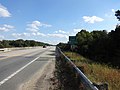 Coffee County border, Ocmulgee River bridge, US319SB.JPG 4,608 × 3,456; 4.74 MB
-
 Coffee County, Pridgen 8 Fire Department.JPG 4,608 × 3,456; 4.57 MB
-
 Comfortel Suites, Package store, Douglas.jpg 5,184 × 3,456; 7.38 MB
-
 Dollar General, Broxton.JPG 4,608 × 3,456; 5.25 MB
-
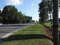 Douglas City limit, US441SB.JPG 4,608 × 3,456; 5.57 MB
-
 Flashing lights, Miller Ave US441N GA31N intersection, Broxton.jpg 5,184 × 3,456; 7.49 MB
-
 GA107 turn left, US441N.jpg 5,184 × 3,456; 5.55 MB
-
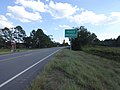
 GA206 end, Douglas.jpg 5,184 × 3,456; 7.73 MB
-
 GA268 US441 split, Broxton.JPG 4,608 × 3,456; 4.01 MB
-
 J.H. Milhollin Memorial Bridge, US441N.jpg 5,184 × 3,456; 5.67 MB
-
 Mill Creek, US441N, Coffee County.jpg 5,184 × 3,456; 5.1 MB
-
 NB Telfair County, Ocmulgee River.jpg 5,184 × 3,456; 5.46 MB
-
 Ocmulgee River Water Trail, Mobley Bluff Landing Ben Hill County, US441N.jpg 5,184 × 3,456; 5.05 MB
-
 Oyo Hotel, Douglas.jpg 5,184 × 3,456; 7.3 MB
-
 Pridgen community US441 NB.jpg 5,184 × 3,456; 9.98 MB
-
 Pridgen limit, US441SB.JPG 4,608 × 3,456; 3.7 MB
-
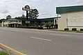
 Ruby Tuesday, Douglas.jpg 5,184 × 3,456; 9.61 MB
-
 Sims Funeral Home, Douglas.jpg 5,184 × 3,456; 8.36 MB
-
 Telfair County US319NB.jpg 5,184 × 3,456; 6.98 MB
-
 Union Banking Company Building, Douglas.jpg 5,184 × 3,456; 8.31 MB
-
 US319 SB Jct GA107 WB.jpg 5,184 × 3,456; 5.69 MB
-
 US319 SB Mobley Bluff Landing.jpg 5,184 × 3,456; 5.56 MB
-
 US441 GA31 SB GA107 EB, US319 SB GA107 WB turn right.jpg 5,184 × 3,456; 5.14 MB
-
 US441 SB, US319 SB turn right.jpg 5,184 × 3,456; 5.3 MB
-
 US441N GA31N GA107W MM27.jpg 5,184 × 3,456; 5.33 MB
-
 US441N GA31N GA107W.jpg 5,184 × 3,456; 5.28 MB
-
 US441N GA31N, Broxton.jpg 5,184 × 3,456; 6.88 MB
-
 US441N US319N GA31N, US319S GA107W turn left.jpg 5,184 × 3,456; 4.97 MB


