Category:USGS Leverett 1928 Posted by CLight
Media in category "USGS Leverett 1928 Posted by CLight"
The following 16 files are in this category, out of 16 total.
-
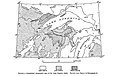 Fig 1 Generalized topographic map of the Lake Superior region.jpg 1,038 × 657; 150 KB
-

-
 Fig 2 map of St Louis River drainage basin.jpg 1,049 × 750; 110 KB
-
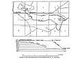 Fig 3 Map and profile of canal of Great Northern Power Co.jpg 1,016 × 738; 82 KB
-
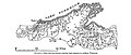 Fig 4 Map showing streams entering Lake Superior in northern Wisconsin.jpg 1,016 × 428; 91 KB
-
 Fig 5 Map of drifts in the northern United States.jpg 1,024 × 1,135; 371 KB
-
 Fig 6 Map showing moraines of Lake Superior lobe.jpg 792 × 739; 103 KB
-
 Fig 7 Map showing drumlins, eskers, and striae in Menominee County.jpg 1,030 × 815; 149 KB
-
 Fig 8 Map showing isobases of the highest beach of glacial Lake Duluth.jpg 1,018 × 835; 133 KB
-
 Fig 9 Map showing isobases of glacial Lake Algonquin.jpg 1,024 × 721; 122 KB
-
 Plate 3 Relief Map of the Lake Superior Region.jpg 1,880 × 1,257; 323 KB
-
 Plate 4 Manitou Falls, on Black River.jpg 1,377 × 1,888; 438 KB
-
 Plate 5 Perch Lake Quadrangle, Mich.jpg 1,234 × 1,588; 321 KB
-
 Plate 6 Houghton Quadrangle, Mich.jpg 1,236 × 1,619; 357 KB
-
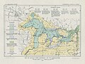 Plate 7 Glacial Lake Algonquin and its Correlatives.jpg 1,410 × 1,075; 284 KB
-
 Plate 8 Nipissing Great Lakes and their Correlatives.jpg 1,457 × 1,056; 245 KB


