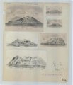
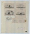
Category:US National Archives series: Manuscript Hydrographic Charts
Media in category "US National Archives series: Manuscript Hydrographic Charts"
The following 34 files are in this category, out of 34 total.
-
Bay of Yedo - NARA - 100307262.jpg 10,112 × 8,363; 5.54 MB
-
Carte de la Coree - NARA - 6039424.jpg 1,890 × 3,150; 3.17 MB
-
Chart from US Japan Expedition - NARA - 100307266.jpg 10,816 × 12,639; 7.4 MB
-
Chart of a Part of the West Coast of Africa - NARA - 6860542.jpg 3,150 × 1,770; 2 MB
-
Chart of Bonin (or Arzobispo) Group - NARA - 109182588.jpg 14,400 × 19,962; 13.96 MB
-
Chart of Heard and McDonald Islands - NARA - 102278574 (page 1).jpg 6,203 × 3,006; 2.87 MB
-
Chart of Heard and McDonald Islands - NARA - 102278574 (page 2).jpg 3,092 × 6,228; 1.6 MB
-
Chart of Loo Choo or Liu Kiu Islands - NARA - 109182628.jpg 15,728 × 10,496; 10.72 MB
-
Chart of Montgomery Group of Islands - NARA - 109182626.jpg 8,032 × 9,421; 4.04 MB
-
Chart of Port Lloyd, on the Western side of Peel Island - NARA - 109182590.jpg 9,952 × 7,660; 7.14 MB
-
Chart of Port Lloyd, on the Western side of Peel Island - NARA - 109182592.jpg 10,016 × 7,296; 7.4 MB
-
Chart of the Bay of Las Palmas - NARA - 100307258.jpg 7,936 × 11,894; 11.15 MB
-
Harbor of Ayan - NARA - 109182614.jpg 14,400 × 16,262; 18.38 MB
-
Harbor of Simoda - NARA - 100307264.jpg 10,816 × 14,667; 11.33 MB
-
Island of Lew-Chew - NARA - 109182618.jpg 9,920 × 9,982; 6.87 MB
-
Landscape Views of Bayonnaise Island (Beyoneisu Retsugan) - NARA - 6919552 (page 1).jpg 2,430 × 3,150; 1.79 MB
-
Landscape Views of Bayonnaise Island (Beyoneisu Retsugan) - NARA - 6919552 (page 2).pdf 2,862 × 3,710; 1.97 MB
-
Landscape Views of Bonin and Volcano Islands - NARA - 6919550 (page 1).jpg 2,485 × 3,150; 1.95 MB
-
Landscape Views of Bonin and Volcano Islands - NARA - 6919550 (page 2).pdf 2,750 × 3,487; 2.03 MB
-
Landscape Views of Farallon de Pajaros (Uracas) Island - NARA - 6919553 (page 1).jpg 2,527 × 3,150; 1.85 MB
-
Landscape Views of Farallon de Pajaros (Uracas) Island - NARA - 6919553 (page 2).pdf 2,862 × 3,568; 2.04 MB
-
Landscape Views of Ponafidin Island (Tori Shima) - NARA - 6919548 (page 1).jpg 2,714 × 3,150; 2.31 MB
-
Landscape Views of Ponafidin Island (Tori Shima) - NARA - 6919548 (page 2).pdf 2,831 × 3,287; 2.21 MB
-
Landscape Views of Smith's Island (Sumisu Jima) - NARA - 6919547 (page 1).jpg 2,779 × 3,150; 2.15 MB
-
Landscape Views of Smith's Island (Sumisu Jima) - NARA - 6919547 (page 2).pdf 2,895 × 3,281; 1.96 MB
-
Lew Chew, Deep Bay - NARA - 109182620.jpg 9,792 × 14,678; 10.42 MB
-
Lew Chew, Shah Bay - NARA - 109182622.jpg 10,784 × 8,121; 6.01 MB
-
Loo-Choo Archipelago and the Southern Part of Japan - NARA - 100307260.jpg 7,680 × 11,434; 6.11 MB
-
Manuscript Map of Japan - NARA - 100307268.jpg 10,816 × 8,974; 6.43 MB
-
The Coffin Group of Islands - NARA - 100307246.jpg 7,232 × 9,037; 3.26 MB
-
The Coffin Group of Islands - NARA - 109182594.jpg 9,824 × 12,057; 10.54 MB
-
The Loo Choo Group of Islands - NARA - 109182624.jpg 14,400 × 14,449; 10.39 MB


