Category:US National Archives series: Old Map File Manuscript and Annotated Maps of the United States and Its Territories
Media in category "US National Archives series: Old Map File Manuscript and Annotated Maps of the United States and Its Territories"
The following 52 files are in this category, out of 52 total.
-
 A Diagram of a Portion of Oregon Territory - NARA - 50926086.jpg 5,280 × 15,004; 12.41 MB
-
 A Diagram of Oregon - NARA - 50926090.jpg 5,952 × 7,392; 4.91 MB
-
 Central United States - NARA - 102278695.jpg 7,811 × 13,520; 13.94 MB
-
 Diagram of Oregon - NARA - 50926092.jpg 7,105 × 5,440; 6.19 MB
-
 Lac Court Oreilles Indian Reservation - NARA - 84786000.jpg 11,444 × 9,267; 4.69 MB
-
 Lands in Mississippi, Ceded by the Chickasaws - NARA - 84785992.jpg 10,366 × 6,784; 6.03 MB
-

-

-
-
 Map of Colorado Territory, Showing the System of Parks - NARA - 23812226.jpg 6,816 × 5,829; 3.37 MB
-
 Map of Fish Lake Forest Reserve - NARA - 131043650.jpg 3,648 × 3,709; 1.67 MB
-
 Map of Georgia and Alabama - NARA - 84785990.jpg 8,832 × 7,968; 7.87 MB
-
 Map of Louisiana - NARA - 102278684 (page 1).jpg 10,598 × 11,160; 15.06 MB
-
 Map of Louisiana - NARA - 102278684 (page 2).jpg 11,196 × 11,955; 13.26 MB
-
 Map of Louisiana - NARA - 102278684 (page 3).jpg 11,194 × 11,797; 13.56 MB
-
 Map of Louisiana - NARA - 102278684 (page 4).jpg 10,985 × 11,594; 12.48 MB
-
 Map of Oregon - NARA - 50926094.jpg 10,589 × 9,344; 11.37 MB
-
 Map of Public Surveys in California & Nevada - NARA - 109182644.jpg 14,400 × 14,460; 21.47 MB
-
 Map of Public Surveys in California & Nevada - NARA - 109182646.jpg 14,400 × 14,831; 20.51 MB
-
 Map of Public Surveys in California & Nevada - NARA - 109182652.jpg 14,176 × 15,444; 21.76 MB
-
 Map of Public Surveys in California - NARA - 109182634.jpg 14,400 × 15,765; 19.68 MB
-
 Map of Public Surveys in California - NARA - 109182636.jpg 12,576 × 14,919; 20.78 MB
-
 Map of Public Surveys in California - NARA - 109182640.jpg 14,400 × 15,181; 15.66 MB
-
 Map of Public Surveys in California - NARA - 109182642.jpg 13,280 × 15,662; 19.28 MB
-
 Map of Public Surveys in California - NARA - 109182650.jpg 13,664 × 14,422; 20.28 MB
-
 Map of Public Surveys in California - NARA - 109182654.jpg 19,470 × 8,864; 11.72 MB
-

-
 Map of Public Surveys in California to Accompany Report of Surveyor General - NARA - 23812171.jpg 10,048 × 11,426; 9.51 MB
-

-
 Map of Public Surveys in California to Accompany Report of Surveyor General - NARA - 23812176.jpg 10,272 × 11,797; 9.07 MB
-

-
 Map of Public Surveys in California to Accompany Report of Surveyor General - NARA - 23812195.jpg 10,784 × 11,101; 9.83 MB
-
 Map of Public Surveys in California to Accompany Report of Surveyor General - NARA - 23812206.jpg 10,688 × 10,814; 10.54 MB
-
 Map of Public Surveys In Colorado Territory - NARA - 23812218.jpg 6,880 × 5,874; 3.67 MB
-
 Map of Public Surveys In Colorado Territory - NARA - 23812251.jpg 10,784 × 7,816; 7.91 MB
-
 Map of Public Surveys In Idaho - NARA - 25464240.jpg 6,880 × 9,850; 4.61 MB
-
 Map of Public Surveys In Idaho - NARA - 25464273.jpg 6,624 × 9,834; 4.71 MB
-
 Map of Public Surveys in Kansas - NARA - 25464348.jpg 11,509 × 7,456; 14.34 MB
-
 Map of Sebastian Military Reservation - NARA - 109182656.jpg 5,920 × 5,558; 2.39 MB
-
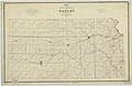
 Map of the Kansas territory - NARA - 25464312.jpg 15,058 × 10,816; 17.54 MB
-
 Map of the Louisiana Purchase Territory - NARA - 594889.jpg 1,200 × 785; 247 KB
-
 Map of the Sebastian Military Reserve - NARA - 109182638.jpg 17,867 × 10,912; 13.53 MB
-
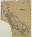
 Map of the State of California - NARA - 23812212.jpg 10,048 × 13,138; 10.62 MB
-

-
 Map of the State of Colorado - NARA - 23812258.jpg 9,728 × 11,276; 11.7 MB
-
 Map of the State of Idaho - NARA - 25464243.jpg 10,816 × 13,535; 12.43 MB
-
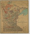
 Map of the State of Minnesota - NARA - 25464399.jpg 7,968 × 9,891; 7.12 MB
-
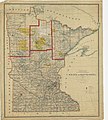
 Map of the State of Minnesota - NARA - 25464402.jpg 8,032 × 9,192; 8.13 MB
-
 Map of the State of Minnesota - NARA - 25464417.jpg 10,528 × 11,652; 12.48 MB
-
 Map of the State of Oregon - NARA - 50926084.jpg 11,387 × 10,336; 14.62 MB
-
 Map of the Territory of Colorado Showing the Extent of the Public Surveys - NARA - 23812254.jpg 9,408 × 11,884; 9.19 MB
-
 Map of the territory of Idaho - NARA - 25464276.jpg 8,064 × 10,399; 6.29 MB


_-_NARA_-_102278691_(page_1).jpg)
_-_NARA_-_102278691_(page_2).jpg)
_-_NARA_-_102278691_(page_3).jpg)


.jpg)
.jpg)
.jpg)
.jpg)


