Category:US National Archives series: Township Plats, City Plans and Island Maps
Media in category "US National Archives series: Township Plats, City Plans and Island Maps"
The following 16 files are in this category, out of 16 total.
-
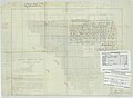
 Commissioners' Plat of the City of Port Royal, SC - NARA - 117090773 (page 1).jpg 13,280 × 9,619; 7.19 MB
-
 Commissioners' Plat of the City of Port Royal, SC - NARA - 117090773 (page 2).jpg 13,216 × 9,670; 4.71 MB
-
 Commissioners' Plat of the City of Port Royal, SC - NARA - 117090776.jpg 11,648 × 9,565; 6.54 MB
-
 Direct Tax Commission 3 - NARA - 55302760.jpg 11,296 × 11,495; 11.16 MB
-
 Direct Tax Commission Item 21 - NARA - 55302742.jpg 11,424 × 9,548; 4.73 MB
-
 Direct Tax Commission Item 27 - NARA - 55302744.jpg 10,304 × 11,023; 3.82 MB
-
 Direct Tax Commission Item 33 - NARA - 55302746.jpg 7,712 × 7,799; 2.47 MB
-
 Direct Tax Commission Item 35 - NARA - 55302748.jpg 7,712 × 7,906; 3.09 MB
-
 Direct Tax Commission Item 50 - NARA - 55302750.jpg 11,424 × 13,695; 5.25 MB
-
 Direct Tax Commission Item 51.1 - NARA - 55302752.jpg 19,008 × 16,910; 17.92 MB
-
 Direct Tax Commission Item 51.2 - NARA - 55302754.jpg 19,264 × 17,246; 18.62 MB
-
 Direct Tax Commission Item 51.3 - NARA - 55302756.jpg 17,664 × 17,081; 19.21 MB
-
 Direct Tax Commission Item 51.4 - NARA - 55302758.jpg 17,472 × 16,791; 17.74 MB
-
 Map of Country around Beaufort City - NARA - 117090780.jpg 10,423 × 10,912; 4.6 MB
-
 Map of Country around Port Royal River - NARA - 117090782.jpg 14,688 × 10,486; 5.69 MB
-
 Map of St. Helena Parish, SC - NARA - 117090778.jpg 11,424 × 11,399; 9.15 MB
.jpg)
.jpg)


