Category:Undy
village in Monmouthshire, Wales, UK  | |||||
| Upload media | |||||
| Instance of | |||||
|---|---|---|---|---|---|
| Location | Monmouthshire, Wales | ||||
 | |||||
English: Undy is a village in Monmouthshire, south east Wales, adjoining the village of Magor with which it forms the community and parish of "Magor with Undy". It is located about 3 miles west of Caldicot and 10 miles east of Newport, close to the junction of the M4 and M48 motorways, and adjoins the Caldicot Levels on the Welsh side of the Bristol Channel.
Subcategories
This category has the following 2 subcategories, out of 2 total.
M
- St Mary's Church, Undy (1 F)
U
- Undy Athletic A.F.C. (2 F)
Media in category "Undy"
The following 35 files are in this category, out of 35 total.
-
 66 539 runs light through Magor - 13767145004.jpg 2,093 × 1,405; 637 KB
-
 66 539 runs light through Magor.jpg 2,577 × 1,921; 1.38 MB
-
 Chapel Lane, Undy - geograph.org.uk - 1243179.jpg 640 × 480; 98 KB
-
 Comms Tower - panoramio - Ray Ok.jpg 1,536 × 2,048; 761 KB
-
 Derelict cottage, Undy.jpg 4,000 × 3,000; 5.03 MB
-
 Former chapel, Undy - geograph.org.uk - 2033695.jpg 640 × 491; 73 KB
-
 Gate into Penhow Woods - panoramio.jpg 1,600 × 1,200; 609 KB
-
 George VI Post Box, Knollbury - geograph.org.uk - 418870.jpg 480 × 640; 122 KB
-
 Network Rail's 31 465 heads light engine from Shrewsbury to Bristol Kingsland RD as 6T84.jpg 3,763 × 2,911; 1.97 MB
-
 Penhow Castle - panoramio - Ray Ok.jpg 1,000 × 319; 73 KB
-
 Penhow Castle - panoramio.jpg 1,600 × 1,200; 571 KB
-
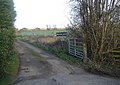
 Railway underpass, Undy - geograph.org.uk - 2033539.jpg 640 × 480; 110 KB
-
 Remnant of Ridge and Furrow Farming - panoramio.jpg 800 × 111; 39 KB
-

-
 Sewage Works, Magor, Monmouthshire - geograph.org.uk - 352345.jpg 640 × 409; 44 KB
-

-
 Start of Footpath to Penhow Castle - panoramio.jpg 1,000 × 491; 167 KB
-
 Undy AFC - panoramio.jpg 2,048 × 1,536; 796 KB
-
 Uskmouth p.s to Stoke Gifford 4F56 with Class 66 951 in charge.jpg 2,630 × 1,844; 3.05 MB
-
 Valley Floor en route to Penhow Castle - panoramio.jpg 1,000 × 356; 114 KB
-
 Veterinary practise - geograph.org.uk - 770268.jpg 640 × 480; 68 KB
-
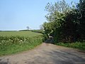
 Bend in the road - north of Knollbury - geograph.org.uk - 418880.jpg 640 × 480; 85 KB
-
 Bend in the Road, Common-y-coed - geograph.org.uk - 418947.jpg 640 × 473; 59 KB
-
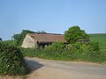
 Chapel Farm, Undy, Monmouthshire - geograph.org.uk - 352253.jpg 640 × 480; 76 KB
-
 Crossroads, north-east of Knollbury - geograph.org.uk - 418923.jpg 640 × 480; 62 KB
-
 Environmentally sympathetic white lines - geograph.org.uk - 418980.jpg 640 × 480; 146 KB
-

-
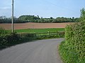
 Junction with Church Road, Undy - geograph.org.uk - 359049.jpg 640 × 480; 92 KB
-
 Looking back from the end of the lane - geograph.org.uk - 418965.jpg 640 × 480; 93 KB
-
 Lower Grange, Magor, Monmouthshire - geograph.org.uk - 352400.jpg 640 × 480; 103 KB
-
-

-
 Road Junction, north of Knollbury - geograph.org.uk - 418897.jpg 640 × 480; 65 KB
-
 Sea Defence near Magor Pill - geograph.org.uk - 352414.jpg 640 × 446; 54 KB
-
 The end of the road, near Undy - geograph.org.uk - 359044.jpg 640 × 451; 87 KB


