Category:United Kingdom photographs taken on 2005-07-15
Countries of Europe: Austria · Belarus · Belgium · Czech Republic · France‡ · Germany · Hungary · Republic of Ireland · Italy · Netherlands‡ · Poland · Romania · Russia‡ · Spain‡ · Sweden · Switzerland · Ukraine · United Kingdom
‡: partly located in Europe
‡: partly located in Europe
| ← | 15 July 2005 | → | ||
| ← | July 2005 | → | ||

United Kingdom photographs taken on 15 July 2005.
Image files should be categorized here automatically using {{taken on}} template. Direct categorisation is also possible, if automatic is impossible.
Subcategories
This category has only the following subcategory.
Media in category "United Kingdom photographs taken on 2005-07-15"
The following 200 files are in this category, out of 245 total.
(previous page) (next page)-
 2005-07-15 - London - Caged Staircase (4888054842).jpg 1,944 × 2,592; 5.5 MB
-
 2005-07-15 - London - Doctor Who style Telephone (4887454437).jpg 2,592 × 1,840; 1.6 MB
-
 2005-07-15 - London - Waterstones - Harry Potter and the Half-Blood Prin (4887462265).jpg 2,592 × 1,944; 2.32 MB
-

-

-
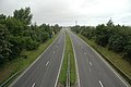
 A27 - A293 Road Junction - geograph.org.uk - 27453.jpg 640 × 480; 97 KB
-
 A27 north of Southwick.jpg 640 × 480; 91 KB
-
 A49 near Warrington.jpg 640 × 426; 106 KB
-
 Allotment Gardens, Woolhampton - geograph.org.uk - 27492.jpg 640 × 480; 204 KB
-
 Alnwick - panoramio.jpg 1,728 × 2,304; 927 KB
-
 Ardvreck Castle ruin on Loch Assynt - Scotish cliché.jpg 1,920 × 1,275; 864 KB
-
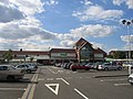 Asda supermarket, Whitley, Coventry - geograph.org.uk - 27506.jpg 640 × 480; 84 KB
-
 Banks East Turret - geograph.org.uk - 868254.jpg 640 × 425; 55 KB
-
 Banks East Turret, Hadrian's Wall - geograph.org.uk - 868257.jpg 640 × 425; 80 KB
-
 Barwell Top Town Blacksmiths Arms - geograph.org.uk - 342736.jpg 640 × 480; 105 KB
-
 Beach at Pevensey Bay, East Sussex - geograph.org.uk - 911265.jpg 640 × 480; 84 KB
-
 Beckwith, near Harrogate - geograph.org.uk - 69922.jpg 640 × 480; 73 KB
-
 Berkeley Castle.jpg 640 × 480; 150 KB
-
 St John's Church Interior, Berkswell - geograph.org.uk - 29745.jpg 427 × 640; 59 KB
-
 Birchwood Forest Park - geograph.org.uk - 29274.jpg 640 × 426; 116 KB
-
 Birdlip Viewpoint - geograph.org.uk - 28360.jpg 640 × 480; 95 KB
-
 Birkhouse Moor - geograph.org.uk - 29081.jpg 640 × 600; 68 KB
-

-
 Buildings at former Glenridding mine - geograph.org.uk - 29033.jpg 640 × 394; 60 KB
-
 Burnthurst - geograph.org.uk - 27539.jpg 640 × 480; 90 KB
-
 Buxton Opera House - geograph.org.uk - 377271.jpg 640 × 598; 129 KB
-
 Buxton Opera House - geograph.org.uk - 378441.jpg 640 × 480; 114 KB
-
 Castle Eden Walkway - geograph.org.uk - 28308.jpg 360 × 480; 44 KB
-
 Centre for Alternative Technology - geograph.org.uk - 27588.jpg 640 × 480; 152 KB
-
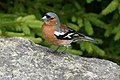 Chaffinch at Loch Ordie - geograph.org.uk - 89798.jpg 640 × 427; 131 KB
-
 Chapel Plate - geograph.org.uk - 302642.jpg 640 × 480; 45 KB
-
 Chatteris Airfield - geograph.org.uk - 81303.jpg 640 × 480; 91 KB
-
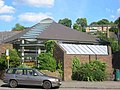 Emmanuel Church hall , Chesham - geograph.org.uk - 27990.jpg 640 × 479; 63 KB
-
 Church near Clackmannan Tower - geograph.org.uk - 267142.jpg 640 × 428; 43 KB
-

-
 Cliff at Beachy Head, East Sussex - geograph.org.uk - 911253.jpg 640 × 480; 55 KB
-
 Construction site on beachfront - geograph.org.uk - 256839.jpg 640 × 236; 50 KB
-
 Cottages at Toppin Castle Farm - geograph.org.uk - 1841133.jpg 640 × 422; 81 KB
-
 Cross Fell summit - geograph.org.uk - 96650.jpg 640 × 452; 101 KB
-
 Cross Roads in Flaunden - geograph.org.uk - 27973.jpg 640 × 479; 60 KB
-
 Dew Pond - geograph.org.uk - 27452.jpg 640 × 480; 146 KB
-
 Dirleton Castle - geograph.org.uk - 267662.jpg 640 × 480; 34 KB
-
 Edinburgh - geograph.org.uk - 267649.jpg 640 × 480; 41 KB
-
 Emmanuel Church Chesham - geograph.org.uk - 27989.jpg 640 × 479; 56 KB
-
 Entrance to Caerphilly Castle - geograph.org.uk - 28361.jpg 640 × 480; 109 KB
-
 Erne Ness, Muckle Roe - geograph.org.uk - 1328818.jpg 480 × 640; 113 KB
-
 Fishing Boats on Loch Ordie - geograph.org.uk - 89794.jpg 640 × 427; 93 KB
-

-

-
 Footbridge over Red Tarn Beck - geograph.org.uk - 29043.jpg 553 × 640; 104 KB
-

-
 Foredown Tower.jpg 640 × 480; 99 KB
-
 Forestry Glen Shiel - geograph.org.uk - 27837.jpg 640 × 480; 108 KB
-
 Fun on the sands - geograph.org.uk - 1098038.jpg 640 × 426; 39 KB
-
 Garden Centre in Chipperfield - geograph.org.uk - 27970.jpg 640 × 479; 58 KB
-

-
 Generator at Kings Langley - geograph.org.uk - 27961.jpg 640 × 480; 26 KB
-
 Gleann Lichd - geograph.org.uk - 27965.jpg 640 × 480; 80 KB
-
 Gospel Hall - geograph.org.uk - 278979.jpg 639 × 426; 88 KB
-
 Gough Square.jpg 640 × 484; 108 KB
-
 Grain stores near Reach - geograph.org.uk - 31662.jpg 640 × 480; 83 KB
-
 Grounds at Alan Higgs sports centre - geograph.org.uk - 27509.jpg 640 × 480; 79 KB
-
 Highrise flats at Seaton - geograph.org.uk - 101214.jpg 640 × 480; 103 KB
-
 Hills Above tynron - panoramio.jpg 2,016 × 1,512; 759 KB
-
 HMS Daedalus - geograph.org.uk - 1106596.jpg 640 × 450; 102 KB
-
 HMS Daedalus airfield - geograph.org.uk - 1106623.jpg 640 × 480; 103 KB
-
 Holbeach St Matthew - geograph.org.uk - 29010.jpg 640 × 481; 161 KB
-
 Hole in the Wall - geograph.org.uk - 29073.jpg 640 × 461; 71 KB
-
 Horses in the countryside, Latimer - geograph.org.uk - 27980.jpg 640 × 480; 25 KB
-

-

-
 Hurst Castle - geograph.org.uk - 39976.jpg 640 × 480; 71 KB
-

-
 Jaguar's Whitley Plant - geograph.org.uk - 27511.jpg 640 × 480; 67 KB
-
 John Lewis, The Mall, Cribbs Causeway - geograph.org.uk - 40080.jpg 480 × 640; 95 KB
-
 King George V Hut, Woolhampton - geograph.org.uk - 27487.jpg 640 × 480; 188 KB
-
 C of E Church Kings Langley - geograph.org.uk - 27963.jpg 640 × 480; 19 KB
-
 Latimer House at Latimer - geograph.org.uk - 27981.jpg 640 × 480; 25 KB
-
 Lee on Solent Beach - geograph.org.uk - 1106604.jpg 640 × 470; 76 KB
-
 Little Ness and Brei Ness - geograph.org.uk - 1328815.jpg 640 × 480; 112 KB
-

-
 Longformacus.jpg 640 × 480; 138 KB
-
 M50 from the Ryton Bridge - geograph.org.uk - 27459.jpg 640 × 479; 103 KB
-
 M50 motorway from Ryton Bridge.jpg 640 × 479; 127 KB
-
 Malham Beck at Malham Cove - geograph.org.uk - 678503.jpg 427 × 640; 118 KB
-
 Meall a Charra - geograph.org.uk - 27694.jpg 640 × 480; 81 KB
-
 Midland Oak.jpg 640 × 508; 101 KB
-
 Midland Plaque.jpg 640 × 552; 139 KB
-
 Milton Keynes College - geograph.org.uk - 29761.jpg 640 × 480; 128 KB
-

-
 Modern Day Aismunderby - geograph.org.uk - 533877.jpg 640 × 480; 80 KB
-
 Moin House Highland - Between Heaven and earth.jpg 2,048 × 1,360; 1.02 MB
-
 Moor Lane and Newark Road junction - geograph.org.uk - 1071285.jpg 640 × 480; 92 KB
-

-
 Neasden Temple - Shree Swaminarayan Hindu Mandir - Gate.jpg 2,223 × 1,631; 1.46 MB
-
 Neasden Temple - Shree Swaminarayan Hindu Mandir - Power Plant.jpg 2,471 × 1,558; 1.4 MB
-
 Neasden Temple - Shree Swaminarayan Hindu Mandir - Trilokyavijaya - Shrihari.jpg 2,140 × 1,784; 2.44 MB
-
 Neasden Temple - Shree Swaminarayan Hindu Mandir 4887425485.jpg 1,413 × 1,325; 1.27 MB
-
 Neasden Temple - Shree Swaminarayan Hindu Mandir 4887439699.jpg 1,944 × 2,592; 3.8 MB
-
 Neasden Temple - Shree Swaminarayan Hindu Mandir 4888028464.jpg 2,541 × 1,922; 3.04 MB
-
 Neasden Temple - Shree Swaminarayan Hindu Mandir 4888029836.jpg 2,471 × 1,558; 3.06 MB
-
 Neasden Temple - Shree Swaminarayan Hindu Mandir 4888031784.jpg 2,113 × 1,818; 3.26 MB
-
 Neasden Temple - Shree Swaminarayan Hindu Mandir 4888034418.jpg 1,960 × 1,650; 3.07 MB
-
 Neasden Temple - Shree Swaminarayan Hindu Mandir 4888036478.jpg 2,592 × 1,944; 4.45 MB
-
 Neasden Temple - Shree Swaminarayan Hindu Mandir 4888038102.jpg 2,223 × 1,479; 2.97 MB
-
 Neasden Temple - Shree Swaminarayan Hindu Mandir 4888039092.jpg 2,501 × 1,934; 1.72 MB
-
 Neasden Temple - Shree Swaminarayan Hindu Mandir 4888042310.jpg 2,520 × 1,944; 2.17 MB
-
 Neasden Temple - Shree Swaminarayan Hindu Mandir 4888044478.jpg 2,119 × 1,944; 3.9 MB
-

-

-
 Old farmyard at Cilshafe Fawr - geograph.org.uk - 204832.jpg 640 × 480; 112 KB
-

-
 Peak on Striding Edge - geograph.org.uk - 29076.jpg 640 × 480; 79 KB
-
-

-
 Portland Bill Lighthouse - geograph.org.uk - 1722508.jpg 2,000 × 1,494; 209 KB
-
 Powerstock Railway Station.jpg 640 × 480; 266 KB
-

-
 Reach Village - geograph.org.uk - 31663.jpg 640 × 480; 78 KB
-
 Red Tarn - geograph.org.uk - 29048.jpg 640 × 480; 81 KB
-
 Redmarley D'Abitot War Memorial - geograph.org.uk - 27415.jpg 640 × 479; 93 KB
-

-
 Rest and Be Thankful - geograph.org.uk - 27444.jpg 640 × 480; 151 KB
-
 Ridge to Sgurr a Bhealaich Dheirg - geograph.org.uk - 27698.jpg 480 × 640; 95 KB
-

-
 Rose and Crown Pub Kings Langley - geograph.org.uk - 27964.jpg 640 × 480; 24 KB
-

-

-

-
 Ryton-on-Dunsmore village hall - geograph.org.uk - 27521.jpg 640 × 480; 148 KB
-
 Ryton-on-Dunsmore war memorial - geograph.org.uk - 27519.jpg 640 × 480; 142 KB
-
 Scampston Hall 1.jpg 640 × 480; 105 KB
-
 Sheepfold Ruins on Glenridding Beck - geograph.org.uk - 29039.jpg 640 × 480; 84 KB
-
 Sheffield Pike - geograph.org.uk - 29063.jpg 640 × 407; 47 KB
-
 Slop Bog Nature Reserve - geograph.org.uk - 27402.jpg 640 × 480; 109 KB
-

-
 St Annes Pier - geograph.org.uk - 629221.jpg 640 × 426; 64 KB
-
 Stansfield All Saints Church - geograph.org.uk - 30783.jpg 640 × 480; 84 KB
-
 Staunton Mill - geograph.org.uk - 27429.jpg 640 × 479; 106 KB
-

-
 Stocks on Village Green, Berkswell - geograph.org.uk - 29743.jpg 640 × 427; 90 KB
-
 Street scene in Chesham - geograph.org.uk - 27993.jpg 640 × 479; 54 KB
-
 Telecommunications Mast - geograph.org.uk - 29762.jpg 480 × 640; 83 KB
-

-
 The Alan Higgs sports centre - geograph.org.uk - 27504.jpg 640 × 480; 61 KB
-
 The Bounds, Much Marcle - geograph.org.uk - 27569.jpg 640 × 479; 98 KB
-
 The End of Civilisation. - geograph.org.uk - 27435.jpg 640 × 479; 133 KB
-
 The Green Dragon, Flaunden - geograph.org.uk - 27977.jpg 640 × 480; 30 KB
-

-

-

-
 The Lottery - "Best Kept Road Sign " - geograph.org.uk - 27438.jpg 640 × 479; 85 KB
-

-
 The River Leadon at Ketford - geograph.org.uk - 27460.jpg 640 × 479; 148 KB
-
 The River Usk side of Newport Docks - geograph.org.uk - 356135.jpg 640 × 375; 50 KB
-
 The Royal Border Bridge - geograph.org.uk - 1480553.jpg 640 × 482; 71 KB
-

-
 The Square, St Annes - geograph.org.uk - 629222.jpg 640 × 426; 66 KB
-
 There's a storm coming^ - geograph.org.uk - 51497.jpg 640 × 480; 74 KB
-
 Toppin Castle Farm House.jpg 427 × 640; 72 KB
-

-
 Tynron - panoramio.jpg 2,016 × 1,512; 735 KB
-
 Tynron Village - panoramio.jpg 2,016 × 1,512; 793 KB
-
 Venetian Characters by Phillip Jackson - geograph.org.uk - 67459.jpg 640 × 480; 137 KB
-
 View from Aonach Meadhoin - geograph.org.uk - 27710.jpg 640 × 480; 49 KB
-

-
 View from Bealach an Lapain - geograph.org.uk - 27684.jpg 640 × 480; 46 KB
-
 View from Saileag - geograph.org.uk - 27689.jpg 480 × 640; 66 KB
-
 View from Sgurr a Bhealaich Dheirg - geograph.org.uk - 27705.jpg 640 × 480; 72 KB
-
 View from Tregarne, Lizard Peninsula - geograph.org.uk - 228224.jpg 640 × 480; 125 KB
-

-
 Village pump and green at Latimer - geograph.org.uk - 27978.jpg 640 × 480; 26 KB
-
 Village sign and Brazier Ley Hill - geograph.org.uk - 27982.jpg 640 × 480; 18 KB
-

-
 Welcome to a new Wembley 4888046936.jpg 1,898 × 2,471; 2.97 MB
-
 Windsurfers - geograph.org.uk - 1106614.jpg 640 × 480; 77 KB
-
 Allt Coire a Chuil Droma Mhoir - geograph.org.uk - 27949.jpg 640 × 480; 80 KB
-
 Birchwood Golf Club - geograph.org.uk - 27317.jpg 640 × 426; 104 KB
-
 Birchwood Park - geograph.org.uk - 27320.jpg 640 × 426; 94 KB
-
 Burnthurst - geograph.org.uk - 27534.jpg 640 × 480; 82 KB
-
 Burnthurst - geograph.org.uk - 27537.jpg 640 × 480; 134 KB
-
 Bury to Clare walk at Thurston - geograph.org.uk - 30779.jpg 640 × 480; 119 KB
-
 Castle Eden Inn - geograph.org.uk - 28311.jpg 640 × 480; 55 KB
-
 Coastline South of Tantallon Castle - geograph.org.uk - 267667.jpg 640 × 480; 40 KB
-
 Craigend - geograph.org.uk - 27577.jpg 640 × 480; 98 KB
-
 Crobeag Farm - geograph.org.uk - 623814.jpg 640 × 480; 49 KB
-
 Crops and woodland - geograph.org.uk - 27570.jpg 640 × 480; 65 KB
-
 Crossroad in the fens - geograph.org.uk - 31666.jpg 640 × 480; 98 KB
-
 Cutmill and Ketford Farm - geograph.org.uk - 27446.jpg 640 × 479; 72 KB
-

-
 Disused dam and pools under Brown Cove - geograph.org.uk - 29054.jpg 640 × 474; 77 KB
-
 Down House Parkland - geograph.org.uk - 27420.jpg 640 × 479; 124 KB
-
 Durbridge House - geograph.org.uk - 27450.jpg 640 × 479; 142 KB
-

-
 Elterwater and the Langdale Pikes - geograph.org.uk - 70716.jpg 640 × 480; 65 KB
-
 Farmland and hillside at Ruallt - geograph.org.uk - 28294.jpg 384 × 288; 16 KB
-

-
 Fulwood Free Methodist Church - geograph.org.uk - 27405.jpg 640 × 480; 89 KB
-
 Gardens at Dirleton Castle - geograph.org.uk - 267660.jpg 480 × 640; 68 KB
-
 Glebe Barn - geograph.org.uk - 27431.jpg 640 × 479; 104 KB
.jpg)
.jpg)
.jpg)


_Tinsley_Green,_Crawley,_West_Sussex_-_geograph.org.uk_-_27687.jpg)


_and_B2036_(Horley_to_Balcombe)_Road,_Near_Crawley,_West_Sussex._-_geograph.org.uk_-_27700.jpg)


