Category:United Nations Buffer Zone in Cyprus
demilitarised zone in Cyprus  | |||||
| Upload media | |||||
| Instance of |
| ||||
|---|---|---|---|---|---|
| Part of |
| ||||
| Location | Cyprus, Mediterranean Sea | ||||
| Operator | |||||
| Maintained by | |||||
| Inception |
| ||||
| |||||
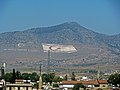
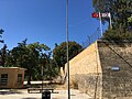
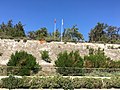
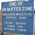
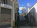
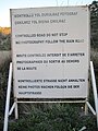
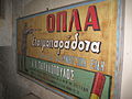
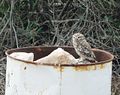
English: This category contains media concerning the United Nations Buffer Zone in Cyprus, which runs for more than 180.5 kilometres (112.2 mi) along what is known as the Green Line and has an area of 346 square kilometres (134 sq mi). The zone partitions the island of Cyprus into a southern area effectively controlled by the government of the Republic of Cyprus (which is the de jure government for the entire island save for the British Sovereign Base Areas), and the northern area controlled by the Turkish Republic of Northern Cyprus.
Subcategories
This category has the following 4 subcategories, out of 4 total.
B
M
N
Pages in category "United Nations Buffer Zone in Cyprus"
The following 9 pages are in this category, out of 9 total.
C
- Commons:Copyright rules by territory/United Nations Buffer Zone in Cyprus
- Commons:Copyright rules by territory/United Nations Buffer Zone in Cyprus/de
- Commons:Copyright rules by territory/United Nations Buffer Zone in Cyprus/en
- Commons:Copyright rules by territory/United Nations Buffer Zone in Cyprus/es
- Commons:Copyright rules by territory/United Nations Buffer Zone in Cyprus/fr
- Commons:Copyright rules by territory/United Nations Buffer Zone in Cyprus/pl
- Commons:Copyright rules by territory/United Nations Buffer Zone in Cyprus/ru
- Commons:Copyright rules by territory/United Nations Buffer Zone in Cyprus/zh
Media in category "United Nations Buffer Zone in Cyprus"
The following 86 files are in this category, out of 86 total.
-
 2009 1001 04 Nicosia (4240910783).jpg 2,816 × 2,112; 3.62 MB
-
 2009 1001 14 Nicosia (4241046279).jpg 2,112 × 2,816; 3.53 MB
-
 2009 1001 15 Nicosia (4241762018).jpg 2,816 × 2,112; 3.57 MB
-
 2009 1001 17 Nicosia (4241002283).jpg 2,816 × 2,112; 3.59 MB
-
 2009 1001 19 Nicosia (4241824200).jpg 2,112 × 2,816; 3.6 MB
-
 2009 1001 38 Nicosia (4241962552).jpg 2,816 × 2,112; 3.56 MB
-
 2009 1001 39 Nicosia (4241967956).jpg 2,816 × 2,112; 3.67 MB
-
 Boeren in bufferzone.jpg 4,416 × 3,312; 5.7 MB
-
 Buffer zone.jpg 800 × 1,200; 175 KB
-
 Bufferzone Cyprus 2009.JPG 3,312 × 4,416; 7.6 MB
-
 Bufferzone Cyprus.JPG 4,248 × 3,132; 2.81 MB
-
 Campo Skouriotissa.jpg 877 × 577; 220 KB
-
 Child playing next to the Green line, Nicosia.jpg 1,200 × 797; 156 KB
-
 Chypre Enkomi.jpg 2,042 × 1,203; 1.75 MB
-
 Cyprus - Turkey border in Niсosia.jpg 3,264 × 2,448; 5.78 MB
-
 Cyprus and Northern Cyprus border area in 2020.01.jpg 4,032 × 3,024; 3.78 MB
-
 Cyprus and Northern Cyprus border area in 2020.02.jpg 4,032 × 3,024; 4.42 MB
-
 Cyprus and Northern Cyprus border area in 2020.03.jpg 4,032 × 3,024; 3.77 MB
-
 Cyprus and Northern Cyprus border area in 2020.04.jpg 4,032 × 3,024; 5.22 MB
-
 Cyprus and Northern Cyprus border area in 2020.05.jpg 4,032 × 3,024; 4.87 MB
-
 Cyprus border.jpg 480 × 480; 397 KB
-
 Cyprus Buffer Zone.jpg 5,184 × 3,456; 9.81 MB
-
 Cyprus Sunset (32381469322).jpg 1,911 × 2,141; 3.2 MB
-
 Cyprus UN cars © DJE 2009.JPG 4,416 × 3,312; 4.53 MB
-
 Einde bufferzone.jpg 3,290 × 3,312; 3.31 MB
-
 ENSZ védőzóna - UN buffer zone - panoramio (1).jpg 800 × 600; 307 KB
-
 ENSZ védőzóna - UN buffer zone - panoramio.jpg 800 × 600; 295 KB
-
 Entrance Kokkina south.JPG 4,320 × 3,240; 3.23 MB
-
 Extinguisher at airport.JPG 4,416 × 3,312; 6.25 MB
-
 Famagusta a védőzónából - Famagusta from buffer zone - panoramio (1).jpg 800 × 600; 267 KB
-
 Famagusta a védőzónából - Famagusta from buffer zone - panoramio.jpg 800 × 600; 262 KB
-
 Famagusta no mans land - panoramio (1).jpg 2,816 × 2,112; 2.18 MB
-
 FamagustaDistrict 01-2017 img04 Paralimni view of Varosha.jpg 3,981 × 2,239; 6.32 MB
-
 Flag map of the United Nations Buffer Zone in Cyprus.png 6,000 × 3,412; 564 KB
-
 GunPlace.JPG 4,272 × 2,848; 2.74 MB
-
 Ingreso Campo Skouriotissa.jpg 888 × 572; 222 KB
-
 KMC Factory (2).JPG 4,272 × 2,848; 3.63 MB
-
 KMC Factory.JPG 448 × 174; 18 KB
-
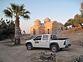
 Kokkina 2.JPG 4,416 × 3,312; 7.72 MB
-
 Kokkina 3.JPG 4,416 × 3,312; 4.52 MB
-
 Kokkina 4.JPG 4,416 × 3,312; 6.99 MB
-
 Kokkina.JPG 4,416 × 3,312; 5.66 MB
-
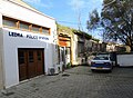 Ledra police station Cyprus Nicosia 01.JPG 3,776 × 2,772; 2.54 MB
-
 Map of Nicosia (2935041347).jpg 1,840 × 1,232; 747 KB
-
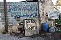 Migrants welcome.jpg 5,184 × 3,456; 7.75 MB
-
 Mijnveld.jpg 4,416 × 3,312; 5.96 MB
-
 Militair zone.jpg 3,312 × 4,416; 5.9 MB
-
 Nicosia (32441834507).jpg 4,032 × 3,024; 2.56 MB
-
 Nicosia (33507114278).jpg 3,024 × 4,032; 2.64 MB
-
 Nicosia (46660276634).jpg 3,024 × 4,032; 1.97 MB
-
 Nicosia (46660279794).jpg 4,032 × 3,024; 2.52 MB
-
 Nicosia (47330625772).jpg 3,024 × 4,032; 2.03 MB
-
 NO MANS LAND - panoramio.jpg 2,816 × 2,112; 2.16 MB
-
 No photos.JPG 3,312 × 4,416; 6.58 MB
-
 No stop zone.JPG 3,312 × 4,416; 5.06 MB
-
 Old Advertising sign in UN Bufferzone Cyprus.JPG 4,416 × 3,312; 5.49 MB
-
 Old Toyota Advertising sign in UN Bufferzone Cyprus.JPG 4,416 × 3,312; 6.39 MB
-
 One of the last planes of Nicosia airport 01.JPG 4,416 × 3,312; 5.58 MB
-
 One of the last planes of Nicosia airport 02.JPG 4,416 × 3,312; 6.72 MB
-

-

-

-

-

-

-

-

-

-
 Owl in UN Bufferzone Cyprus.JPG 1,275 × 1,012; 656 KB
-
 Pufferzone vor Famagusta, Zypern.jpg 4,032 × 2,268; 3.59 MB
-
 Regenboog in de bufferzone.jpg 4,416 × 3,312; 5.63 MB
-
 RuinHouseLadder.JPG 4,272 × 2,848; 3.54 MB
-
 Soccer field in Nicosia (2935898076).jpg 1,840 × 1,232; 1,008 KB
-
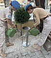 Tree of Peace in Cyprus (Olea europaea).jpg 4,284 × 4,912; 5.19 MB
-
 UN buffer zone in Cyprus.png 1,024 × 568; 682 KB
-
 UN bufferzone.jpg 3,237 × 3,168; 3.58 MB
-
 UN military police on Cyprus 02.JPG 4,416 × 3,312; 5.68 MB
-
 Un patrouille in bufferzone.jpg 4,416 × 3,312; 5.55 MB
-
 UNOP.JPG 4,416 × 3,312; 7.47 MB
-
 Visit to UNFICYP offices, UN Buffer Zone, 18 June 2019 (48101982533).jpg 3,984 × 2,656; 3.28 MB
-
 Visit to UNFICYP offices, UN Buffer Zone, 18 June 2019 (48102004373).jpg 1,200 × 801; 360 KB
-
 Visit to UNFICYP offices, UN Buffer Zone, 18 June 2019 (48102042467).jpg 3,984 × 2,656; 2.84 MB
-
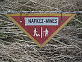
 Warning mines Cyprus.JPG 3,312 × 4,416; 6.27 MB
-
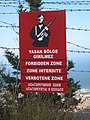
 Warning sign in Cyprus.png 642 × 312; 26 KB
-
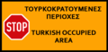
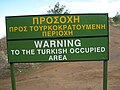 Warning sign to Turkisch occupied area.JPG 4,416 × 3,312; 4.77 MB
-
 Wayne's Keep.JPG 4,000 × 3,000; 4.92 MB
.jpg)
.jpg)
.jpg)
.jpg)
.jpg)
.jpg)
.jpg)


.jpg)


.jpg)


.jpg)

.jpg)


.JPG)


.jpg)


.jpg)
.jpg)
.jpg)
.jpg)
.jpg)


,_UN_Buffer_Zone,_19_June_2019_(48101955016).jpg)
,_UN_Buffer_Zone,_19_June_2019_(48101955326).jpg)
,_UN_Buffer_Zone,_19_June_2019_(48101955436).jpg)
,_UN_Buffer_Zone,_19_June_2019_(48102004913).jpg)
,_UN_Buffer_Zone,_19_June_2019_(48102064962).jpg)
,_UN_Buffer_Zone,_19_June_2019_(48102065132).jpg)
,_UN_Buffer_Zone,_19_June_2019_(48102065242).jpg)
.jpg)
.jpg)


.jpg)
.jpg)


.jpg)
.jpg)
.jpg)


