Category:Unspec SVG created with QGIS
Media in category "Unspec SVG created with QGIS"
The following 200 files are in this category, out of 1,023 total.
(previous page) (next page)-
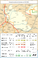
 Transport map of France - 19.svg 850 × 974; 8.35 MB
-
 Railway map of France - 68 - 1870 - fr - small.svg 564 × 933; 6.39 MB
-
 Railway map of France - 68 - 1900 - fr - small.svg 564 × 933; 6.45 MB
-
 Railway map of France - 68 - 1913 - fr - small.svg 564 × 933; 6.53 MB
-
 Railway map of France - 68 - 1919 - fr - small.svg 564 × 933; 6.66 MB
-
 Railway map of France - 68 - 1930 - fr - small.svg 564 × 933; 6.69 MB
-
 Railway map of France - 68 - 1950 - fr - small.svg 564 × 933; 6.65 MB
-
 Railway map of France - 68 - 1980 - fr - small.svg 564 × 933; 6.62 MB
-
 Railway map of France - 68 - 2020 - fr - small.svg 564 × 933; 6.43 MB
-
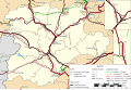
 Railway map of France - 84 - 1870 - fr - small.svg 564 × 861; 4.25 MB
-
 Railway map of France - 84 - 1900 - fr - small.svg 564 × 861; 4.41 MB
-
 Railway map of France - 84 - 1930 - fr - small.svg 564 × 861; 4.5 MB
-
 Railway map of France - 84 - 1980 - fr - small.svg 564 × 861; 4.49 MB
-
 Railway map of France - 84 - 2020 - fr - small.svg 564 × 861; 4.31 MB
-
 Transport map of France - 84.svg 744 × 850; 8.88 MB
-
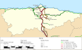
 Rail transport infrastructure map - FR - Bretagne.svg 983 × 511; 3.24 MB
-
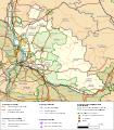
 Rail transport infrastructure map - FR - Nouvelle-Aquitaine.svg 832 × 983; 7.39 MB
-
 Rail transport infrastructure map - FR - Occitanie.svg 812 × 793; 5.29 MB
-
 Rail transport infrastructure map - FR - Pays de la Loire.svg 945 × 699; 4.45 MB
-
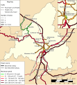
 Transport map of France - 67-68.svg 709 × 1,346; 10.14 MB
-
 Early French railway companies - 1937 map.svg 709 × 868; 16.45 MB
-
 Cuenca-100-B.svg 617 × 795; 1.79 MB
-
 Dankerode in Harzgerode.svg 1,052 × 744; 130 KB
-
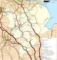
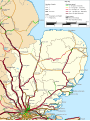
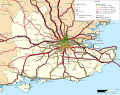 Rail transport infrastructure map - UK - South East England.svg 1,247 × 983; 8.83 MB
-
 Dahlenwarsleben in Niedere Börde.svg 699 × 700; 104 KB
-
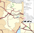 Rail transport infrastructure map - ES - Aragón.svg 719 × 699; 3.03 MB
-
 Rail transport infrastructure map - ES - Cataluña.svg 832 × 737; 2.93 MB
-
 Rail transport infrastructure map - ES - Comunidad de Madrid.svg 680 × 737; 2.05 MB
-

-
 Rail transport infrastructure map - ES - La Rioja, Navarra & País Vasco.svg 832 × 492; 2.37 MB
-
 Rail transport infrastructure map - España.svg 1,399 × 1,115; 17.67 MB
-
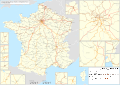
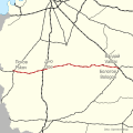
 Railway map of France - 2020 - en - small.svg 496 × 701; 16.02 MB
-
 Bad Salzelmen in Schönebeck.svg 664 × 597; 106 KB
-
 Districts of Niedere Börde.svg 699 × 700; 104 KB
-
 Districts of Schönebeck.svg 664 × 597; 106 KB
-
 Elbenau in Schönebeck.svg 664 × 597; 106 KB
-
 Felgeleben in Schönebeck.svg 664 × 597; 106 KB
-
 Frohse in Schönebeck.svg 664 × 597; 106 KB
-
 Groß Ammensleben in Niedere Börde.svg 699 × 700; 104 KB
-
 Grünewalde in Schönebeck.svg 664 × 597; 105 KB
-
 Gutenswegen in Niedere Börde.svg 699 × 700; 104 KB
-
 Jersleben in Niedere Börde.svg 699 × 700; 104 KB
-
 Klein Ammensleben in Niedere Börde.svg 699 × 700; 104 KB
-
 Meseberg in Niedere Börde.svg 699 × 700; 104 KB
-
 Plötzky in Schönebeck.svg 664 × 597; 106 KB
-
 Pretzien in Schönebeck.svg 664 × 597; 106 KB
-
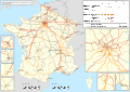
 Railway map of France - 2020 - en - large.svg 2,105 × 1,489; 41.64 MB
-
 Railway map of France - 2020 - en - medium.svg 1,053 × 744; 21.89 MB
-
 Ranies in Schönebeck.svg 664 × 597; 106 KB
-
 Samswegen in Niedere Börde.svg 699 × 700; 104 KB
-
 Schönebeck in Schönebeck.svg 664 × 597; 105 KB
-
 Vahldorf in Niedere Börde.svg 699 × 700; 104 KB
-
 Map Тёсовская УЖД 2022-03-10.svg 655 × 655; 340 KB
-

-
 Rail transport infrastructure map - ES - Andalucia.svg 1,020 × 793; 3.59 MB
-
 Rail transport infrastructure map - ES - Castilla y León.svg 1,133 × 775; 5.75 MB
-
 Rail transport infrastructure map - ES - Castilla-La Mancha.svg 1,096 × 832; 4.65 MB
-
 Rail transport infrastructure map - ES - Extremadura.svg 756 × 605; 2.58 MB
-
 Rail transport infrastructure map - ES - Región de Murcia.svg 661 × 492; 1.01 MB
-
 Rail transport infrastructure map - ES - Asturias.svg 1,059 × 643; 1.5 MB
-
 Rail transport infrastructure map - ES - Cantabria.svg 756 × 624; 1.19 MB
-
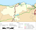
 Rail transport infrastructure map - ES - Galicia.svg 851 × 605; 2.66 MB
-
 Cösitz in Zörbig.svg 641 × 651; 107 KB
-
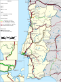 Rail transport infrastructure map - Portugal.svg 869 × 1,153; 5.62 MB
-
 Cuenca-010-011-012-013-B.svg 944 × 831; 4.85 MB
-
 Cuenca-010-B.svg 924 × 699; 8.08 MB
-
 Cuenca-014-015-016-B.svg 1,537 × 1,047; 4.17 MB
-
 Cuenca-017-018-B.svg 1,162 × 1,645; 2.99 MB
-
 Cuenca-020-021-B.svg 1,552 × 1,528; 7.64 MB
-
 Cuenca-022-B.svg 487 × 1,495; 3.62 MB
-
 Cuenca-023-024-025-026-027-028-B.svg 2,133 × 1,873; 6.03 MB
-
 Cuenca-028-029-B.svg 1,000 × 1,370; 6.74 MB
-
 Cuenca-032-B.svg 1,158 × 762; 5.39 MB
-
 Cuenca-034-035-036-037-B.svg 1,465 × 1,414; 7.03 MB
-
 Cuenca-038-039-040-041-042-B.svg 1,308 × 871; 3.24 MB
-
 Cuenca-042-043-B.svg 1,960 × 1,522; 12.23 MB
-
 Cuenca-044-B.svg 1,245 × 1,457; 2.92 MB
-
 Cuenca-045-B.svg 1,008 × 818; 4.32 MB
-
 Cuenca-046-B.svg 469 × 933; 3.75 MB
-
 Cuenca-047-048-049-B.svg 1,004 × 840; 6.33 MB
-
 Cuenca-050-051-B.svg 2,026 × 701; 2.72 MB
-
 Cuenca-052-053-054-B.svg 1,300 × 844; 5.14 MB
-
 Cuenca-052-B.svg 1,139 × 427; 2.65 MB
-
 Cuenca-055-056-057-058-B.svg 2,079 × 1,356; 5.94 MB
-
 Cuenca-060-B.svg 1,301 × 841; 8.04 MB
-
 Cuenca-061-070-B.svg 662 × 847; 4.95 MB
-
 Cuenca-070-071-072-B.svg 1,517 × 688; 8.32 MB
-
 Cuenca-072-073-074-080-B.svg 2,063 × 1,256; 10.46 MB
-
 Cuenca-081-082-B.svg 2,520 × 1,346; 7.33 MB
-
 Cuenca-083-B.svg 1,832 × 1,619; 8.64 MB
-
 Cuenca-0832-0837-0838-B.svg 2,515 × 1,146; 4.35 MB
-
 Cuenca-084-B.svg 1,052 × 744; 2.11 MB
-
 Cuenca-085-086-087-B.svg 1,027 × 724; 3.63 MB
-
 Cuenca-088-B.svg 1,151 × 832; 4.18 MB
-
 Cuenca-089-090-091-092-B.svg 2,032 × 1,073; 16.61 MB
-
 Cuenca-092-093-094-095-B.svg 1,178 × 603; 11.79 MB
-
 Cuenca-100-101-102-B.svg 1,177 × 611; 9.16 MB
-
 Cuenca-102-103-B.svg 1,604 × 1,117; 9.12 MB
-
 Cuenca-104-B.svg 1,174 × 851; 5.23 MB
-
 Cuenca-1041-B.svg 1,053 × 745; 3.84 MB
-
 Cuenca-105-B.svg 976 × 882; 2.67 MB
-
 Cuenca-107-108-B.svg 1,276 × 822; 2.13 MB
-
 Cuenca-111-B.svg 2,206 × 1,365; 10.26 MB
-
 Cuenca-113-B.svg 1,914 × 1,460; 4.27 MB
-
 Cuenca-115-B.svg 2,146 × 1,545; 14.31 MB
-
 Cuenca-120-B.svg 881 × 1,567; 3.24 MB
-
 Cuenca-123-B.svg 1,153 × 1,524; 2.8 MB
-
 Cotovelo, Parnamirim (RN).svg 800 × 647; 38 KB
-
 Coronel Fabriciano Bairros.svg 1,052 × 744; 2.2 MB
-
 Connecticut State Road 610 map.svg 1,027 × 609; 74 KB
-
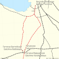 Map Gatchina railway 2024.svg 655 × 655; 211 KB
-
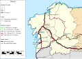
 Rail transport infrastructure map - Republic of Ireland.svg 1,247 × 1,701; 10.29 MB
-
 Rail transport infrastructure map - Northern Ireland.svg 1,172 × 983; 2.55 MB
-
 Rail transport infrastructure map - Entire Ireland.svg 1,360 × 1,701; 10.86 MB
-
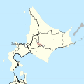 Jr nemuro line closure 2024-04-01.svg 540 × 540; 1.2 MB
-
 South Korean legislative election map (2024).svg 794 × 1,122; 1.67 MB
-
 Cohabinal, Parnamirim (RN).svg 800 × 625; 55 KB
-
 Map Bologoe Pskov railway 2024.svg 655 × 655; 1,004 KB
-
 Rail transport infrastructure map - UK - East Midlands.svg 983 × 1,020; 6.31 MB
-
 Rail transport infrastructure map - UK - East of England.svg 907 × 1,209; 5.78 MB
-
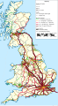 Rail transport infrastructure map - UK - Great Britain.svg 680 × 1,228; 22.08 MB
-
 Rail transport infrastructure map - UK - Greater London.svg 1,588 × 1,247; 3.74 MB
-
 Rail transport infrastructure map - UK - North East England.svg 756 × 869; 1.72 MB
-
 Rail transport infrastructure map - UK - North West England.svg 869 × 1,323; 6.08 MB
-
 Rail transport infrastructure map - UK - Scotland.svg 1,323 × 1,739; 15.8 MB
-
 Rail transport infrastructure map - UK - South West England.svg 1,209 × 945; 6.67 MB
-
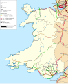 Rail transport infrastructure map - UK - Wales.svg 1,059 × 1,285; 4.84 MB
-
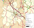 Rail transport infrastructure map - UK - West Midlands.svg 1,059 × 869; 5.49 MB
-
 Rail transport infrastructure map - UK - Yorkshire and the Humber.svg 983 × 1,285; 7.87 MB
-
 Centro, Parnamirim (RN).svg 800 × 625; 55 KB
-
 Carte-topo Cret-Neige FR.svg 2,105 × 1,428; 14.57 MB
-
 Carte-topo Monts-Jura FR.svg 2,242 × 3,132; 12.92 MB
-
 Cajupiranga, Parnamirim (RN).svg 800 × 625; 55 KB
-
 Calbe in Calbe.svg 611 × 525; 32 KB
-
 CAN QC 03 La Côte-de-Gaspé.svg 1,096 × 678; 11.86 MB
-
 CAN QC 08 La Matanie.svg 1,298 × 575; 18.9 MB
-
 CAN QC 09 La Mitis.svg 813 × 980; 12.01 MB
-
 CAN QC 10 Rimouski-Neigette.svg 878 × 845; 11.88 MB
-
 CAN QC 11 Les Basques.svg 781 × 785; 7.09 MB
-
 CAN QC 12 Rivière-du-Loup.svg 877 × 780; 7.81 MB
-
 CAN QC 13 Témiscouata.svg 913 × 865; 14.31 MB
-
 CAN QC 14 Kamouraska.svg 724 × 1,084; 11.01 MB
-
 CAN QC 15 Charlevoix-Est.svg 815 × 937; 13.34 MB
-
 CAN QC 17 L'Islet.svg 788 × 918; 8.76 MB
-
 CAN QC 18 Montmagny.svg 759 × 982; 11.21 MB
-
 CAN QC 19 Bellechasse.svg 845 × 805; 10.43 MB
-
 CAN QC 20 L'Île-d'Orléans.svg 883 × 551; 4.32 MB
-
 CAN QC 23 Québec.svg 783 × 677; 9.83 MB
-
 CAN QC 251 Lévis.svg 838 × 637; 7.56 MB
-
 CAN QC 26 La Nouvelle-Beauce.svg 888 × 641; 6.63 MB
-
 CAN QC 27 Robert-Cliche.svg 807 × 723; 7.33 MB
-
 CAN QC 28 Les Etchemins.svg 677 × 1,003; 8.86 MB
-
 CAN QC 29 Beauce-Sartigan.svg 904 × 734; 9.32 MB
-
 CAN QC 30 Le Granit.svg 854 × 879; 12.87 MB
-
 CAN QC 31 Les Appalaches.svg 763 × 885; 10.11 MB
-
 CAN QC 32 L'Érable.svg 781 × 784; 6.37 MB
-
 CAN QC 33 Lotbinière.svg 1,002 × 643; 7.56 MB
-
 CAN QC 36 Shawinigan.svg 745 × 834; 11.12 MB
-
 CAN QC 371 Trois-Rivières.svg 748 × 640; 3.76 MB
-
 CAN QC 372 Les Chenaux.svg 904 × 639; 6.37 MB
-
 CAN QC 38 Bécancour.svg 892 × 683; 5.97 MB
-
 CAN QC 39 Arthabaska.svg 874 × 782; 9.45 MB
-
 CAN QC 40 Les Sources.svg 962 × 581; 7.55 MB
-
 CAN QC 41 Le Haut-Saint-François.svg 762 × 875; 9.09 MB
-
 CAN QC 42 Le Val-Saint-François.svg 958 × 648; 10.22 MB
-
 CAN QC 43 Sherbrooke.svg 670 × 697; 5.77 MB
-
 CAN QC 44 Coaticook.svg 909 × 646; 8.47 MB
-
 CAN QC 45 Memphrémagog.svg 780 × 791; 11.69 MB
-
 CAN QC 46 Brome-Missisquoi.svg 935 × 632; 8.23 MB
-
 CAN QC 47 La Haute-Yamaska.svg 770 × 658; 5.29 MB
-
 CAN QC 48 Acton.svg 680 × 800; 4.23 MB
-
 CAN QC 49 Drummond.svg 828 × 796; 7.12 MB
-
 CAN QC 50 Nicolet-Yamaska.svg 1,067 × 532; 4.19 MB
-
 CAN QC 51 Maskinongé.svg 729 × 995; 15.24 MB
-
 CAN QC 52 D'Autray.svg 644 × 1,085; 13.33 MB
-
 CAN QC 53 Pierre-De Saurel.svg 750 × 710; 3.2 MB
-
 CAN QC 54 Les Maskoutains.svg 700 × 864; 4.07 MB
-
 CAN QC 55 Rouville.svg 786 × 662; 4.38 MB
-
 CAN QC 56 Le Haut-Richelieu.svg 646 × 875; 4.47 MB
-
 CAN QC 57 La Vallée-du-Richelieu.svg 526 × 1,074; 5.5 MB
-
 CAN QC 58 Longueuil.svg 566 × 810; 5.31 MB
-
 CAN QC 59 Marguerite-D'Youville.svg 542 × 1,016; 6.25 MB
-
 CAN QC 60 L'Assomption.svg 649 × 736; 3.66 MB
-
 CAN QC 61 Joliette.svg 701 × 751; 5.63 MB
-
 CAN QC 63 Montcalm.svg 832 × 639; 7.5 MB
-
 CAN QC 64 Les Moulins.svg 819 × 534; 4.05 MB
-
 CAN QC 65 Laval.svg 790 × 584; 9.39 MB
-
 CAN QC 66 Montréal.svg 791 × 701; 15.96 MB
-
 CAN QC 67 Roussillon.svg 843 × 588; 5.61 MB
-
 CAN QC 68 Les Jardins-de-Napierville.svg 683 × 783; 3.41 MB
-
 CAN QC 69 Le Haut-Saint-Laurent.svg 1,228 × 440; 4.86 MB
-
 CAN QC 70 Beauharnois-Salaberry.svg 930 × 536; 4.01 MB
-
 CAN QC 71 Vaudreuil-Soulanges.svg 845 × 705; 8.35 MB
-
 CAN QC 72 Deux-Montagnes.svg 883 × 522; 5.3 MB
-
 CAN QC 73 Thérèse-De Blainville.svg 516 × 859; 4.45 MB
-
 CAN QC 74 Mirabel.svg 739 × 698; 6.8 MB
-
 CAN QC 75 La Rivière-du-Nord.svg 682 × 785; 9.8 MB
-
 CAN QC 76 Argenteuil.svg 841 × 741; 12.12 MB
-
 CAN QC 77 Les Pays-d'en-Haut.svg 797 × 730; 14.67 MB
-
 CAN QC 81 Gatineau.svg 928 × 549; 7.05 MB


.svg)


.svg)
.svg)

.svg)


.svg)


